Our Self-Guided Road Trip Around Iceland
We spent two weeks road tripping around Iceland in October 2018. We began our trip by visiting many of the wonderful sights that can be found in what is known as Iceland’s Golden Circle. There is so much to see in this area of Iceland which encompasses around 300 kms. However, our trip brought us far beyond what is found in this area and we were so glad that we had the opportunity to venture further afield!
The Golden Circle is the busiest tourist circuit on the island as most of the attractions are easily accessed from the capital city of Reykjavík via guided tours, self guided day trips or like us, as part of a self-guided loop of Iceland in a rental car. In addition, the Golden Circle is part of Iceland’s Ring Road which is the main road (Route 1) that runs all around the island and is 1,332 kilometres long (828 miles).
Here follows our Top 10 Attractions in Iceland and while some of these are located within the Golden Circle, others are not!
Fresh Off The Plane
When we landed in Keflavik Airport we wasted no time collecting our rental car and hitting the road. Unfortunately the weather was truly horrendous, we had to battle gale force winds, torrential sideways rain and thick fog - what a shocking welcome to Iceland!
We stopped briefly at a large supermarket near the airport. We bought some supplies to make a simple dinner that evening in our apartment and some fresh fruit for our breakfast the following morning. We had brought some staple breakfast supplies with us (as well as nuts and cereal bars for snacks) as we read online that groceries are more expensive in Iceland and some items would be hard to find.
We slowly drove our little rental car all the way to the Selfoss Apartments (Austurvegur 36, 800 Selfoss) where we would be spending our first night. Our apartment was lovely, warm, large, well equipped and had easy parking right outside the door. After making and devouring a simple vegetarian pasta dinner we hit the hay early.
Ready To See Iceland!
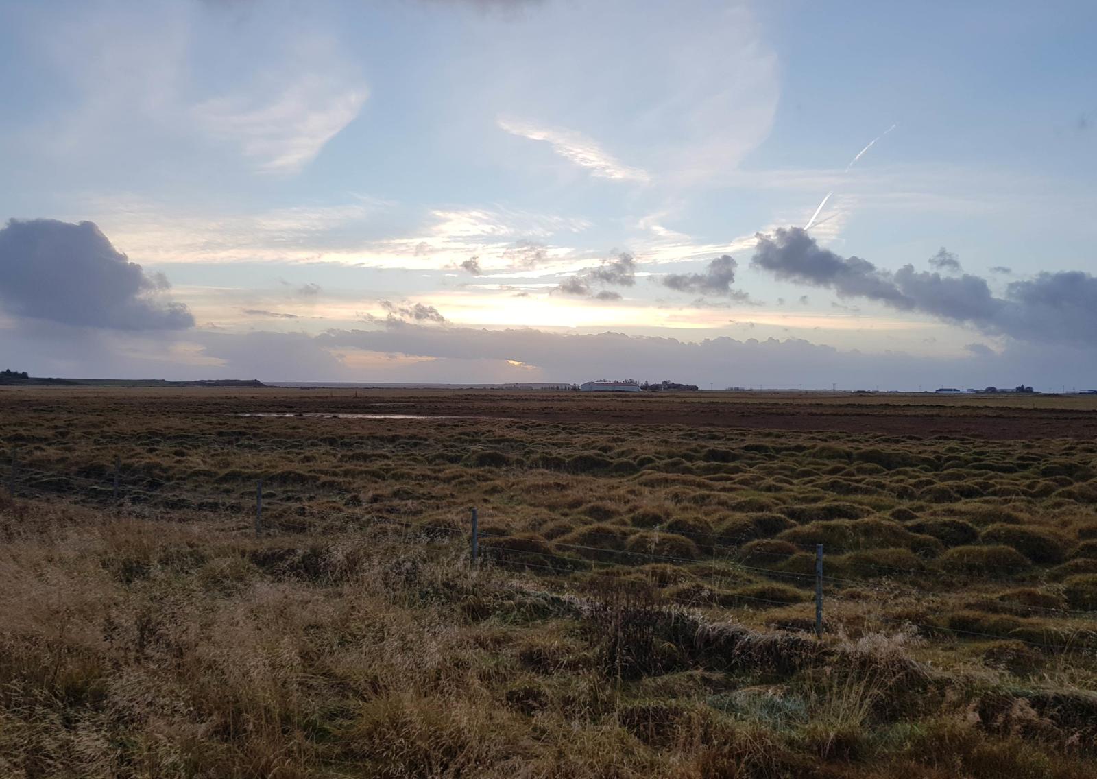
We woke to complete SILENCE - after a wild night of wind and rain, order had been restored once again. The weather was calm, dry and we could even see the sun. We both ventured out for a quick morning run, albeit with plenty of layers as it was SO COLD!
While running, we finally got our first glimpse of the Icelandic countryside and it was gorgeous.
After showering, cooking breakfast and packing up we were ready for road and excited to get going now that we had some sunshine and would be able to see where we were going. Keep reading to see what we got up to!
Iceland’s Top 10 Attractions!
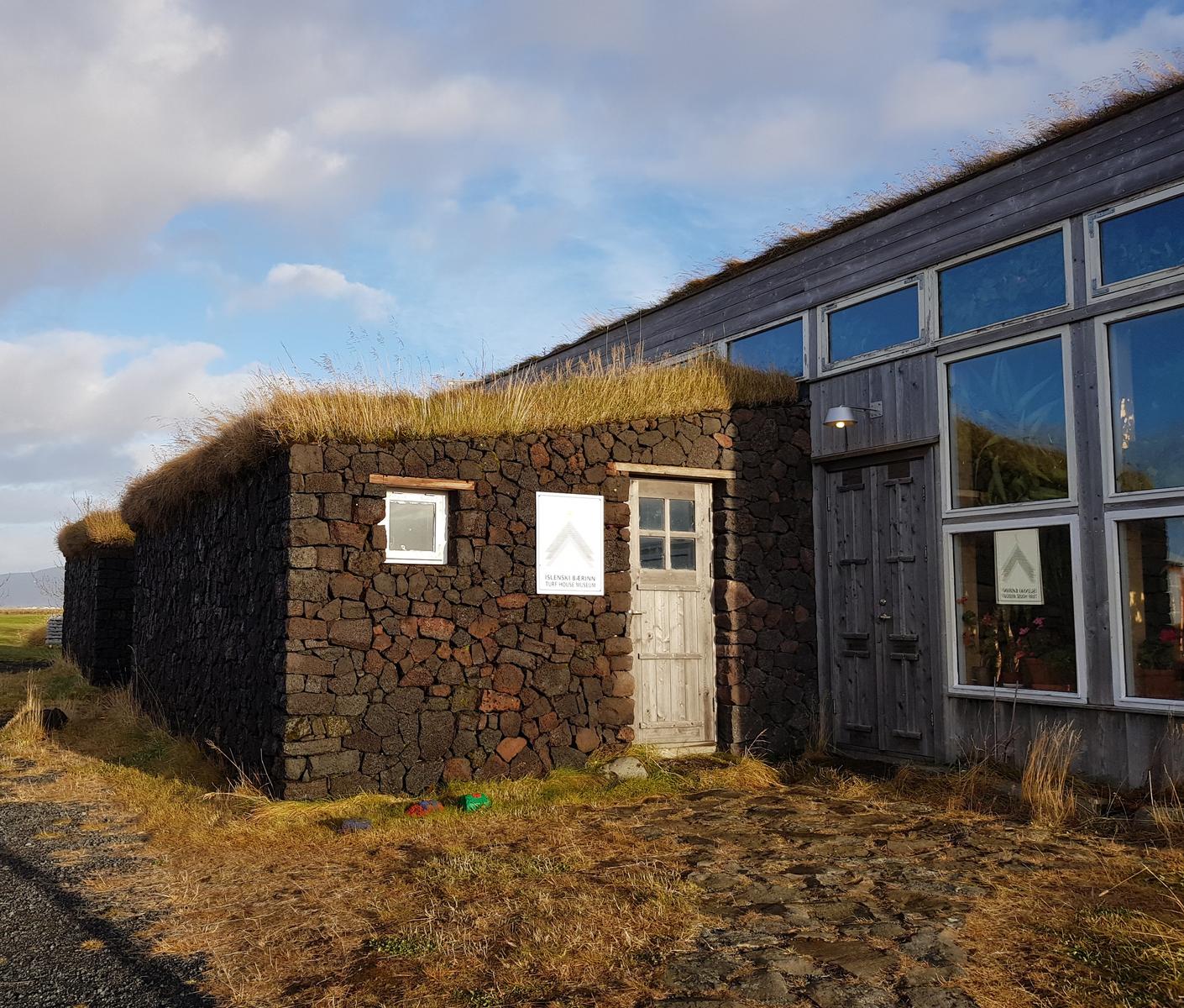
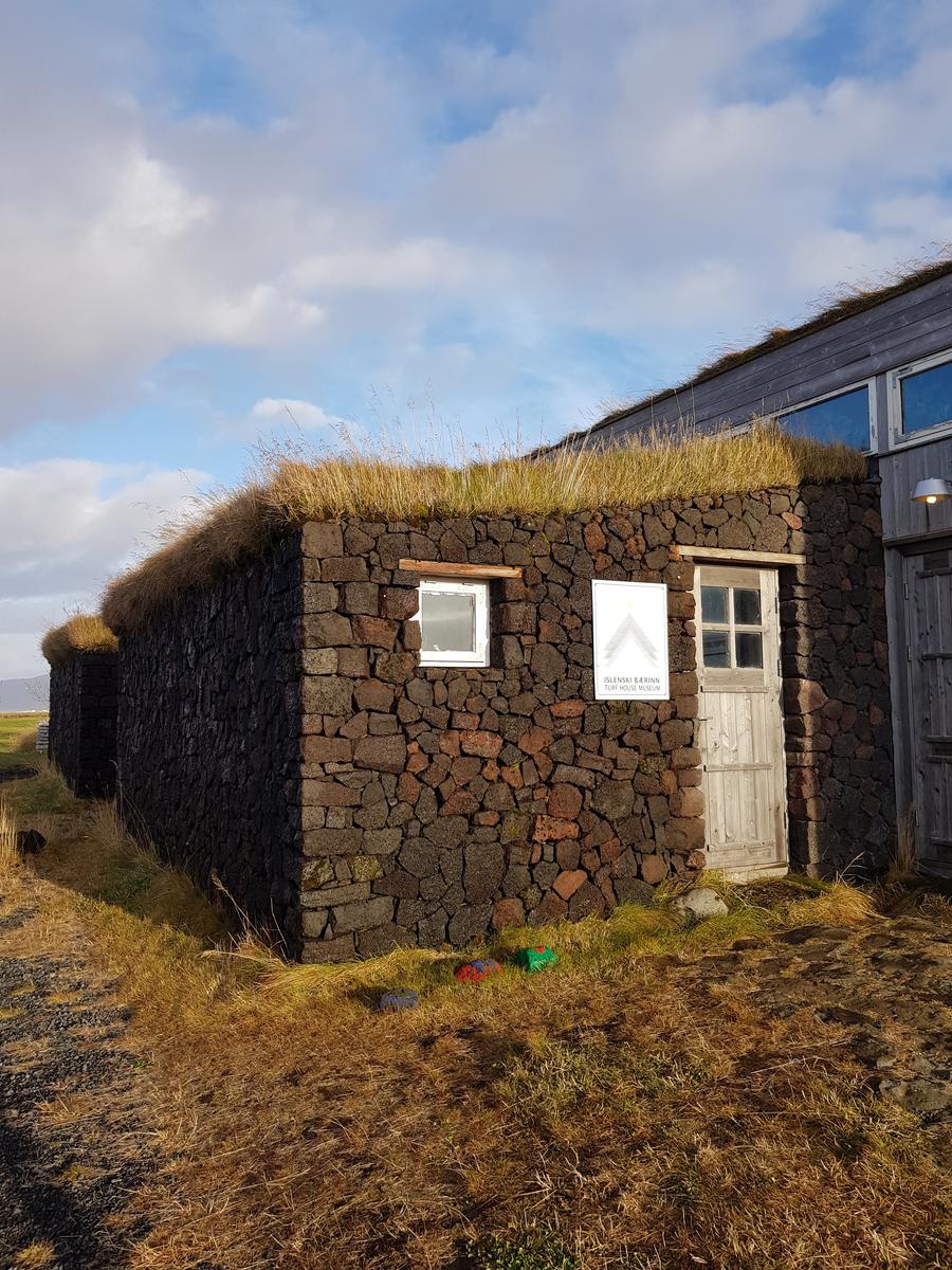
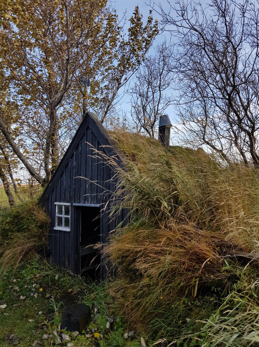
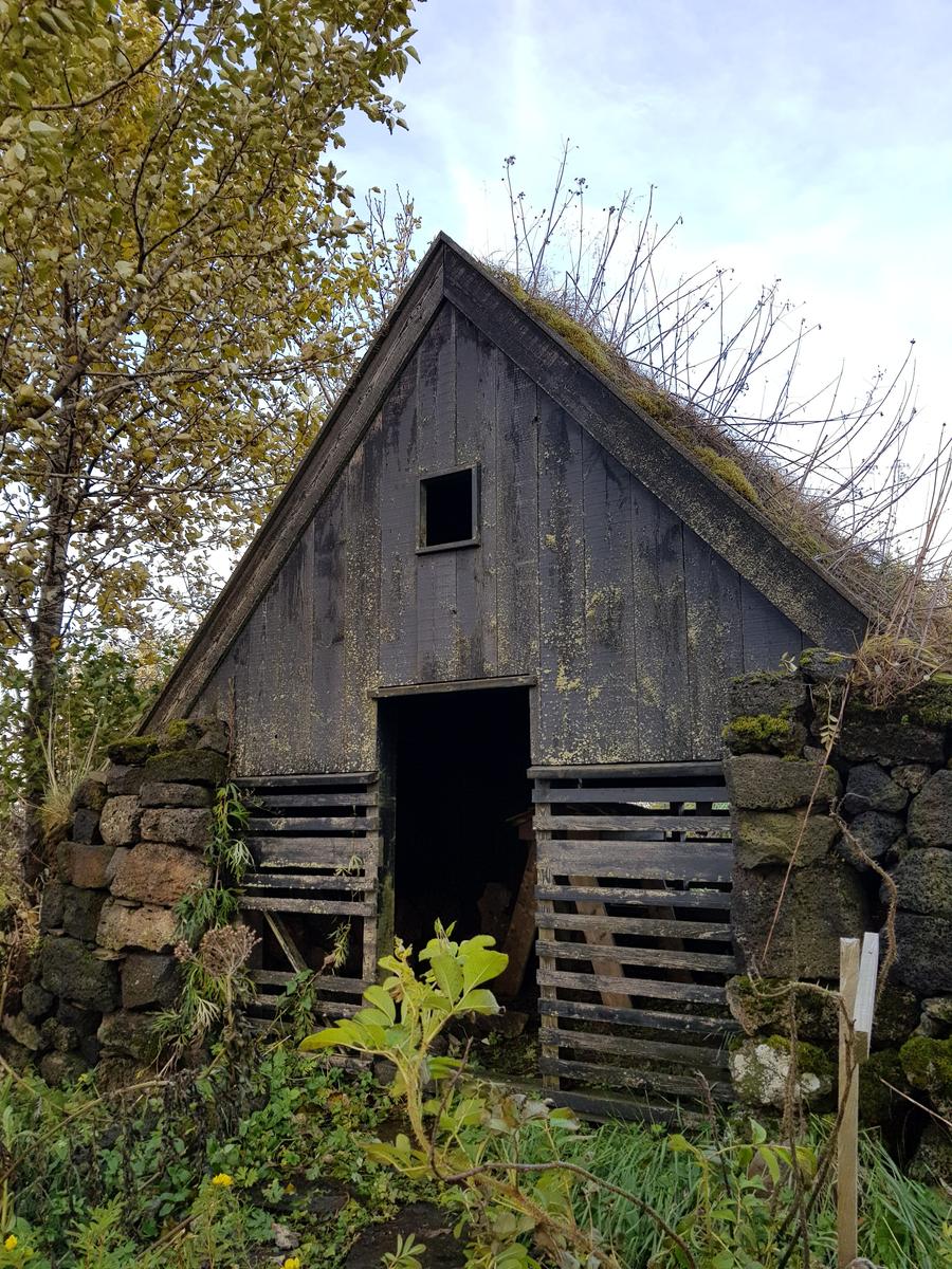
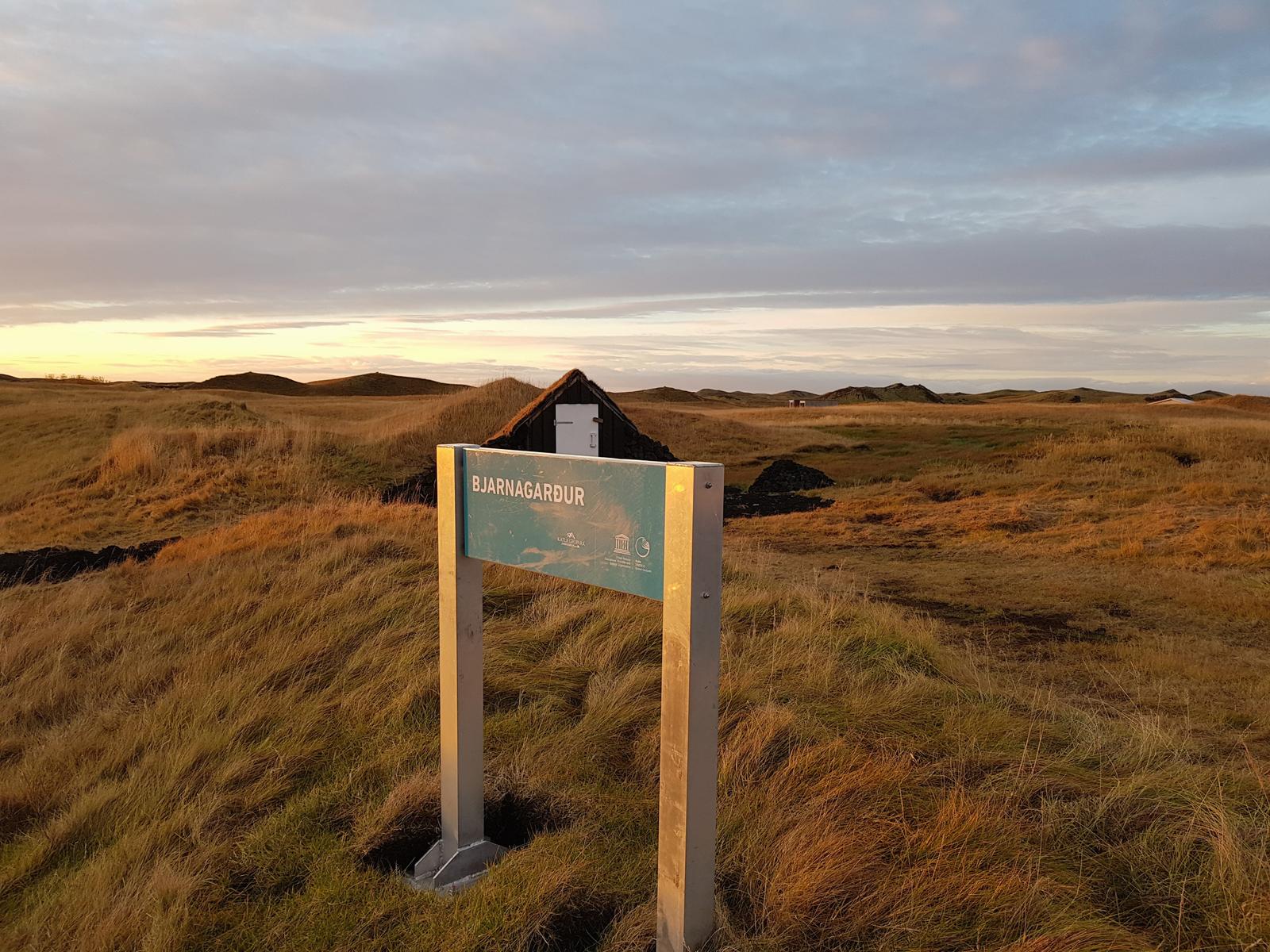
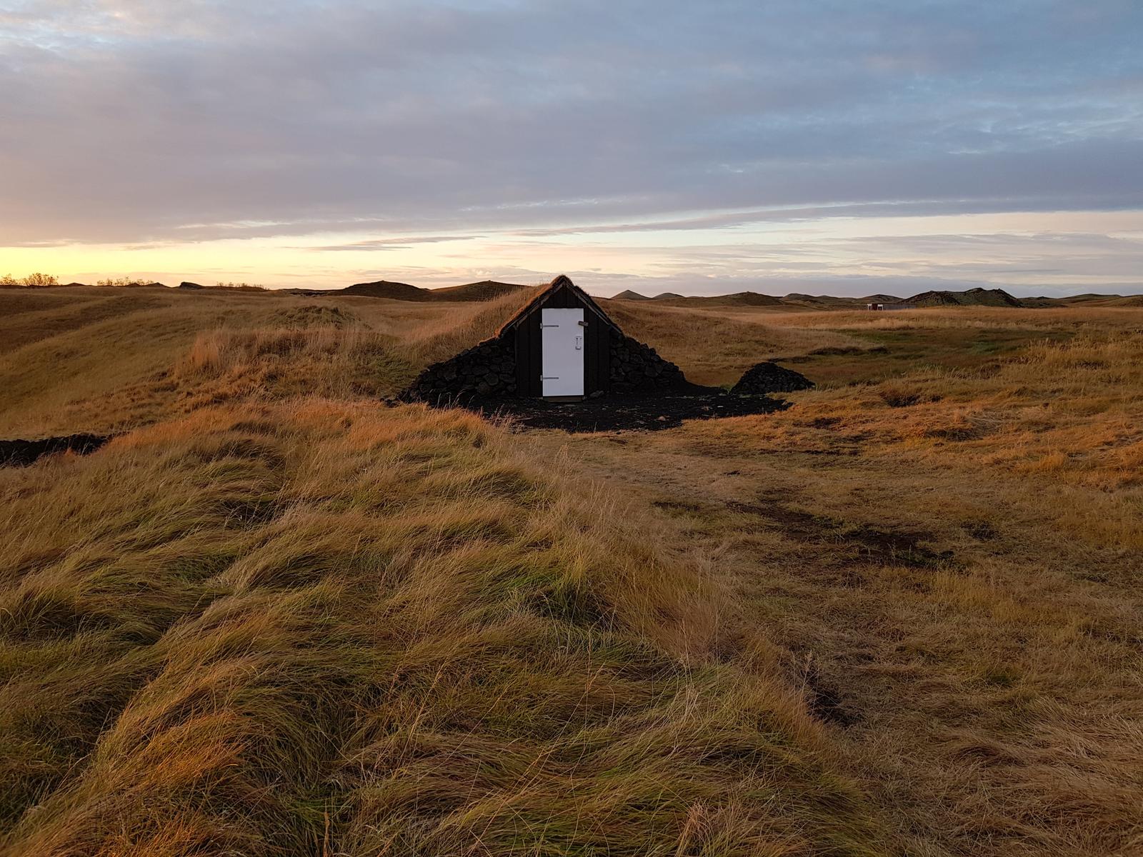
1. Turf House - Íslenski Bærinn.
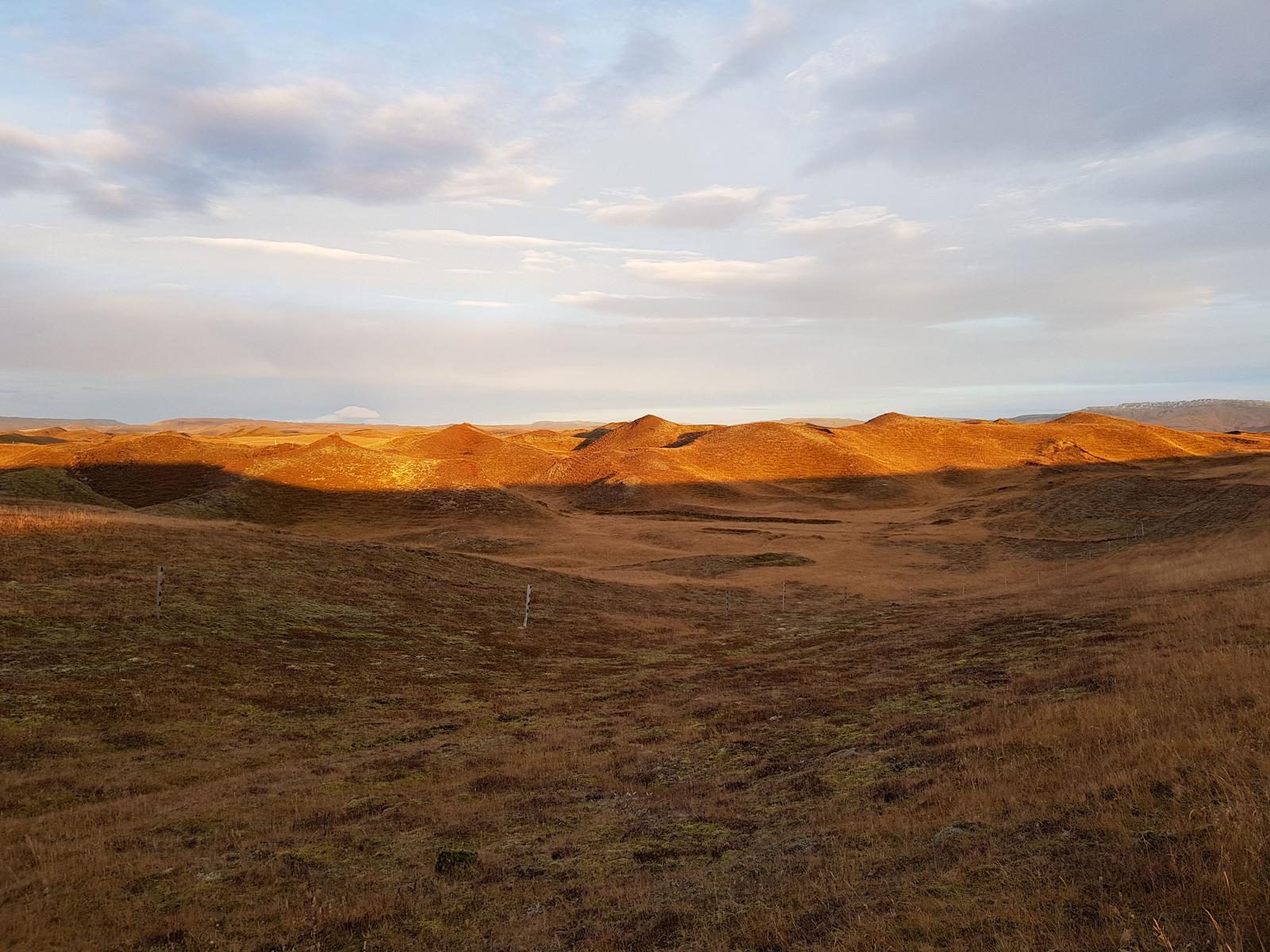
I really wanted to see some turf houses and had starred a few popular tourist ones on my map when planning the trip. However, the Íslenski bærinn turf houses and museum were only a short detour from our route to Seljalandsfoss so we decided to visit. The view from the car-park was lovely:
While the information centre and museum weren’t open (we were too early) it didn’t matter to us, we happily walked around and met no one - bliss!
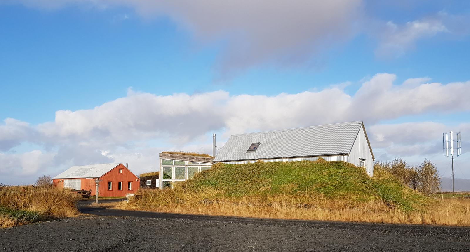
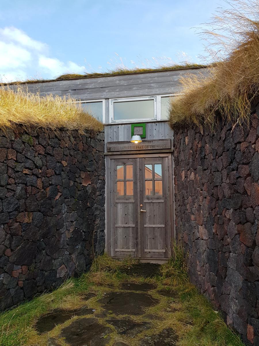
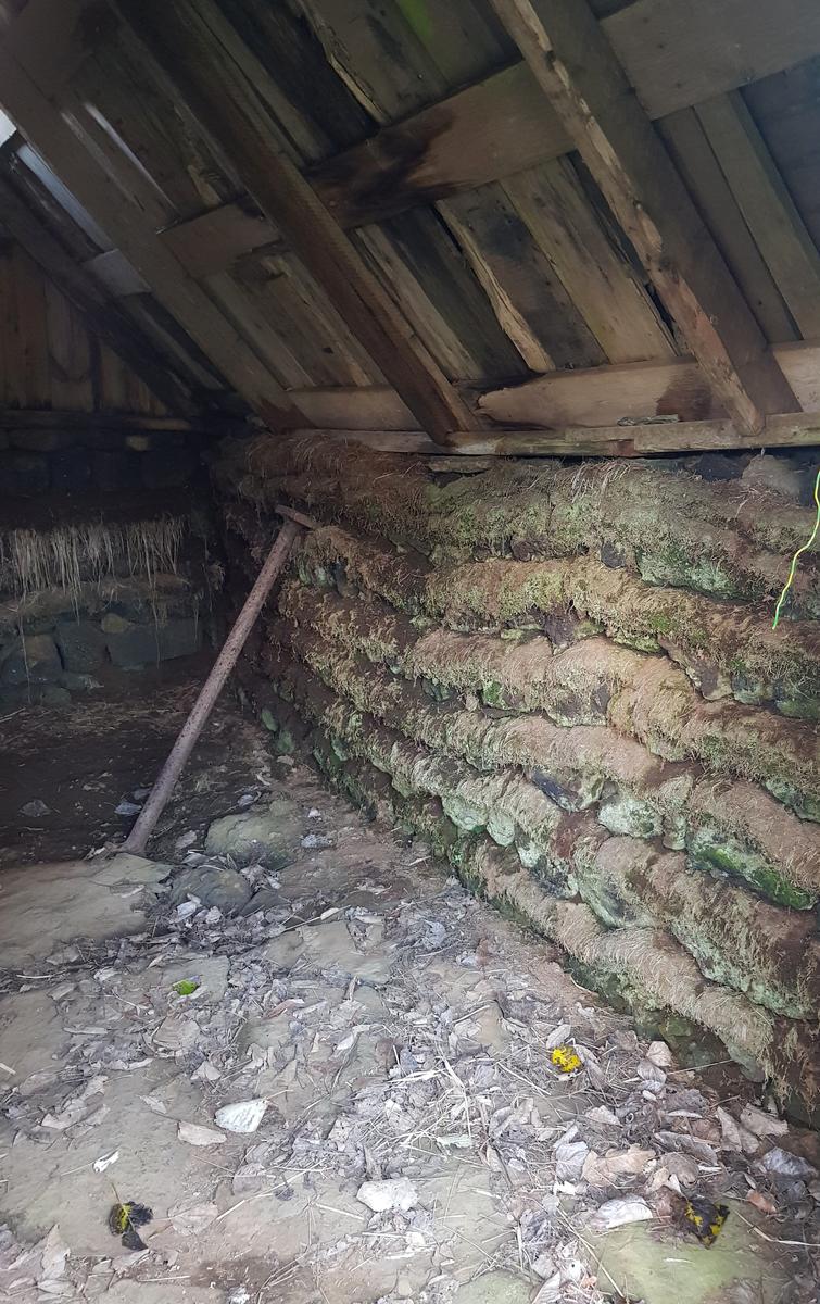
Inside one of the turf houses:
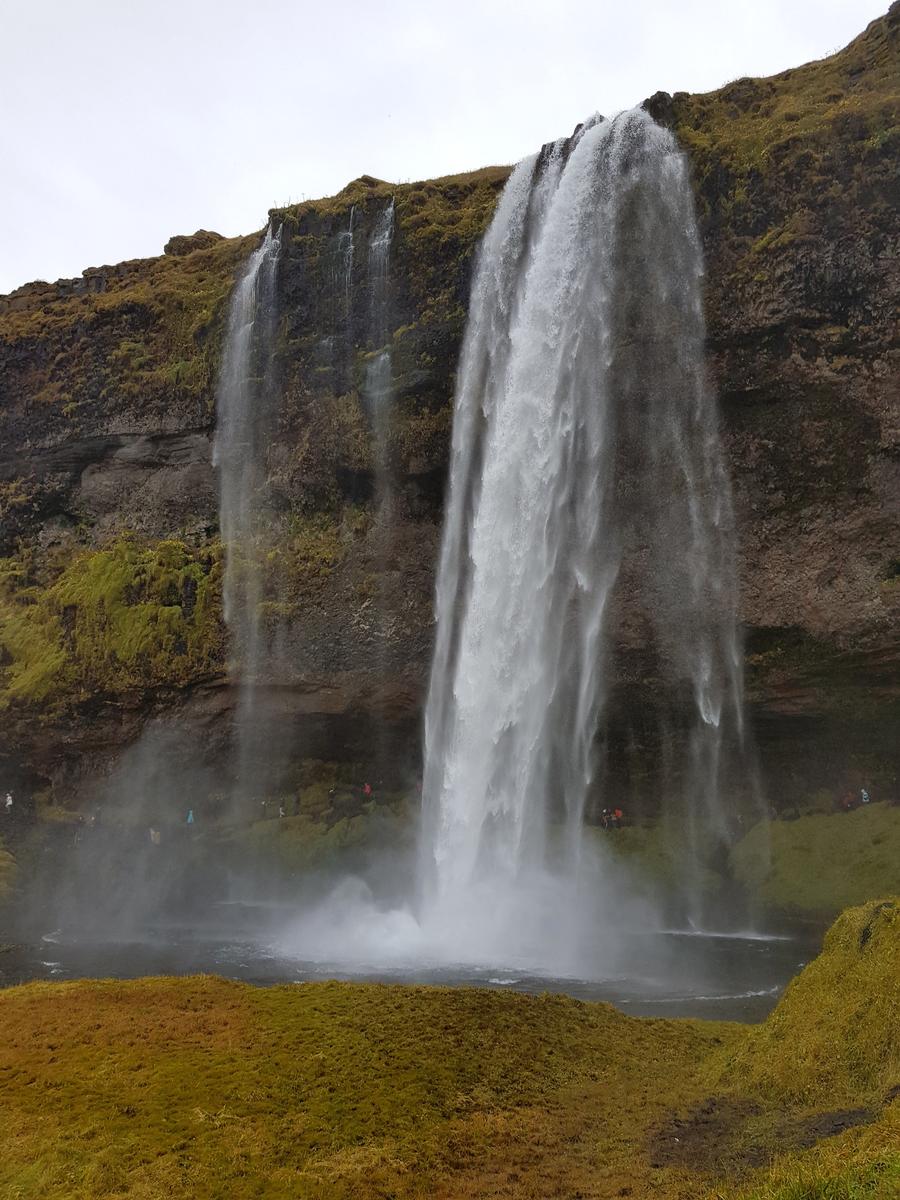
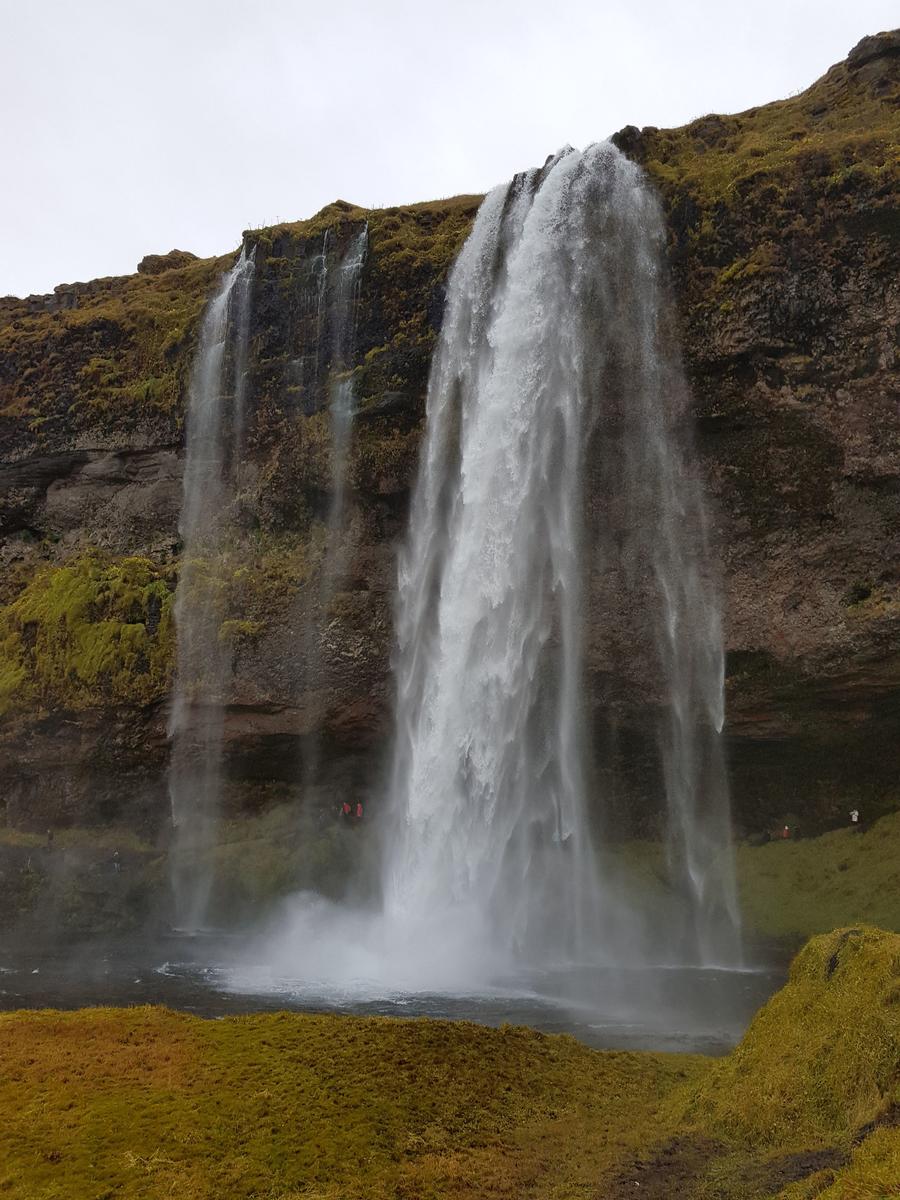
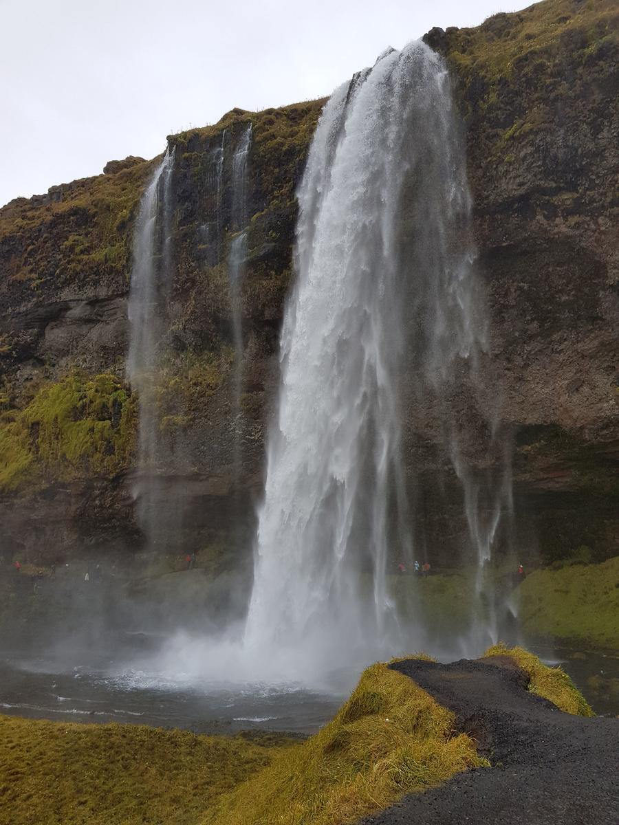
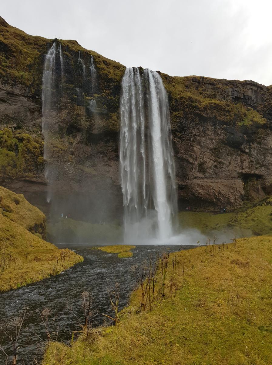
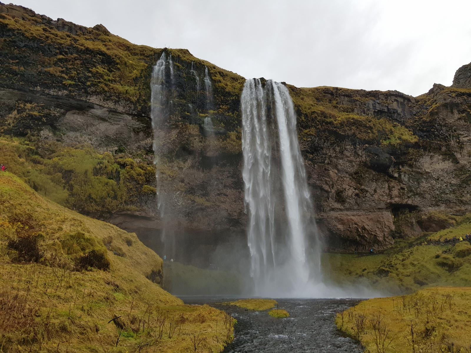
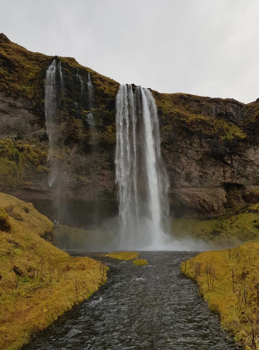
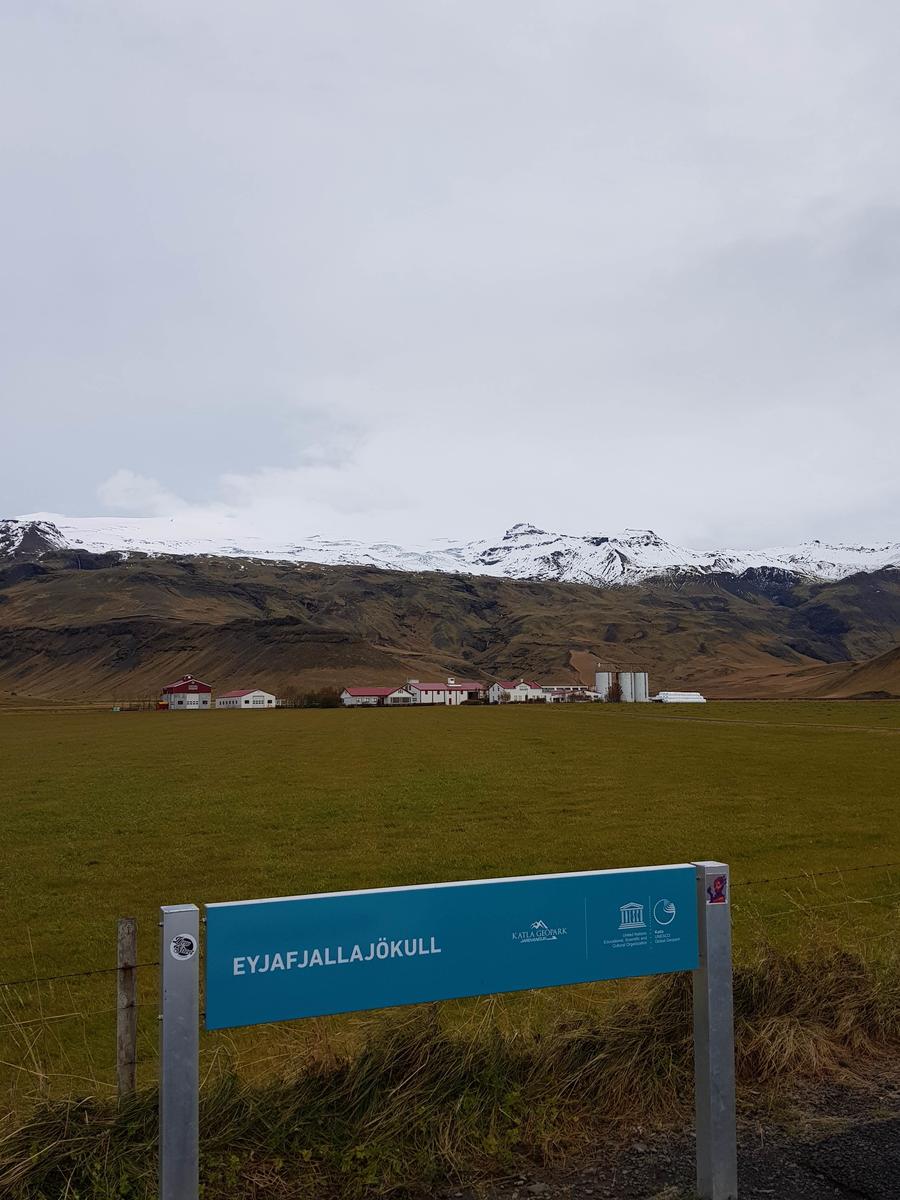
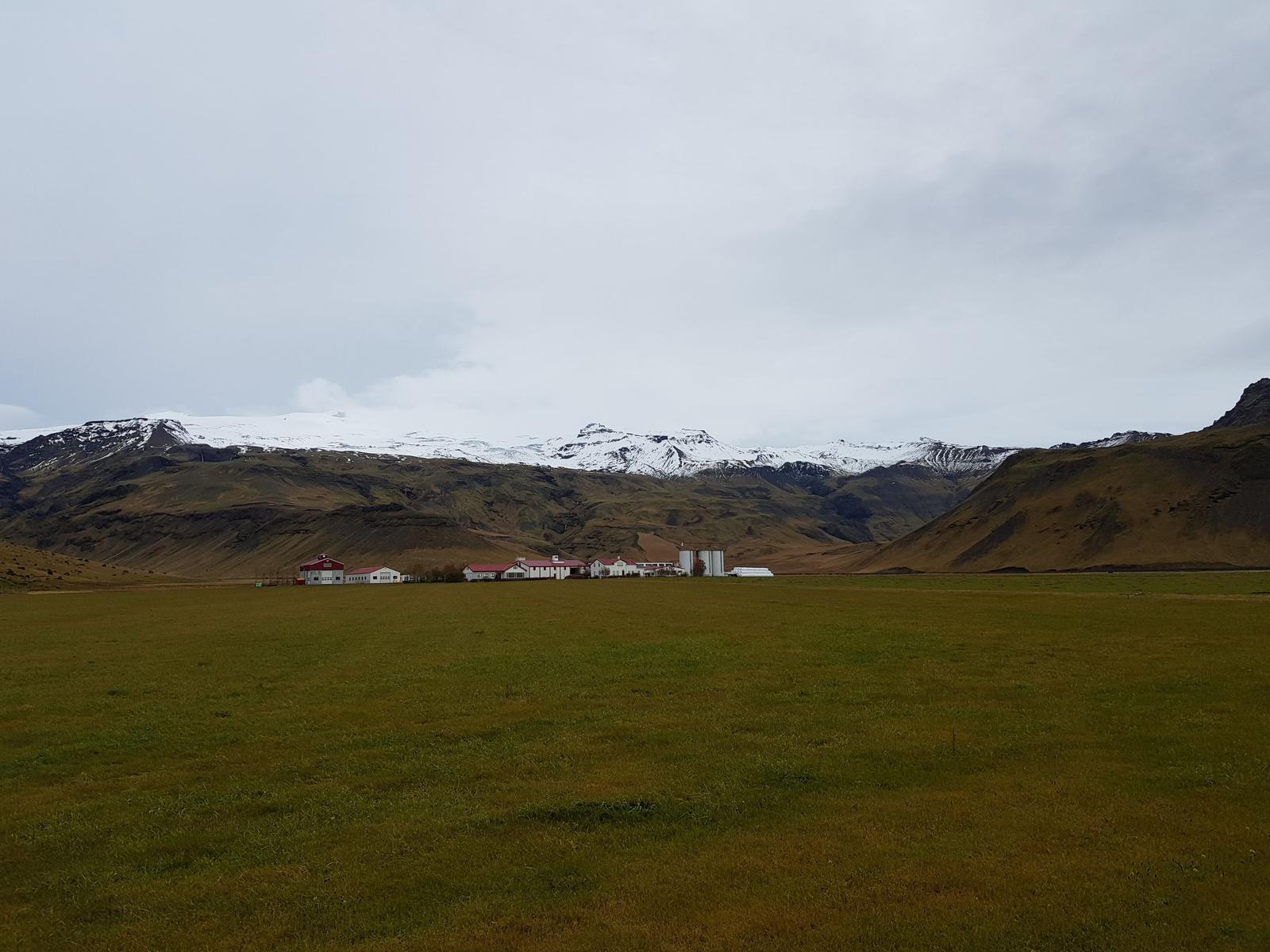
2. Seljalandsfoss.
Our second stop was the famous Seljalandsfoss waterfall (foss = waterfall) which has a height of 60 metres. Seljalandsfoss is:
“… part of the river Seljalandsá, has its origins underneath the glacier Eyjafjallajökull. The volcano beneath this ice cap was the one that erupted in 2010 and caused havoc at airports across Europe.”
There is a large parking lot and we had no trouble finding a spot, parking was pay and display via meters. It was a very short walk to the waterfall from the car-park.
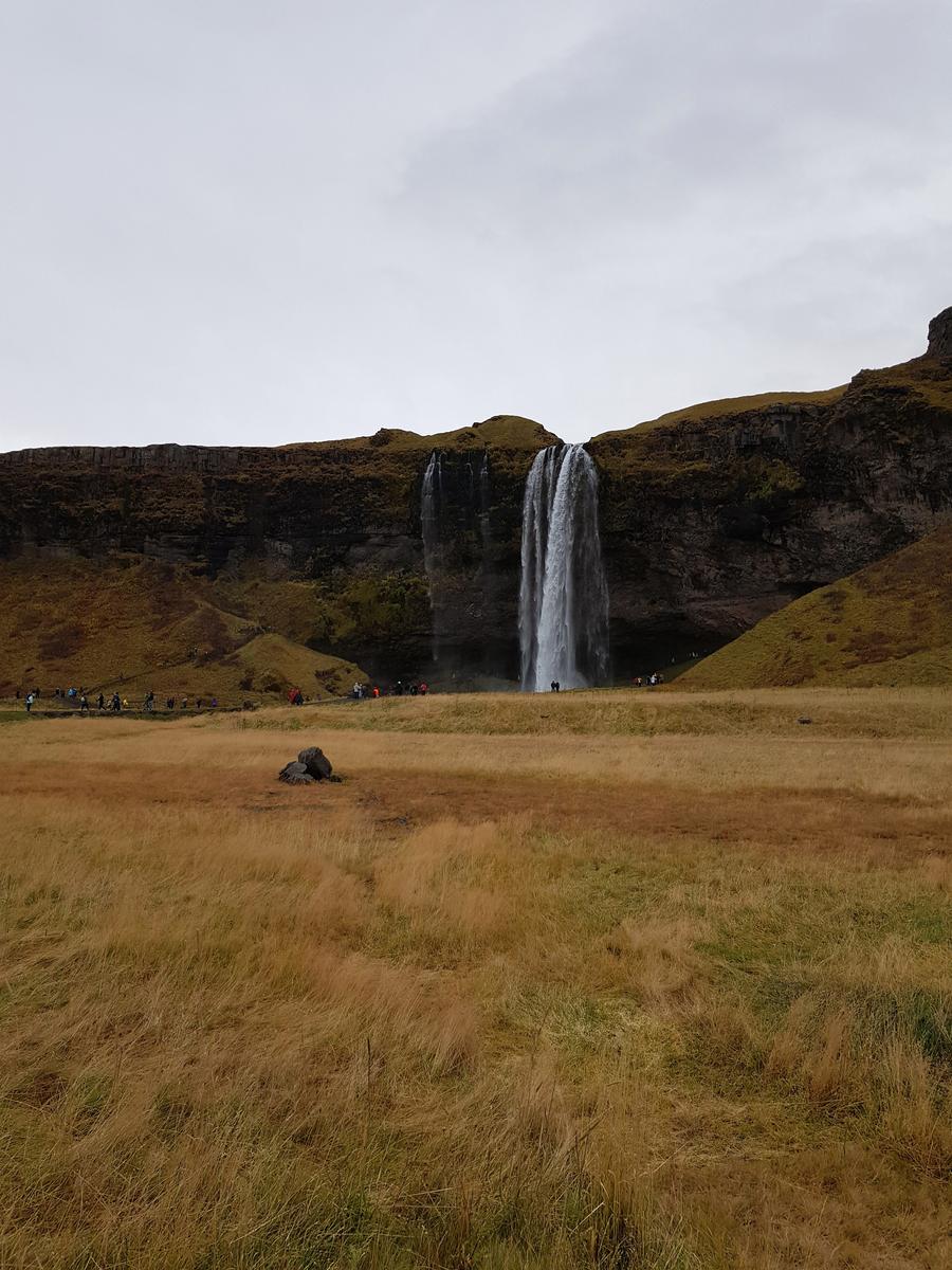
This particular waterfall is popular due to the existence of a looped walking path which brings you directly behind the waterfall - dress appropriately! Needless to say we didn’t volunteer for a soaking, while it wasn’t raining it was still bloody cold. You can see people doing the walk in my photos though!
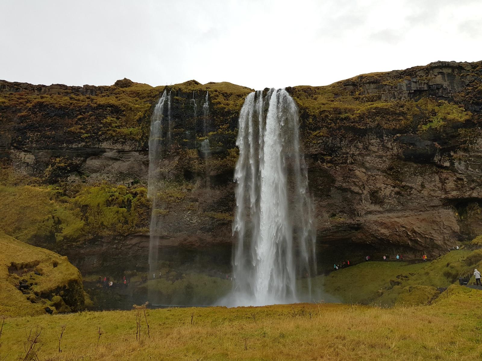
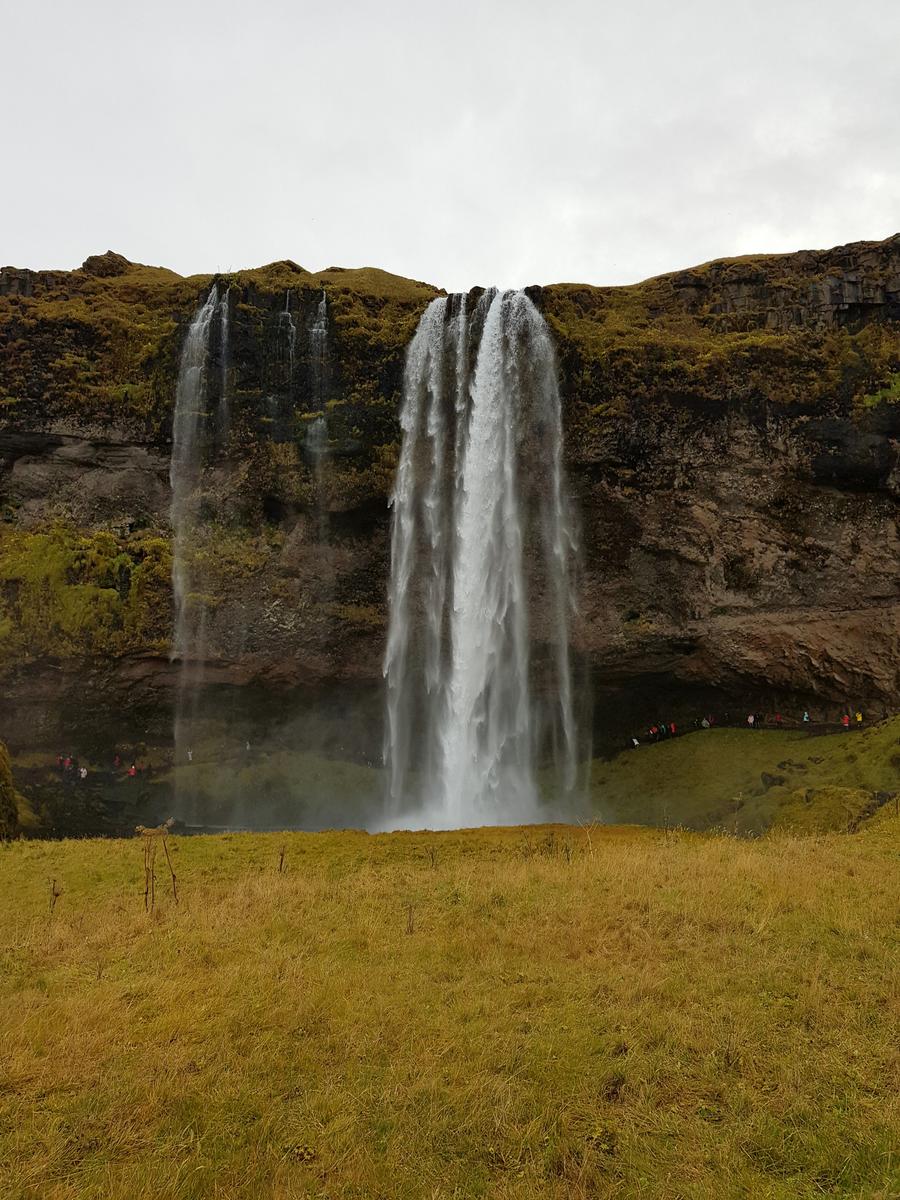
On the way back to our car we grabbed two coffees to warm ourselves on the drive to our next stop. While Seljalandsfoss is gorgeous, it was not my favourite waterfall (there are LOADS of waterfalls in Iceland)… our next stop was Skógafoss and for me it was the nicer of the two we visited that day.
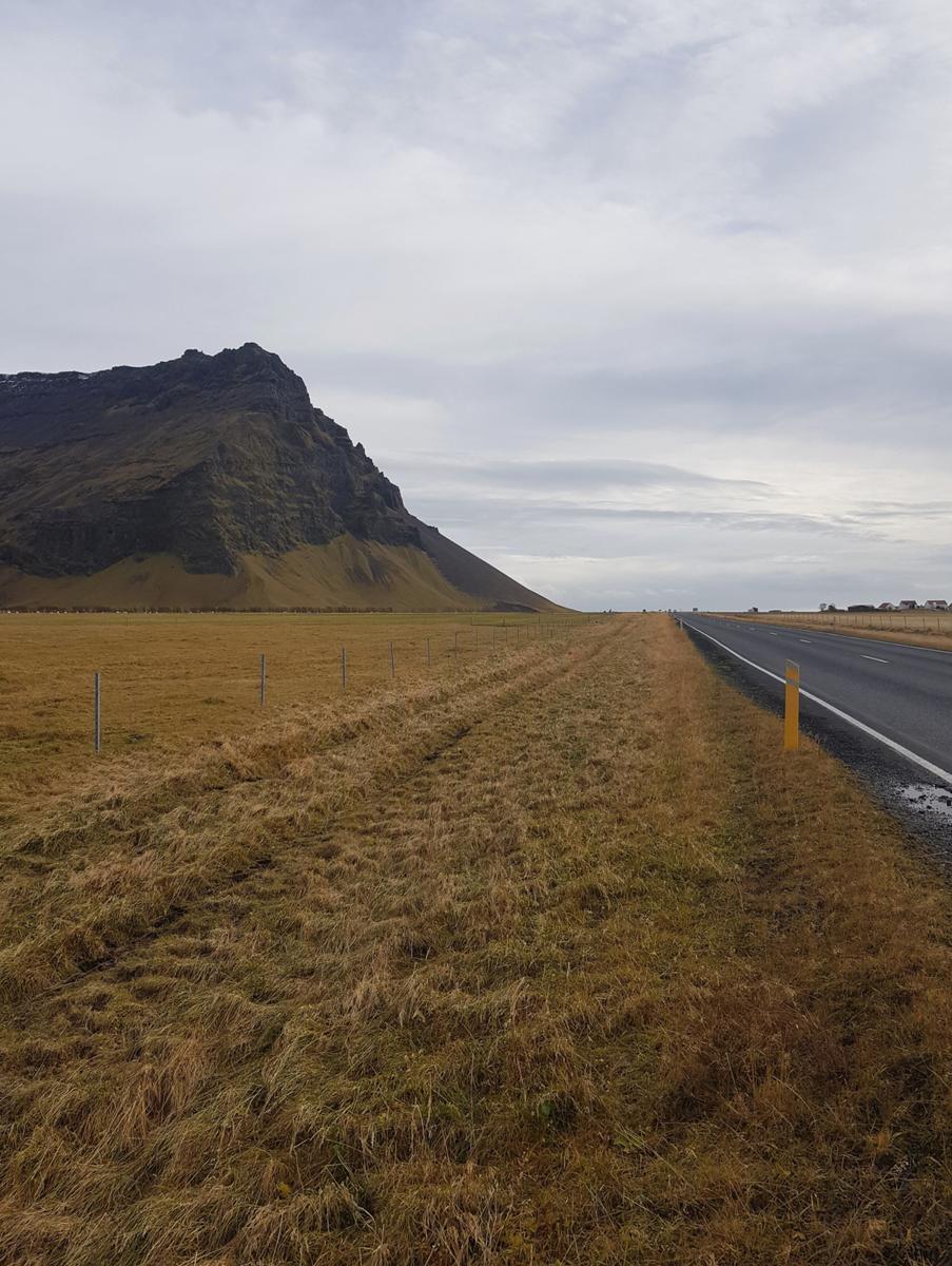
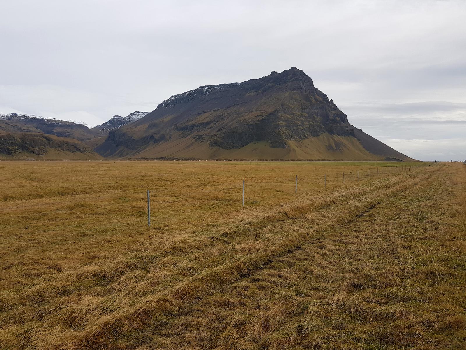
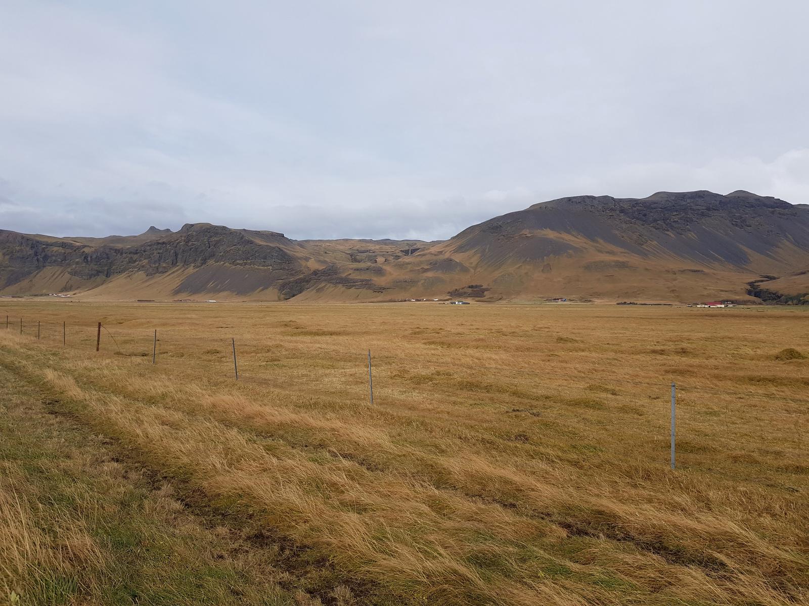
I have to mention that the scenery when driving around Iceland is magical. The drive from Seljalandsfoss to Skógafoss was gorgeous, although there was far nicer to come later on our road trip! We passed the aforementioned Eyjafjallajökull Glacier (source of the river that feeds Seljalandsfoss).
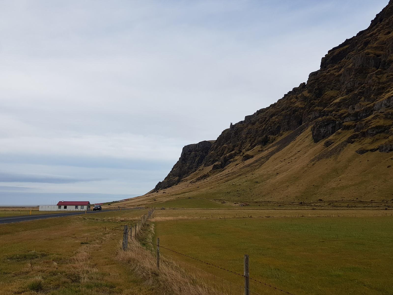
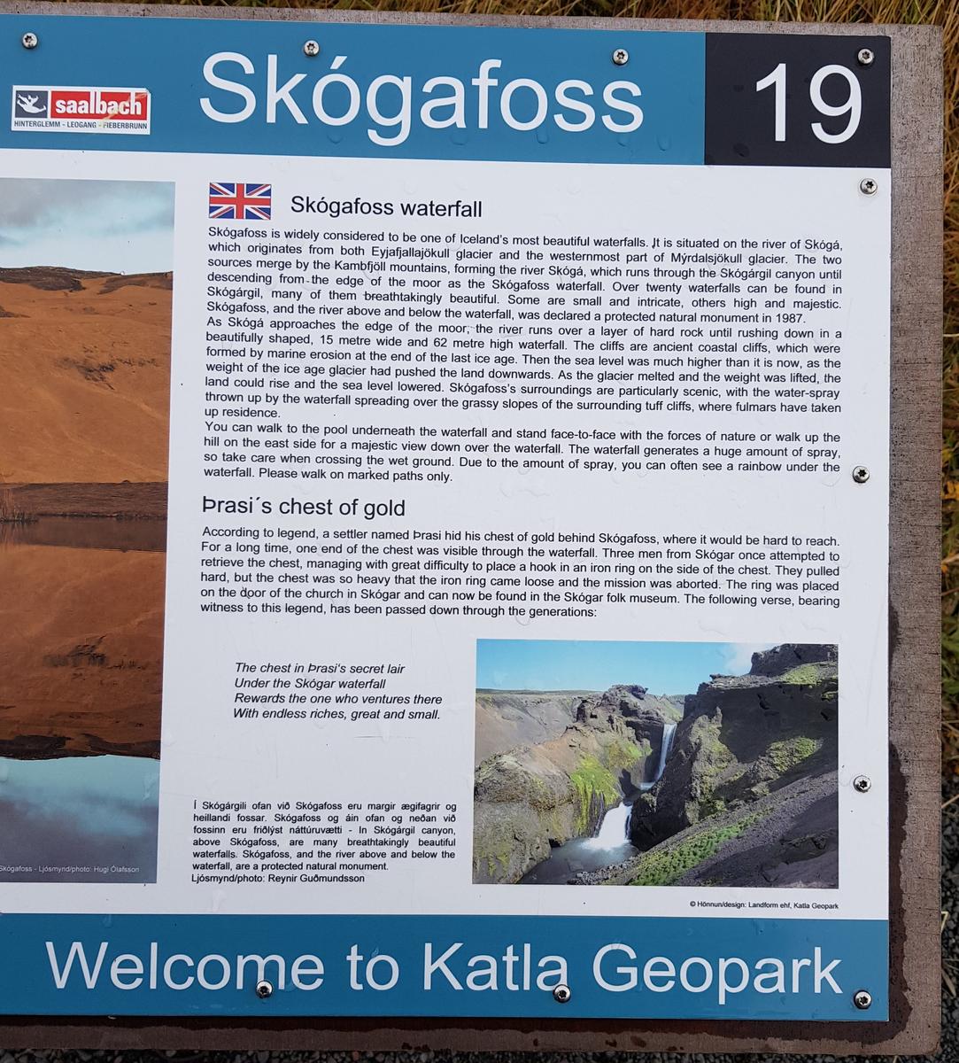
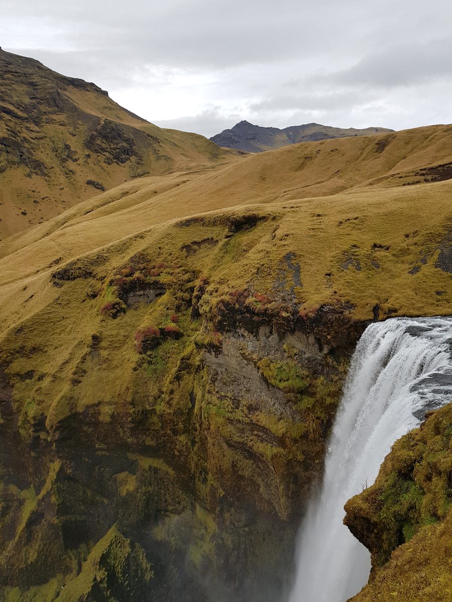
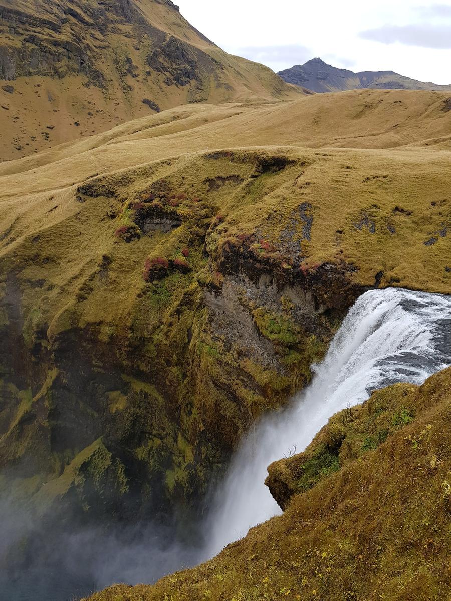
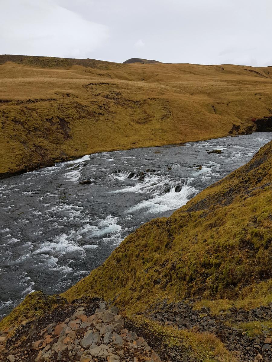
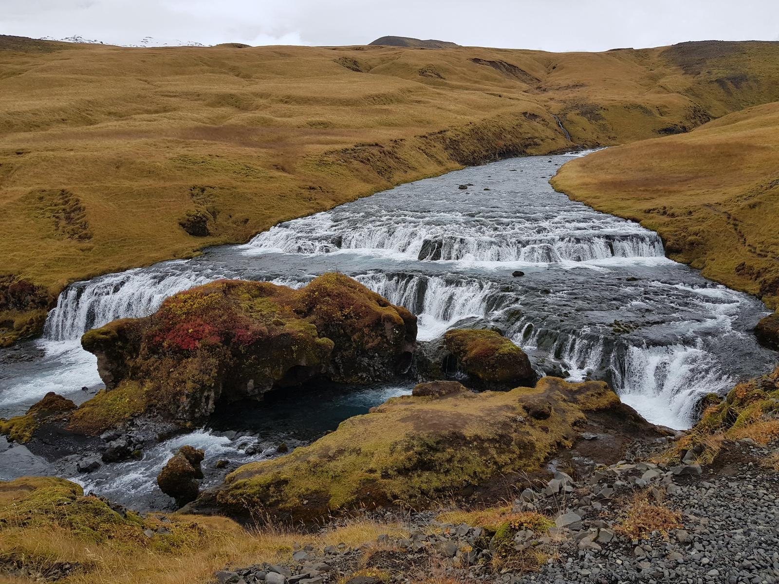
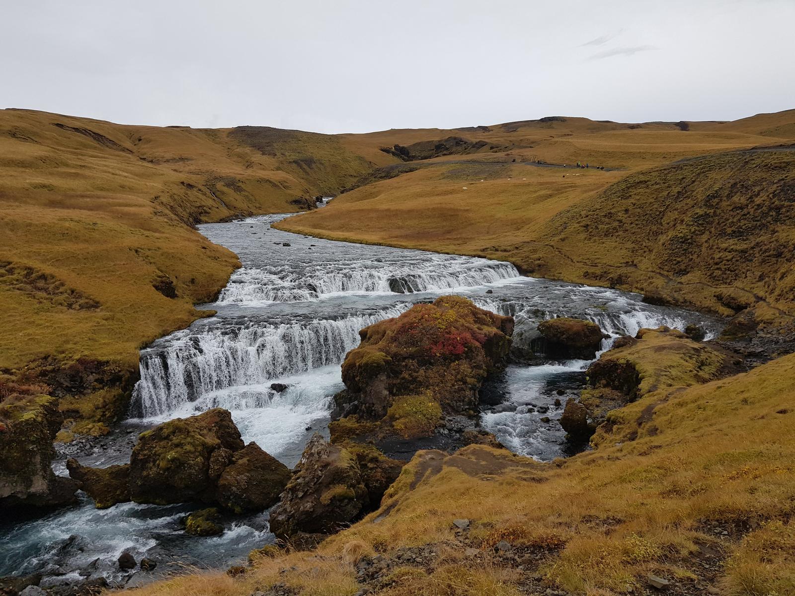
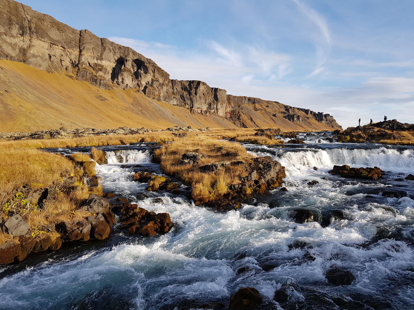
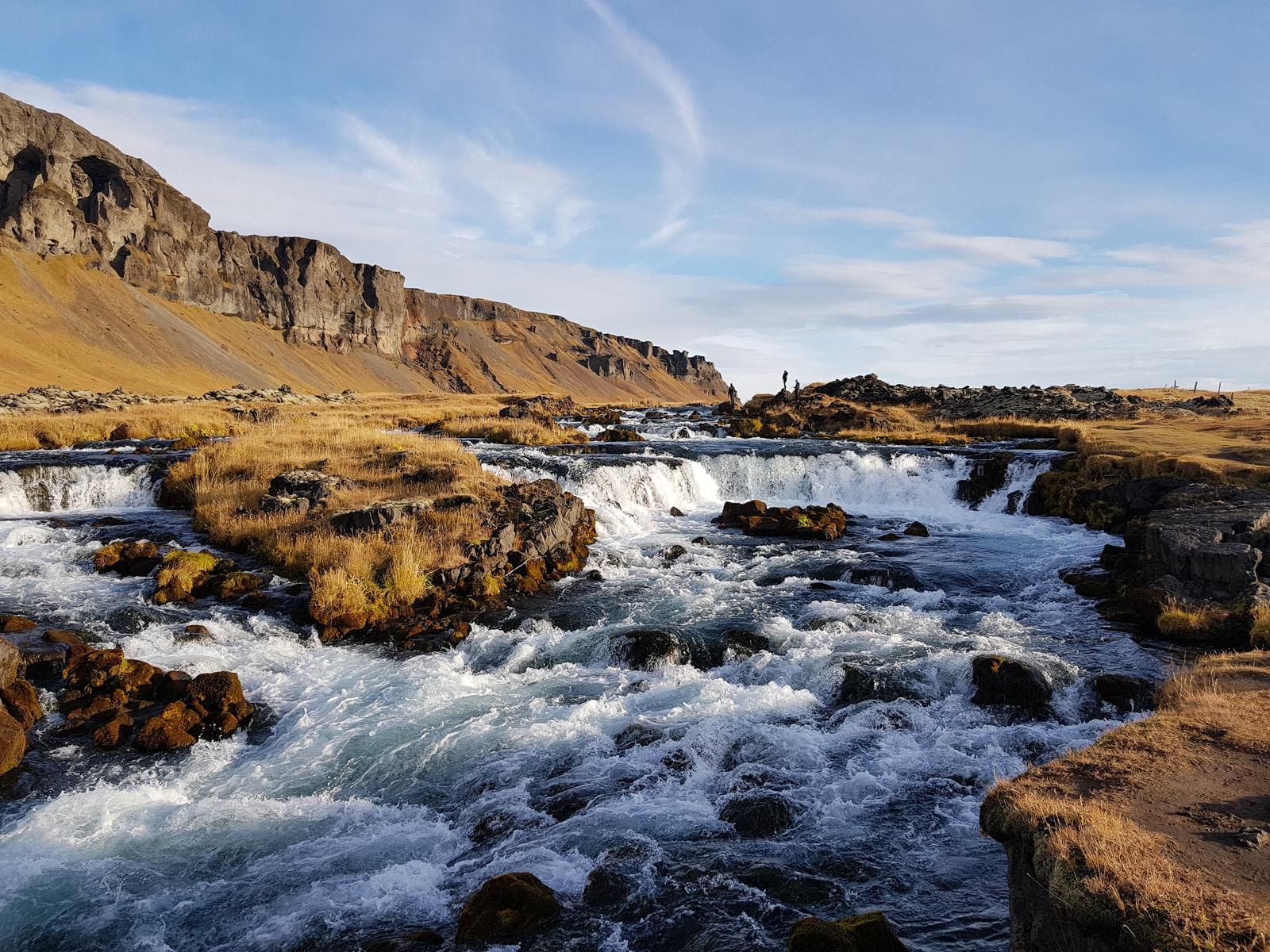
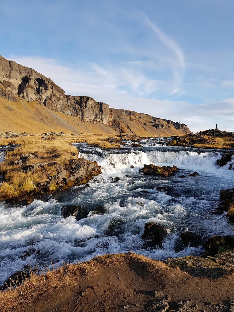
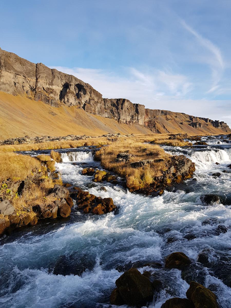
3. Skógafoss.
As you can read in the information board photo below, Skógafoss is situated on the river Skóga. This river originates from both the Eyjafjallajökull Glacier and the Mýrdalsjökull Glacier. At 62 metres, Skógafoss is just slightly higher than Seljalandsfoss which is 60 metres.
Again, the walk from the car-park to the Skógafoss waterfall wasn’t far. There is a cafe, toilets and a camp-site all near the car-park also.
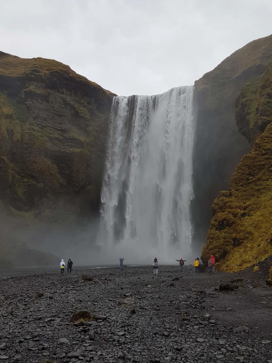
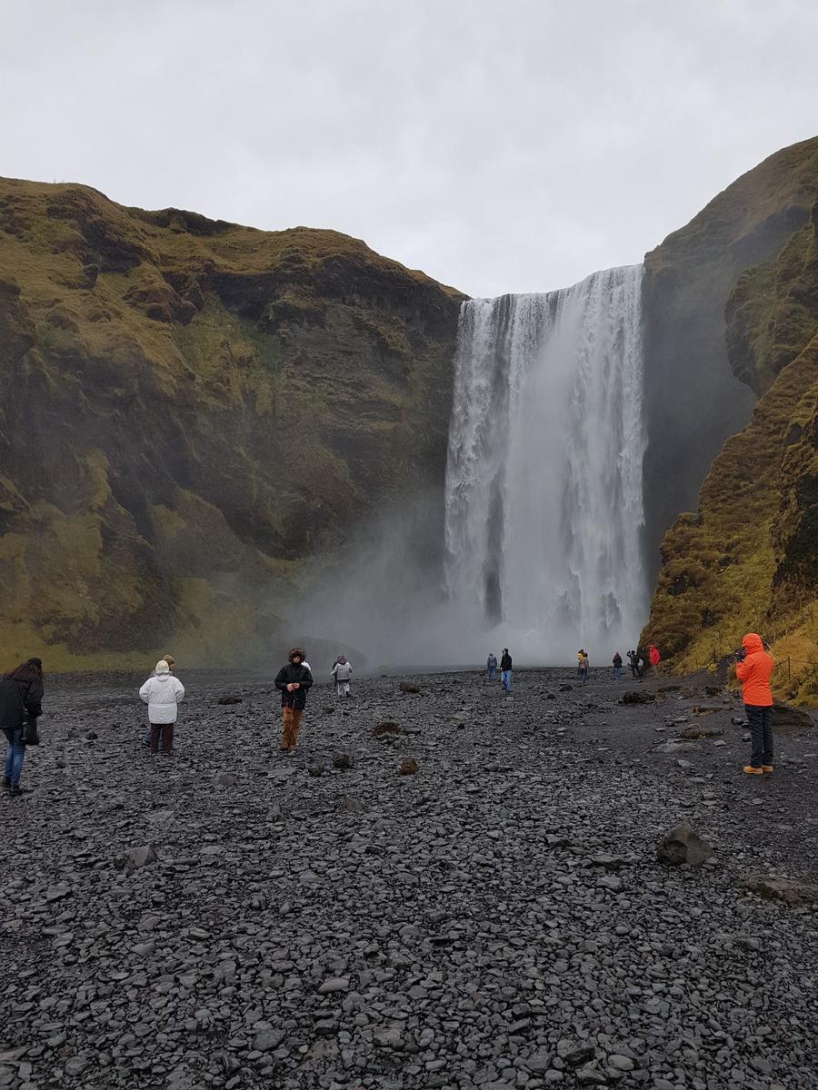
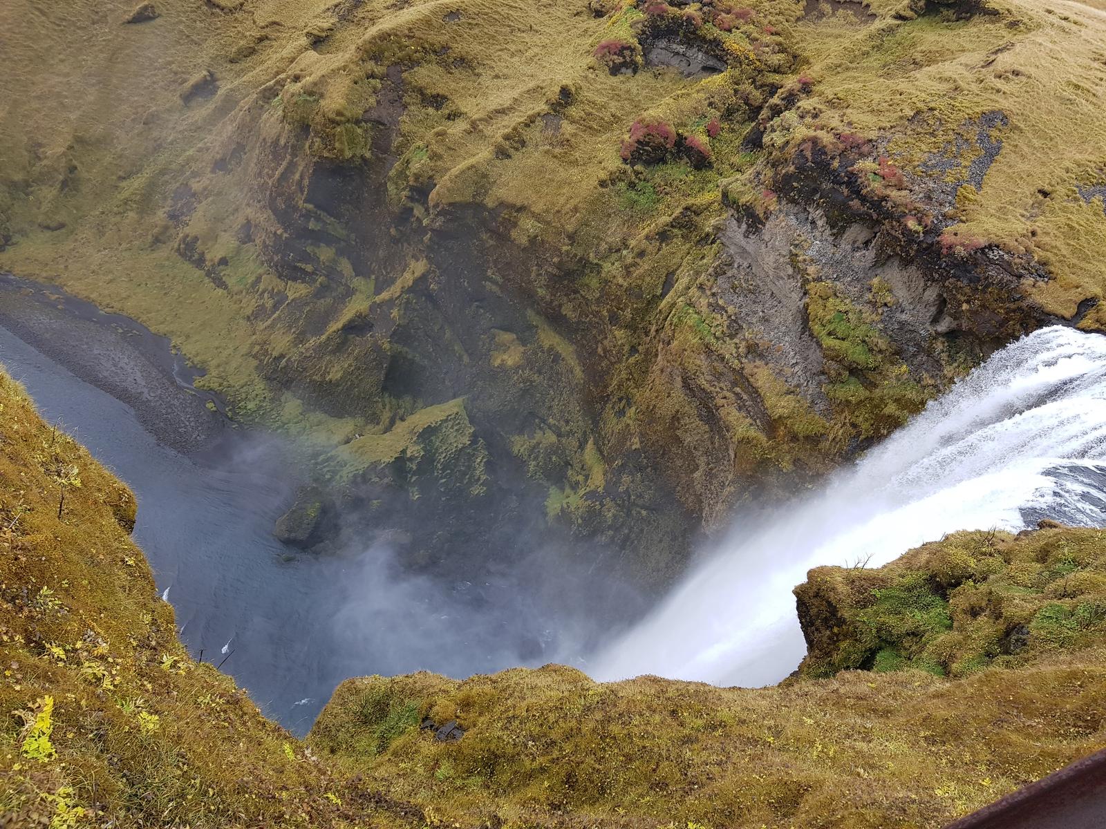
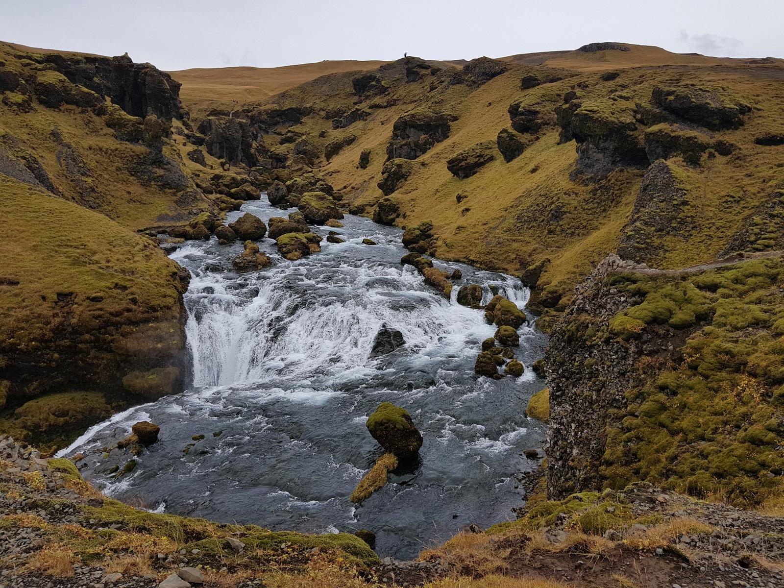
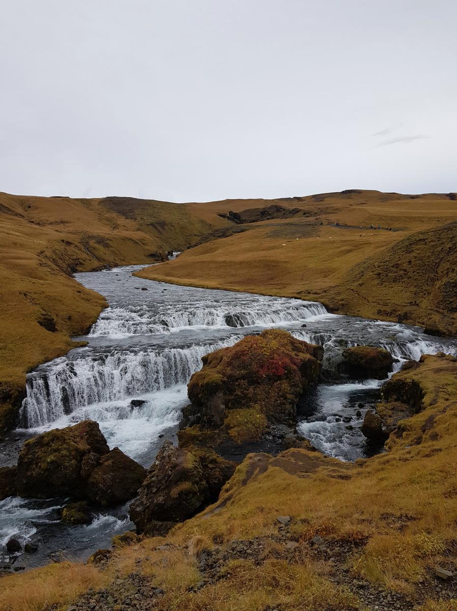
For us, what made this waterfall nicer than the previous one was the ability to follow a series of wooden steps up the right side of waterfall. Once at the top, there was a great view of the surrounding landscape from a viewing platform:
You can continue on dirt trail from the viewing platform, from which there is an alternative view of the waterfall:

We continued along the trail following the river. There are some proper hiking routes that begin here if you had the time I bet they are beautiful! We would have loved to walk further but we had not planned or prepared for hiking so we settled for the easier close-by trail.
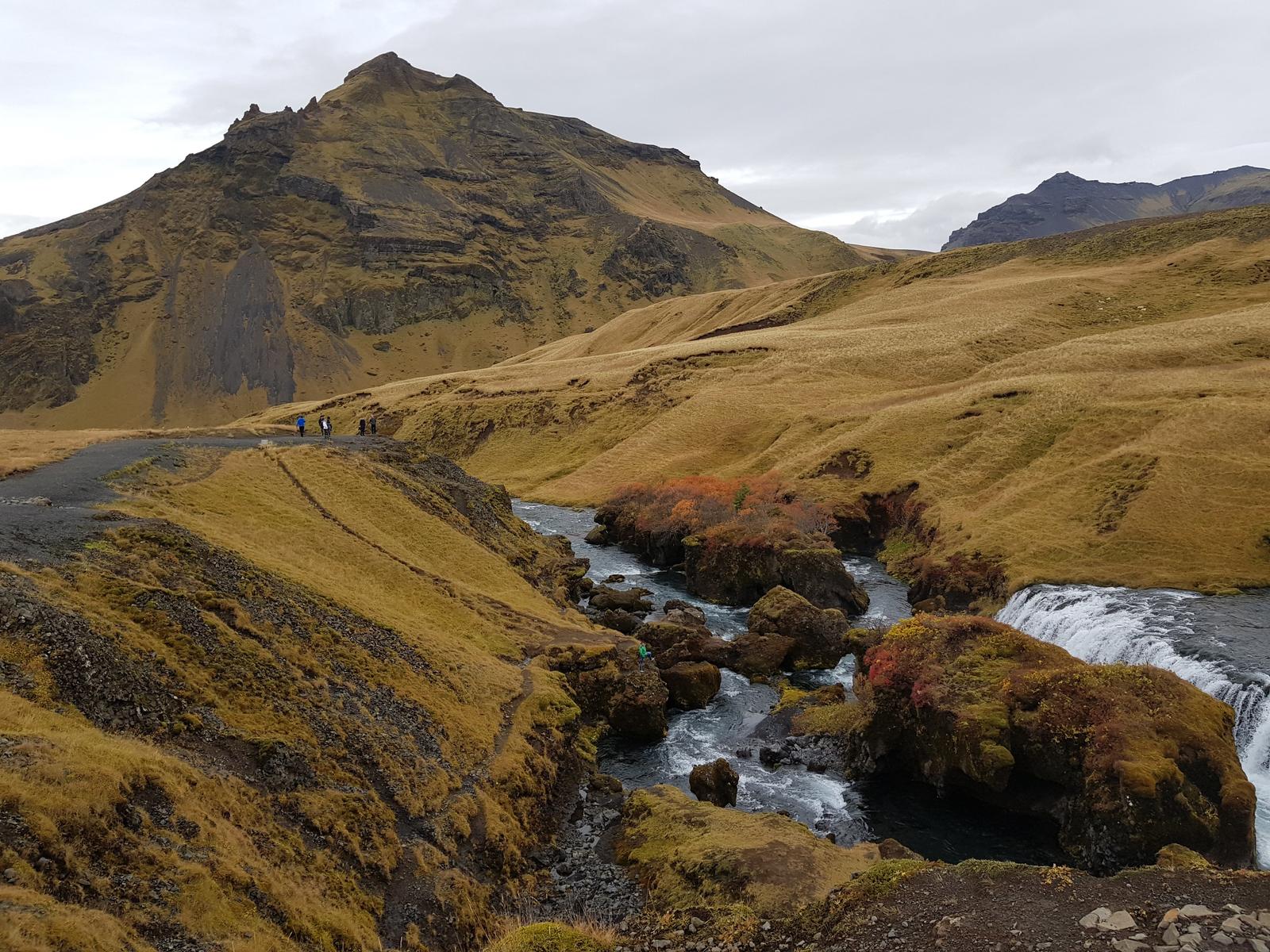
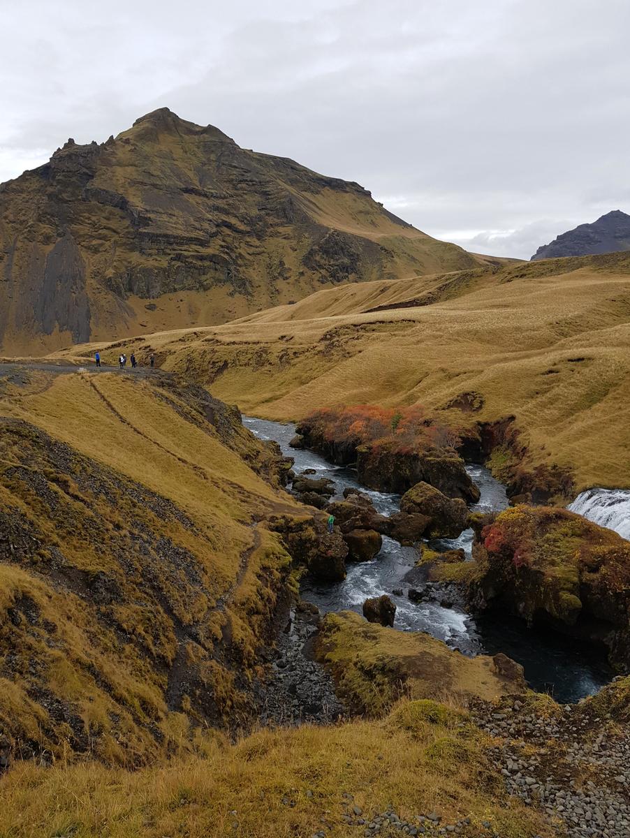
As you can see from our photos, while there were other tourists around, it wasn’t busy at all. The majority of visitors who did walk up the wooden steps didn’t go any further, just to the viewing point and back down.
We probably spent over an hour around the waterfall and the trails before heading back to car where we had our picnic lunch and headed back on the road to the last attraction of the day!
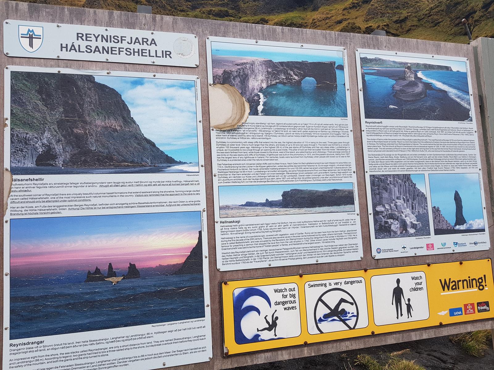
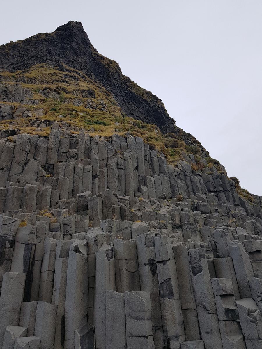
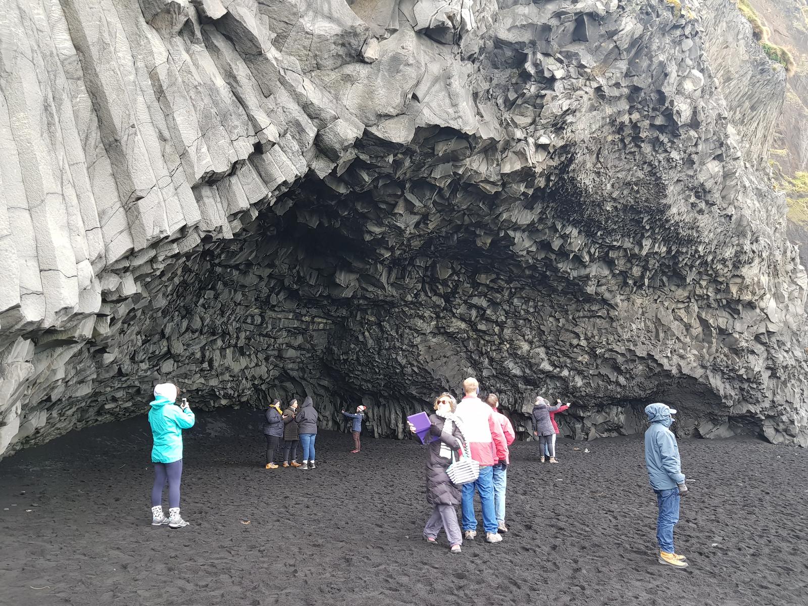
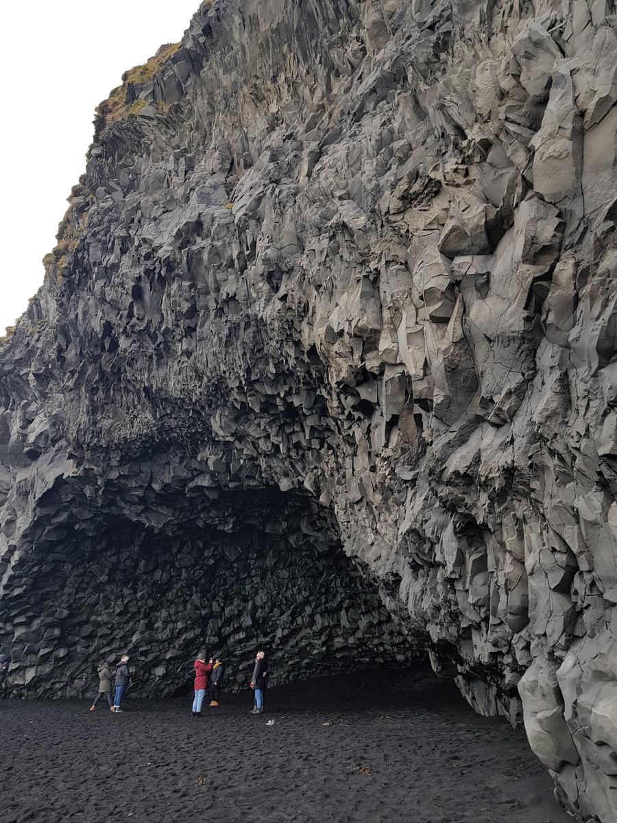
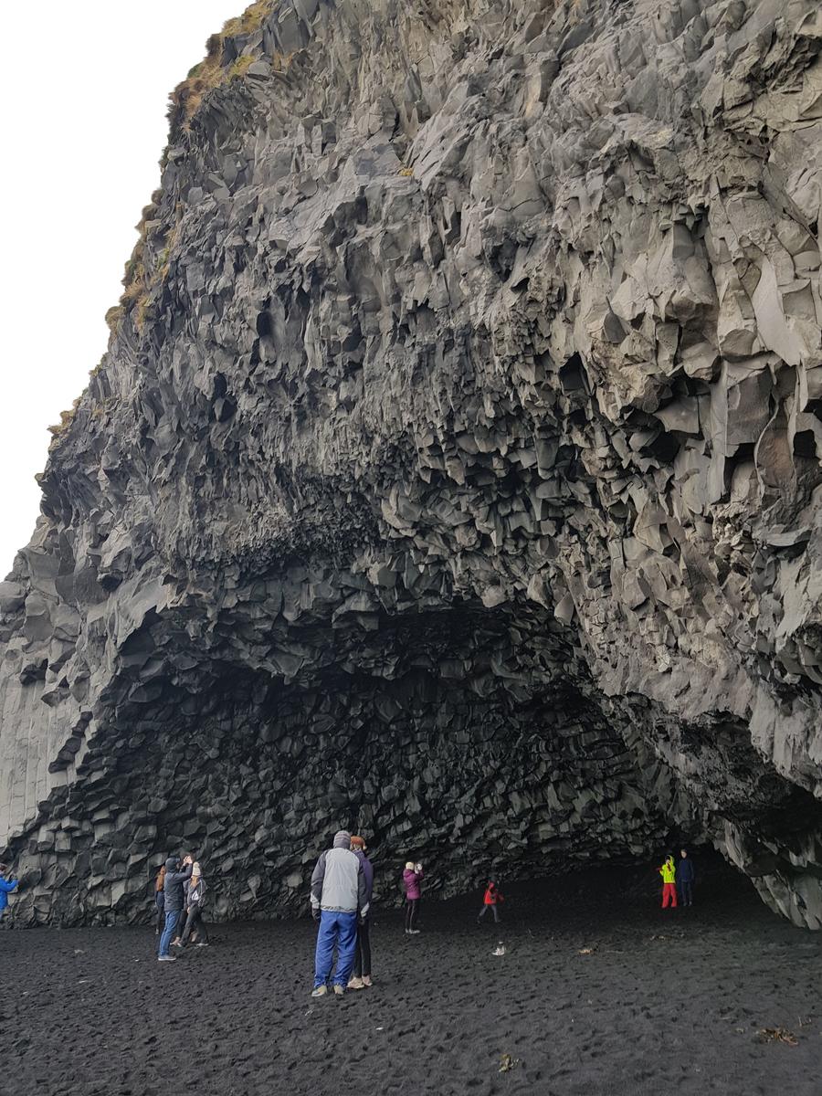
4. Reynisfjara Hálsanefshellir - Black Sand Beach & Caves.
Reynisfjara Hálsanefshellir was definitely the busiest of all the places we visited on our first day, probably as it was early afternoon by the time we got there. The car park was hectic with lots of large tour buses and camper-vans, you will see all the people that were around in our photos. It was really soooo cold here, all the layers were needed!
I had read online about the waves being dangerous at this beach (you can see the warnings on the sign located at the beach in the photo below) and it didn’t take long to see why. The seemingly harmless small waves quickly became massive and unpredictable, sending people close to the shoreline running. There have been fatalities here over the years, mainly tourists. People posing for photos on the shoreline with their backs to the water who are knocked over by a large wave, the undertow sucking them so quickly that there is no time for anyone to help. So be warned if you do visit, keep your distance from the water and never turn your back on the sea!
According to funiceland.ie:
“Reynisfjara is probably the most famous black sand beach in Iceland.”
And it allows for:
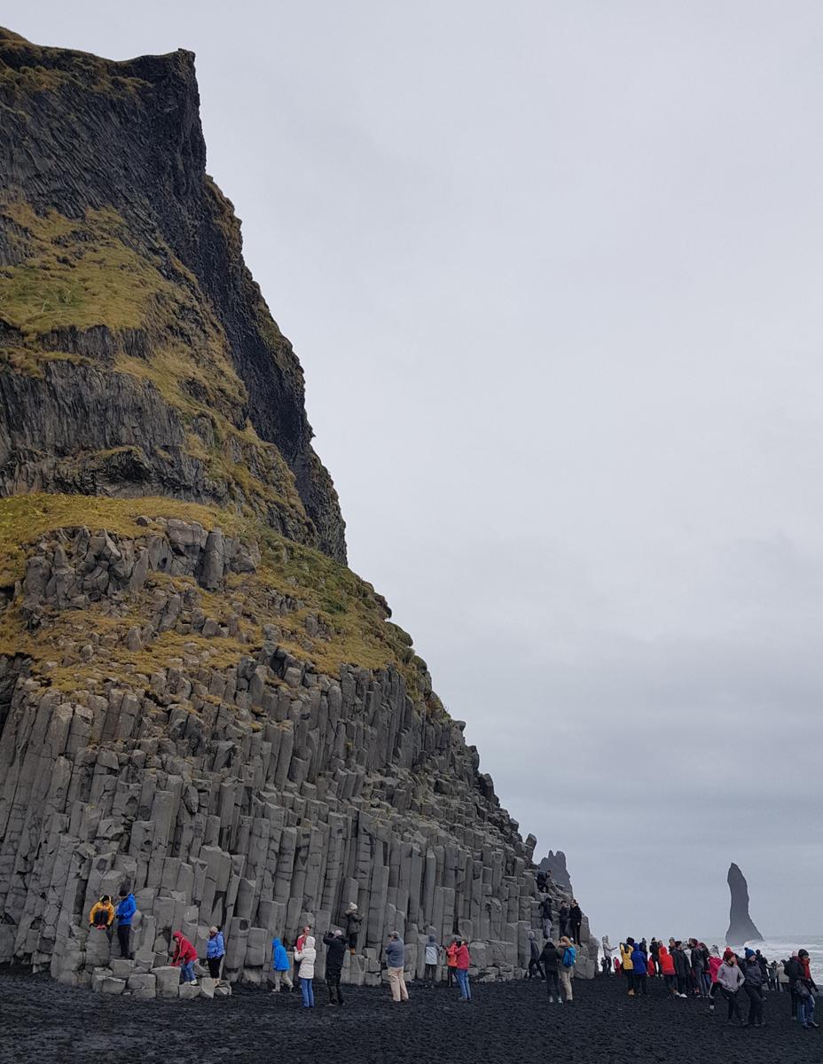
“… some great views of the Atlantic Ocean with the basalt sea stacks Reynisdrangar to the East and the famous peninsula Dyrhólaey to the west.”
From the car-park just follow the path onto the black sand beach and take in the view to the right:
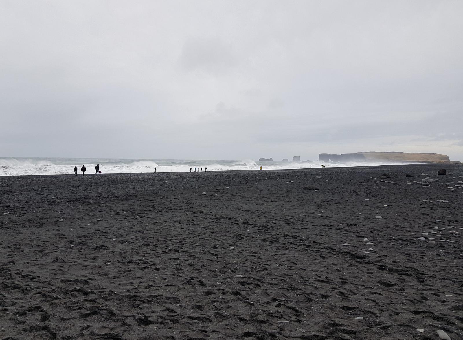
And to your left:
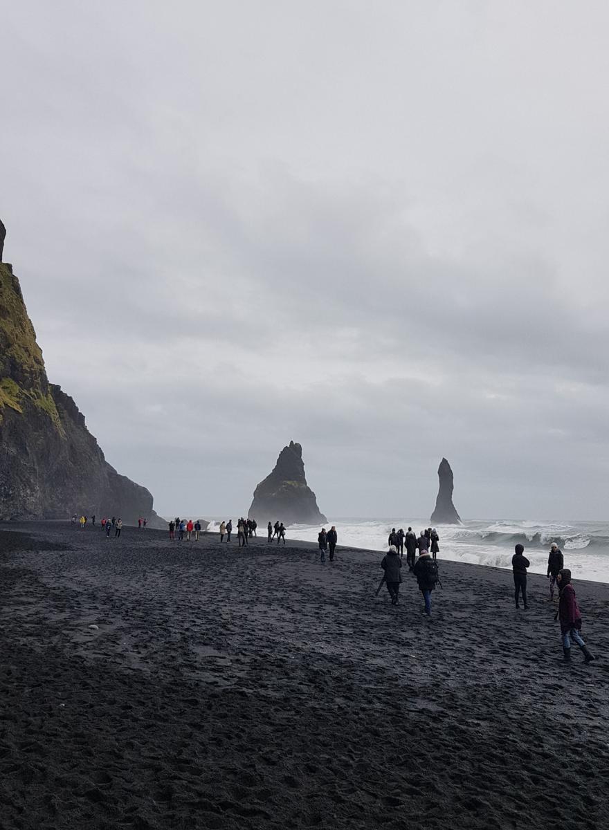

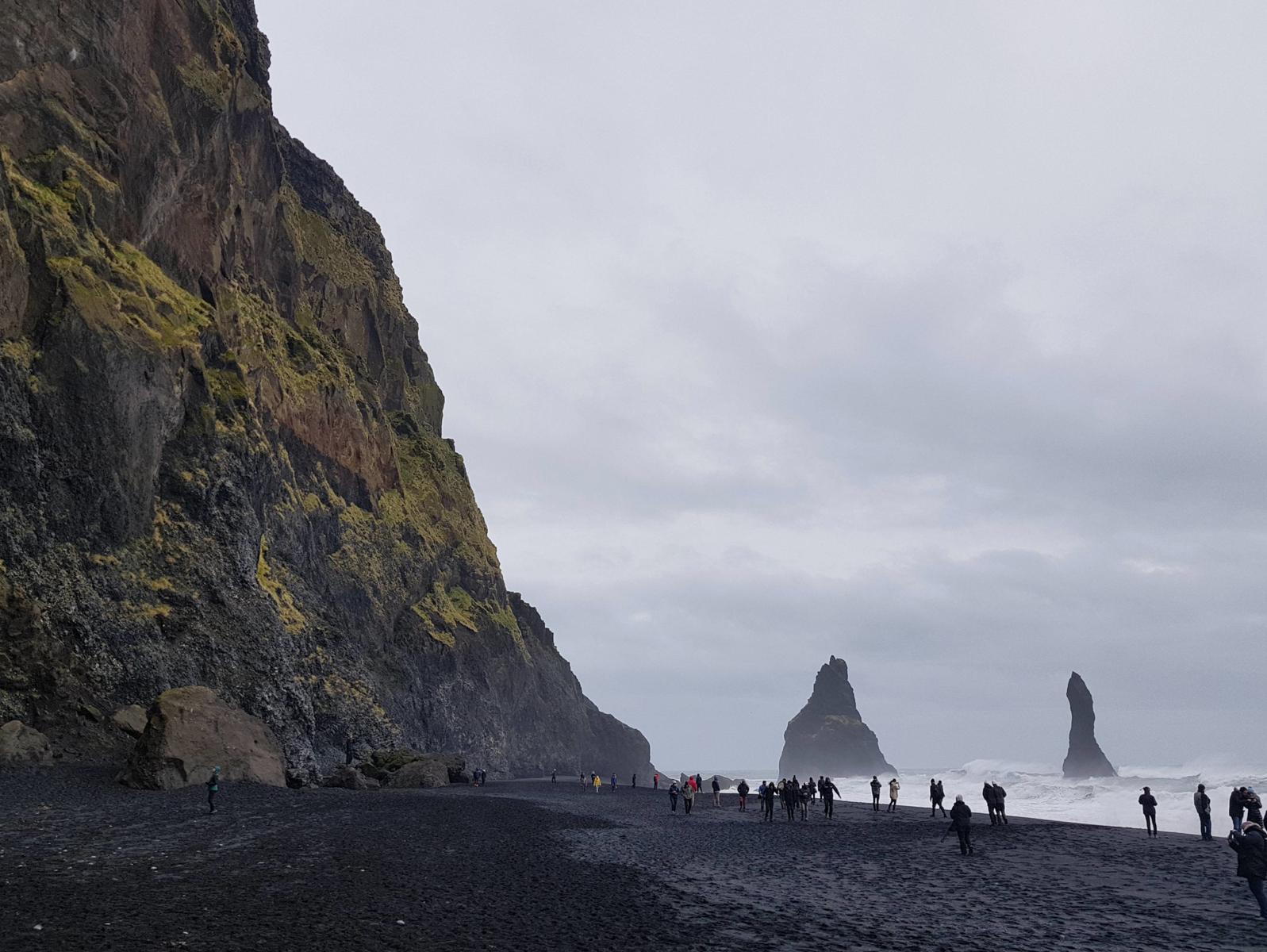
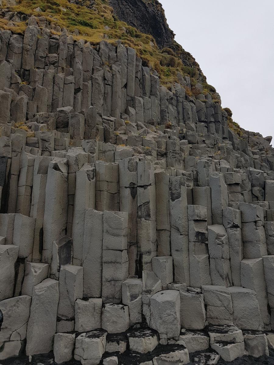
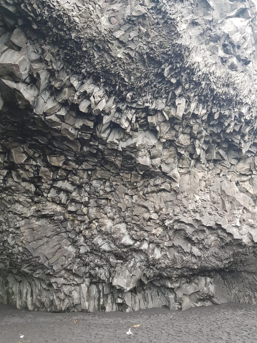
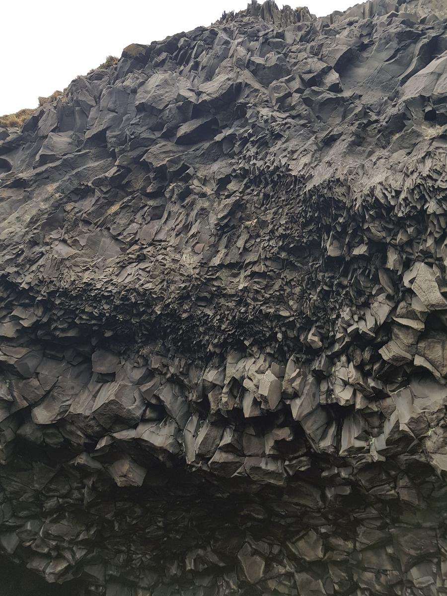
Also on your left are the spectacular basalt formations:
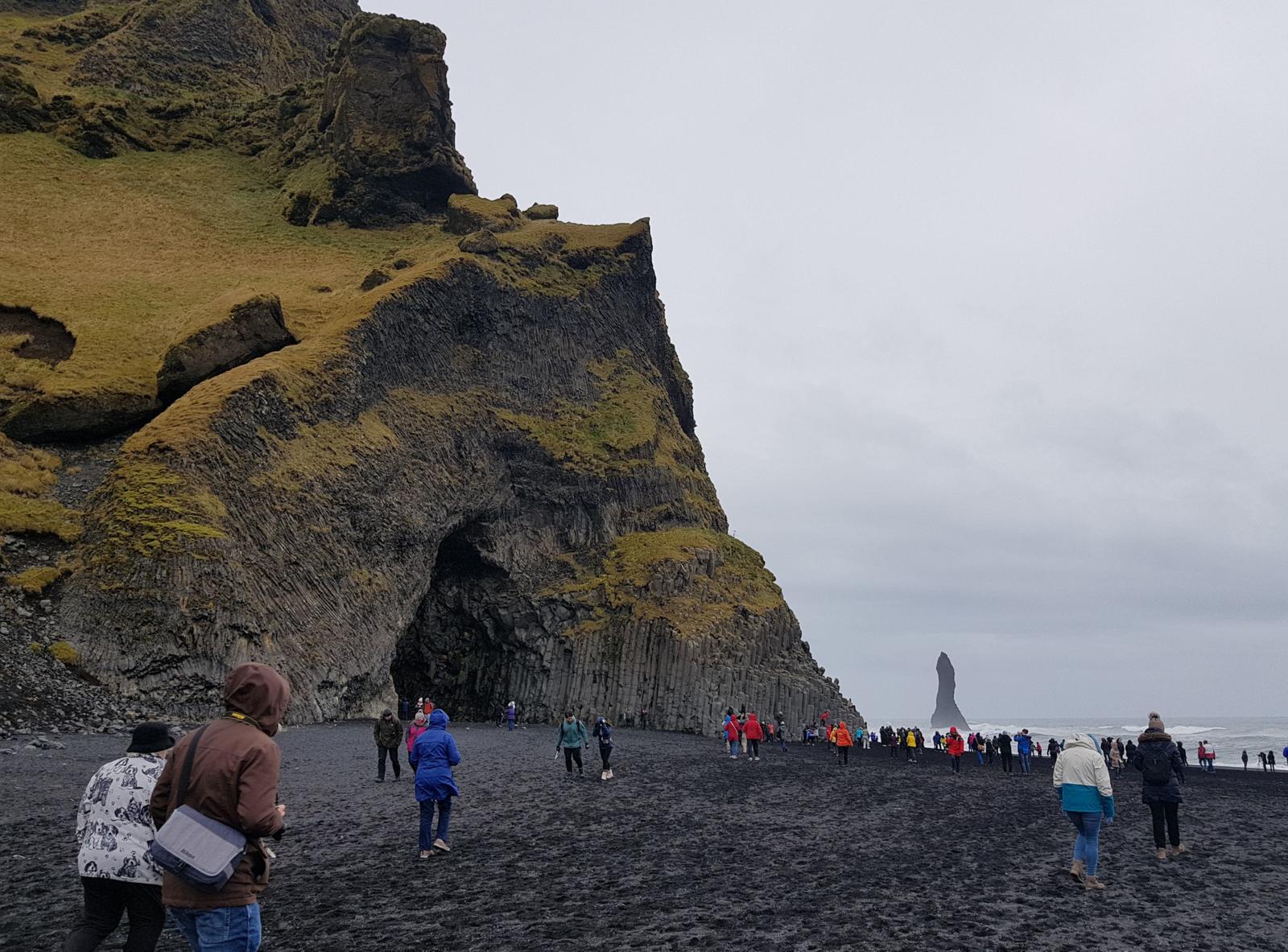
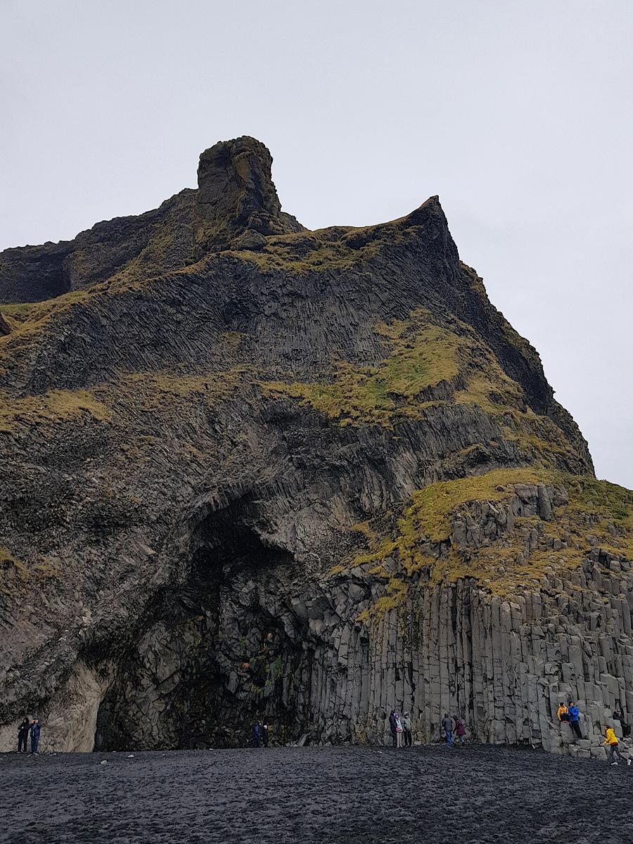
Just a little further on the left is the famous Hálsanefshellir cave:
Sufficiently frozen after a good 40 minutes we headed back to the car and drove to Vik which is the closest settlement to the beach. Here we had a look around and a hot drink before driving to Hotel Laki, our hotel for the night.
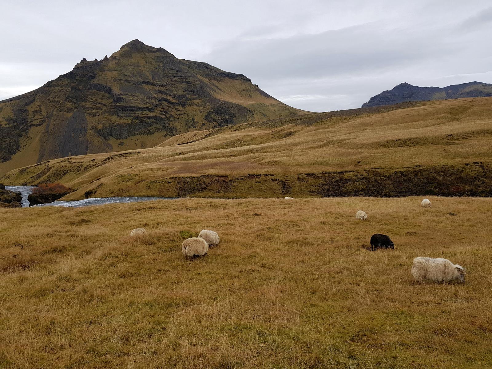
Hotel Laki was really gorgeous, new and modern. We got a free room upgrade as they were quiet. The hotel is located in the country-side, away from any settlements or artificial lights and under the right (aurora) conditions its location makes it the ideal place to see the aurora borealis/northern lights. Unfortunately we were not lucky enough to see them on the night we stayed!
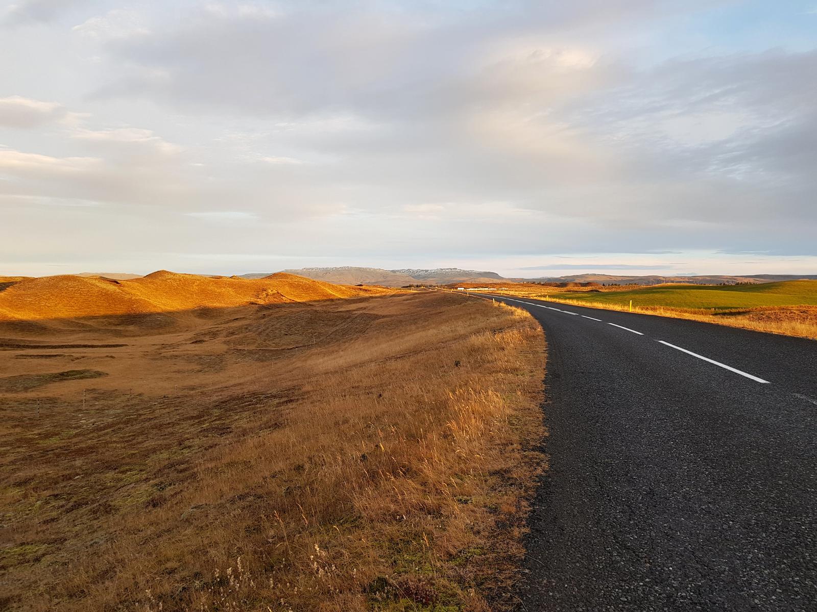
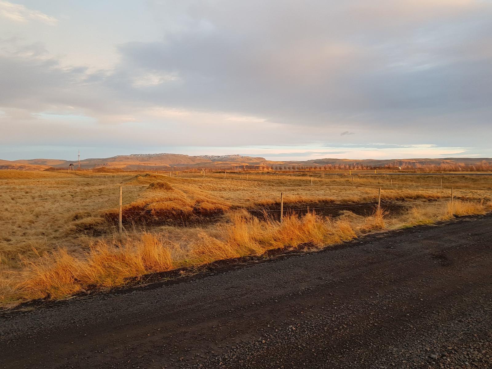
Like the previous morning, on day 2 we also woke early and to good weather! Off we went for a quick run along the deserted country road. This was my favourite run of the entire trip, a beautiful morning, stunning scenery and the place to myself (J way ahead of me as always).
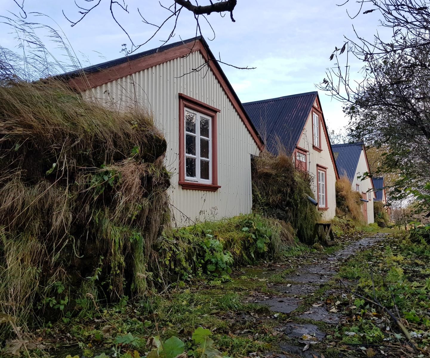
Another reason I liked this run was that I unexpectedly passed another very cute Turf House!
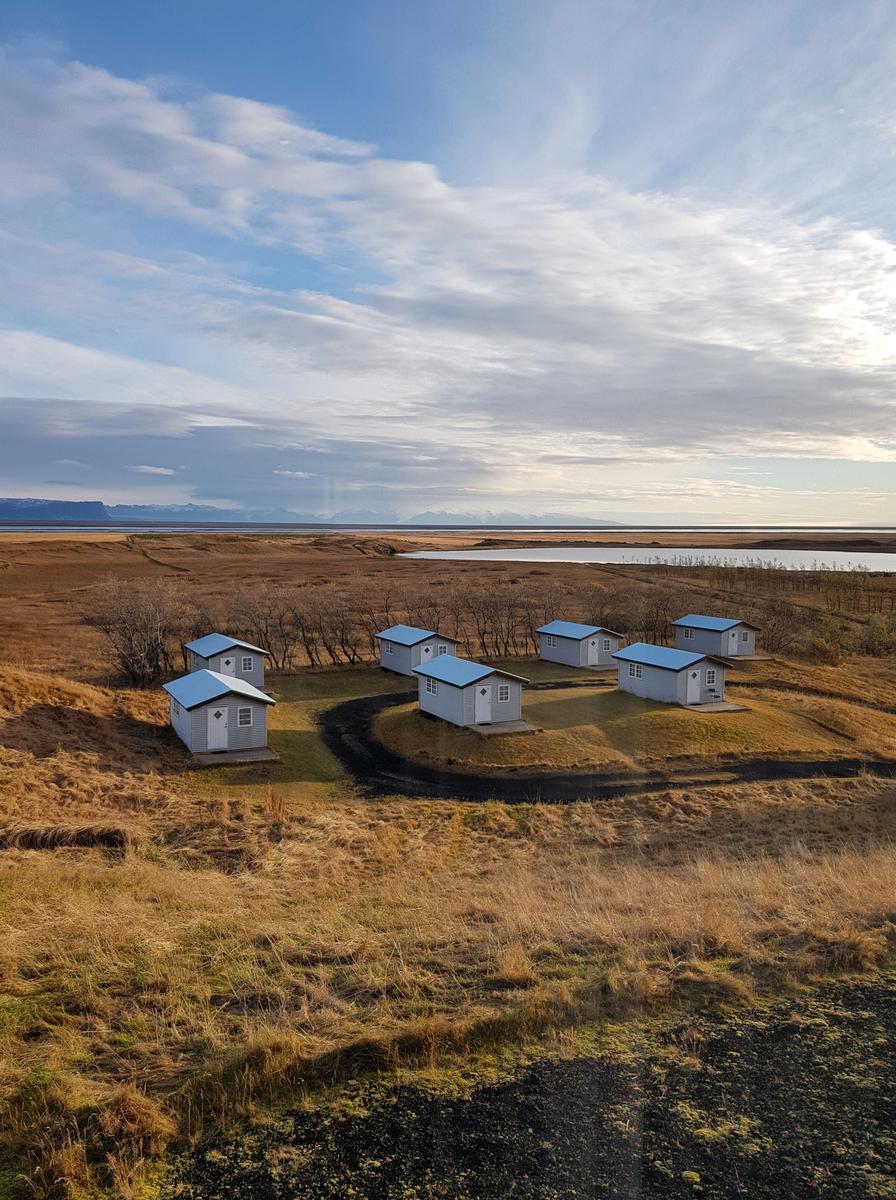
We had breakfast included in our hotel so we inhaled that after a quick shower. The view from the breakfast room was really nice and we could see the cabins that the hotel also rents, I think you would need warmer weather for them though! You can also do a full looped walk around the hotel’s lake that you see in the image below.
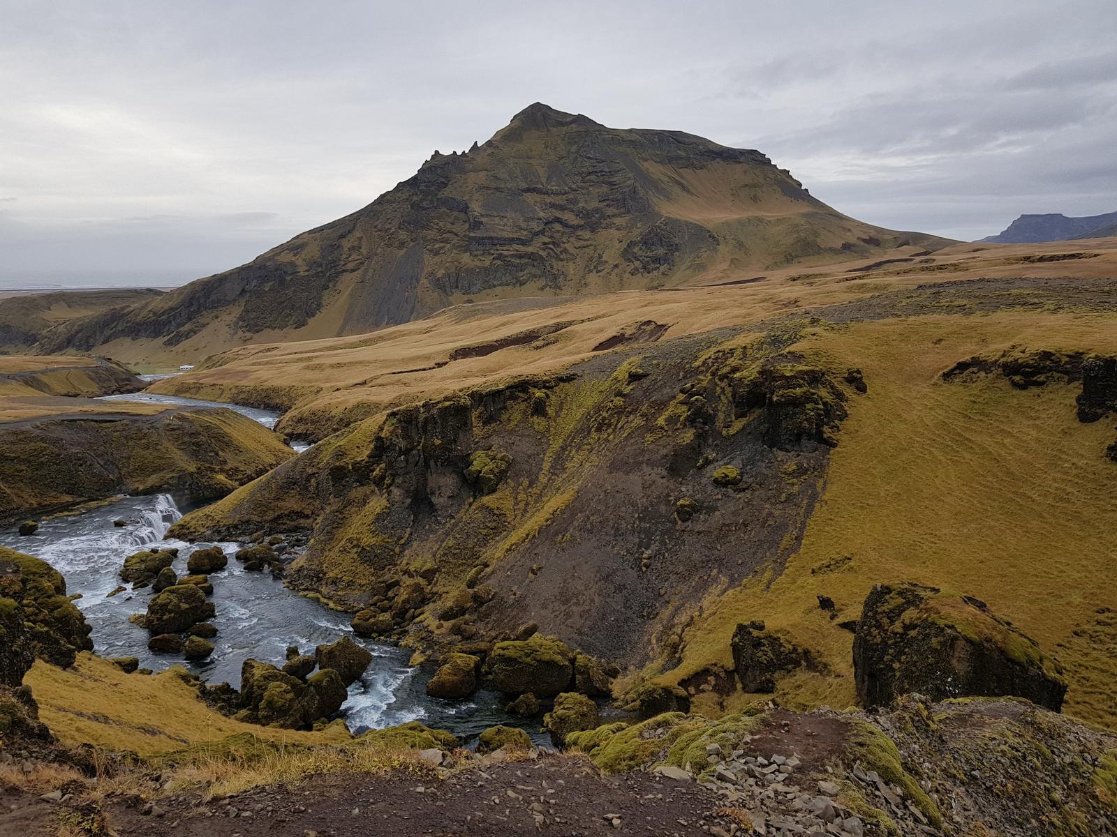
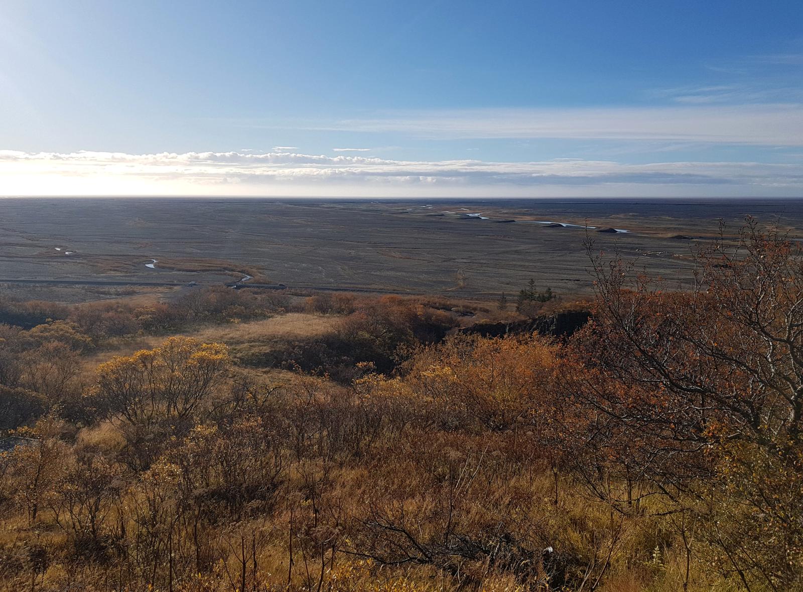
Car loaded up, we hit the road once again, time for the next stop on our Iceland Itinerary - Svartifoss!
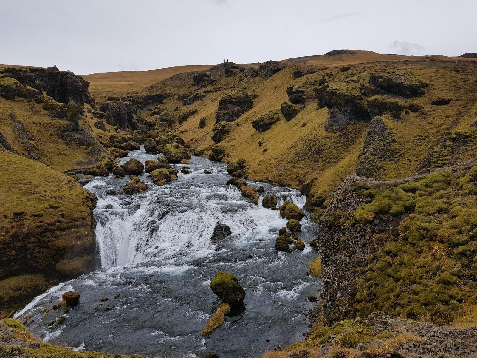
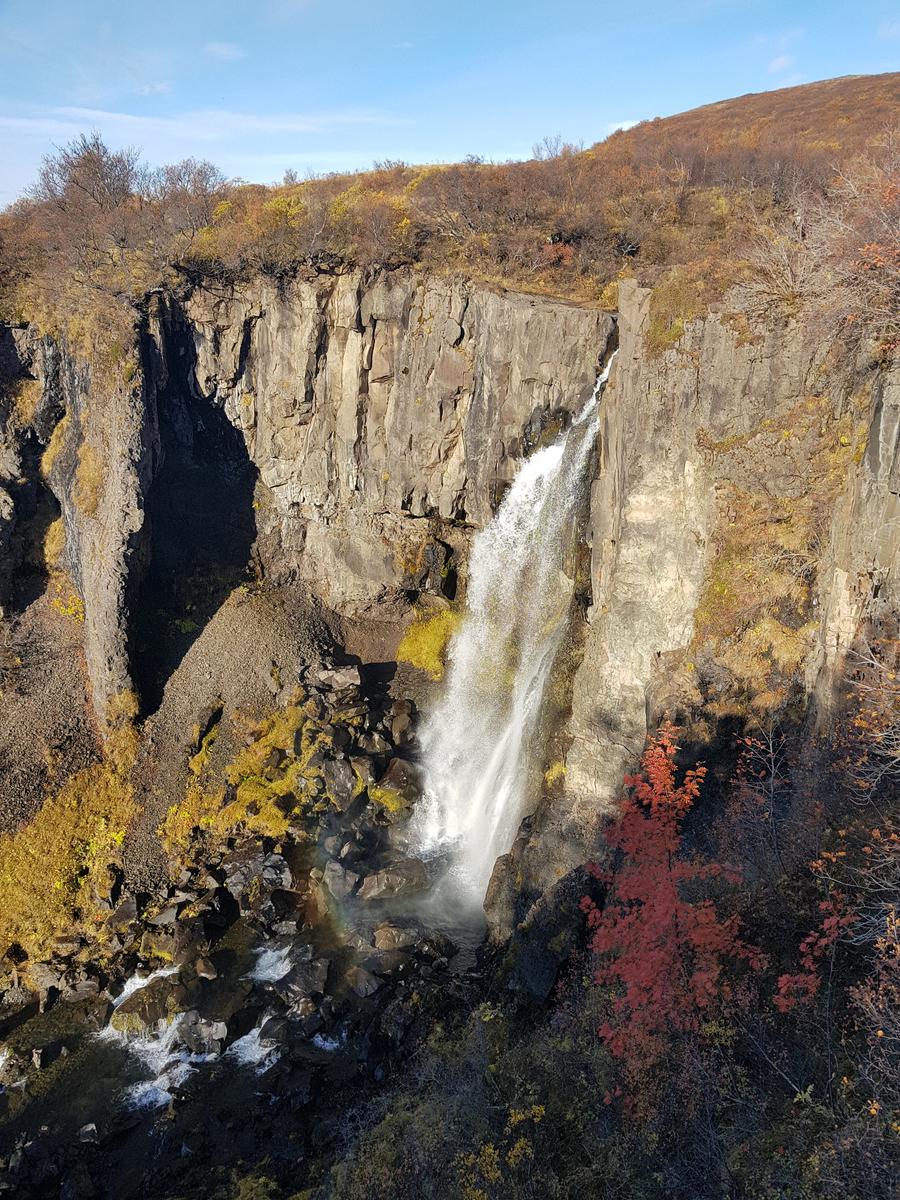
As we made our way to Svartifoss we just had to stop at another waterfall that we spotted from the road. Here is the Google maps link. I am sure you will agree it was worth stopping for, simply spectacular.
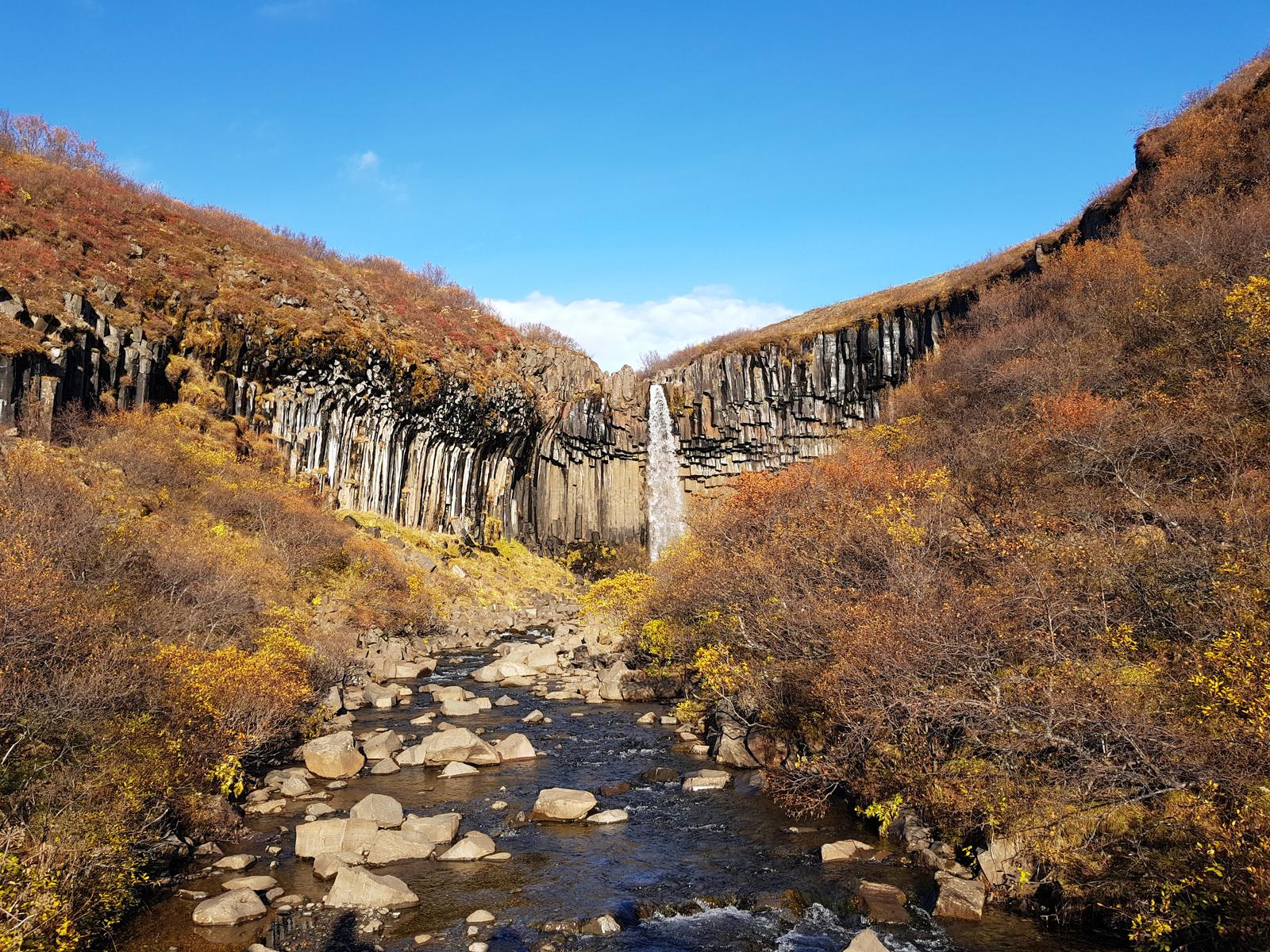
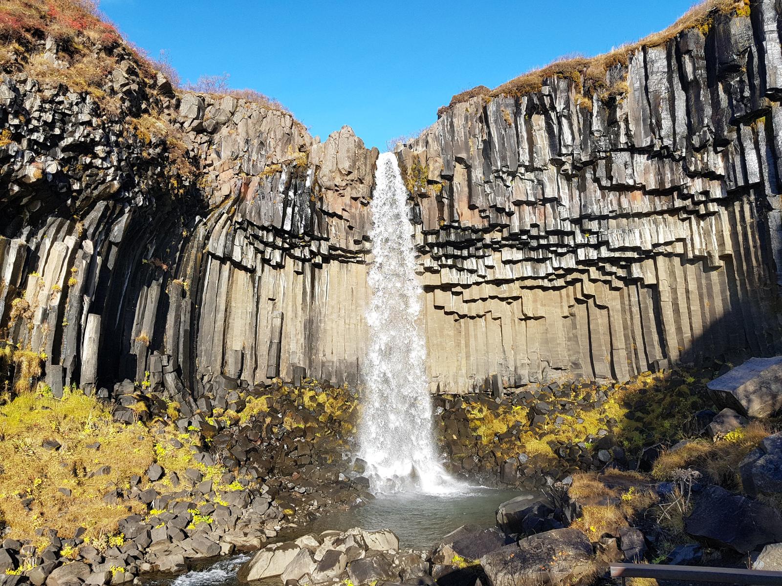
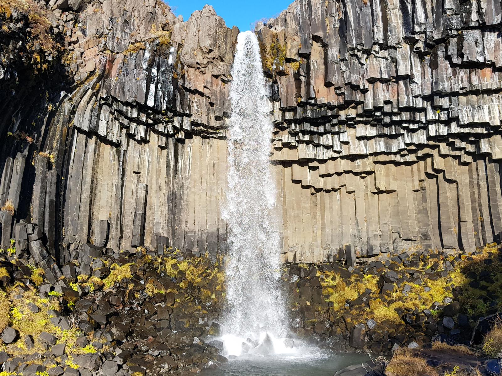
5. Svartifoss.
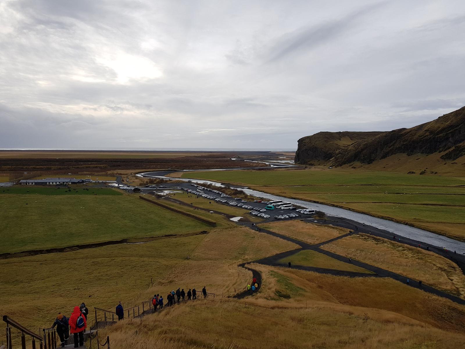
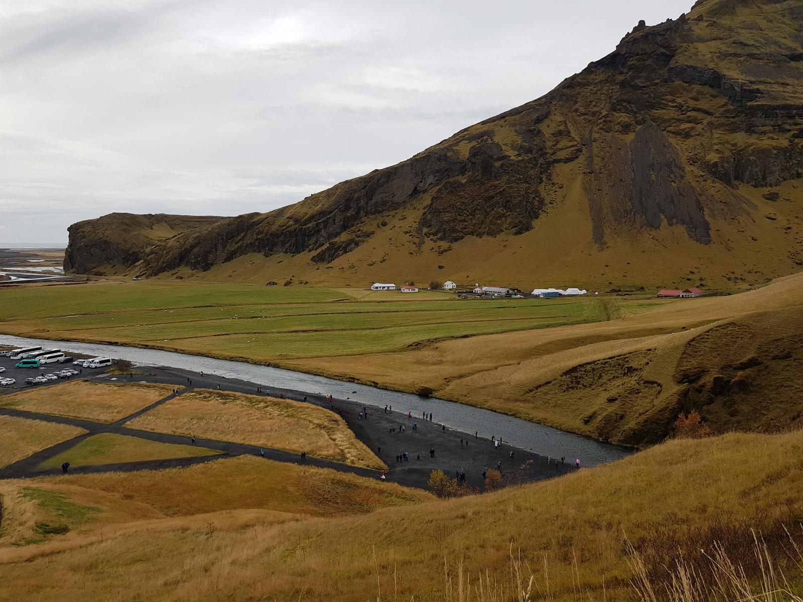
Svartifoss is located in the Skaftafell/Vatnajökull National Park. There is an impressive setup here with plenty of (paid) parking, a large visitors centre, a shop, cafe, toilets and large camp grounds. There were a lot of people dressed for hiking as there are many routes that you can take within the park, guided or unguided. There are lots of signposts and you can also get a park map from the visitors centre if you want.
It is 1.8 kilometres to the actual waterfall from the visitors centre but of course you are within the park all the time and so there is loads to look at as you walk along the well formed path. Read more about the path here.
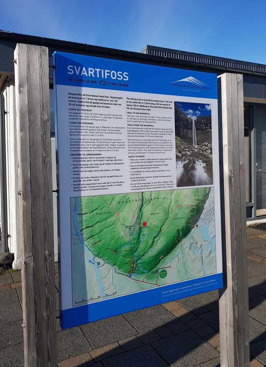
You climb up at the start of the walk for a little while and then after that the path is mostly flat until you descend down to the waterfall.
Our initial view of Svartifoss surrounded in the Autumn colours!
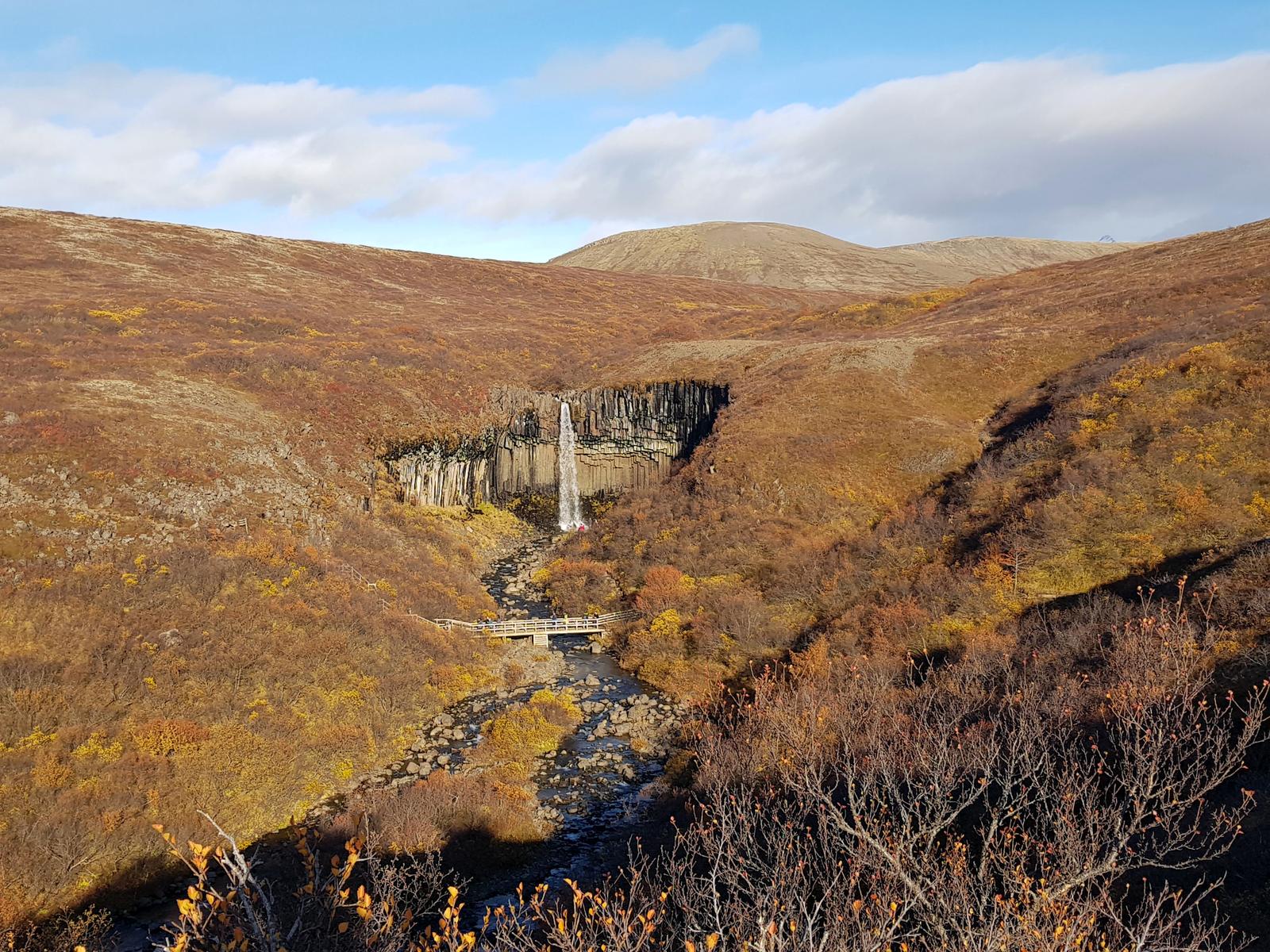
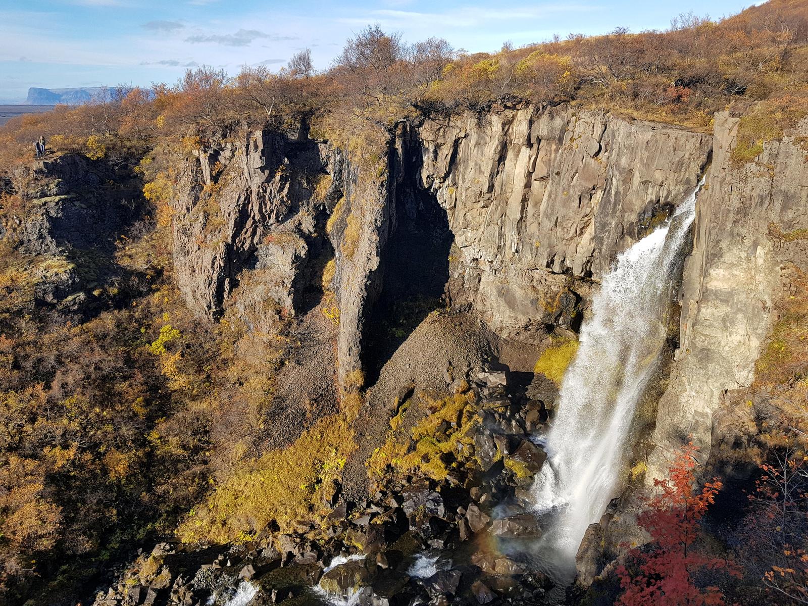
Svartifoss is well worth a visit and is my second favourite Icelandic waterfall. According to europeanwaterfalls.com:
“Svartifoss means black falls because the waterfall is surrounded by dark lava columns. The hexagonal basalt columns were created when lava cooled very slowly so that the molten rock could crystallise.
“There are few waterfalls that drop of a cliff with basalt rocks looking like an church organ. The source of the river Stórilækur that feeds Svartifoss lies at the edge of the glacier Vatnajökull, near the mountaintop Kristinartindar (1.1.26m). The river Stórilækur has a length of 7,38 km before it ends in the river Skaftafellsa.”
As we walked back to the car in the sunshine, it was so warm we were even able to shed our coats!
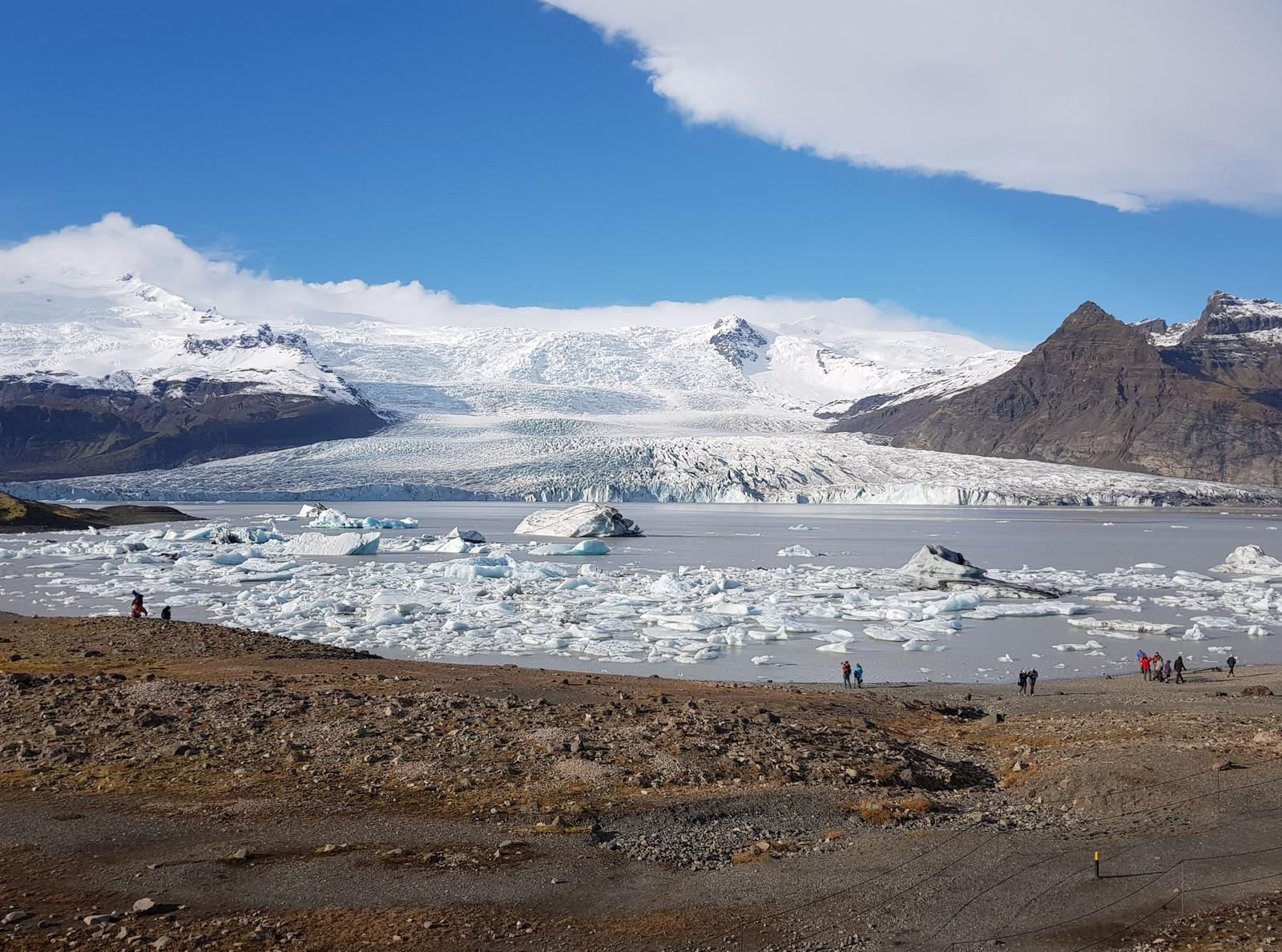
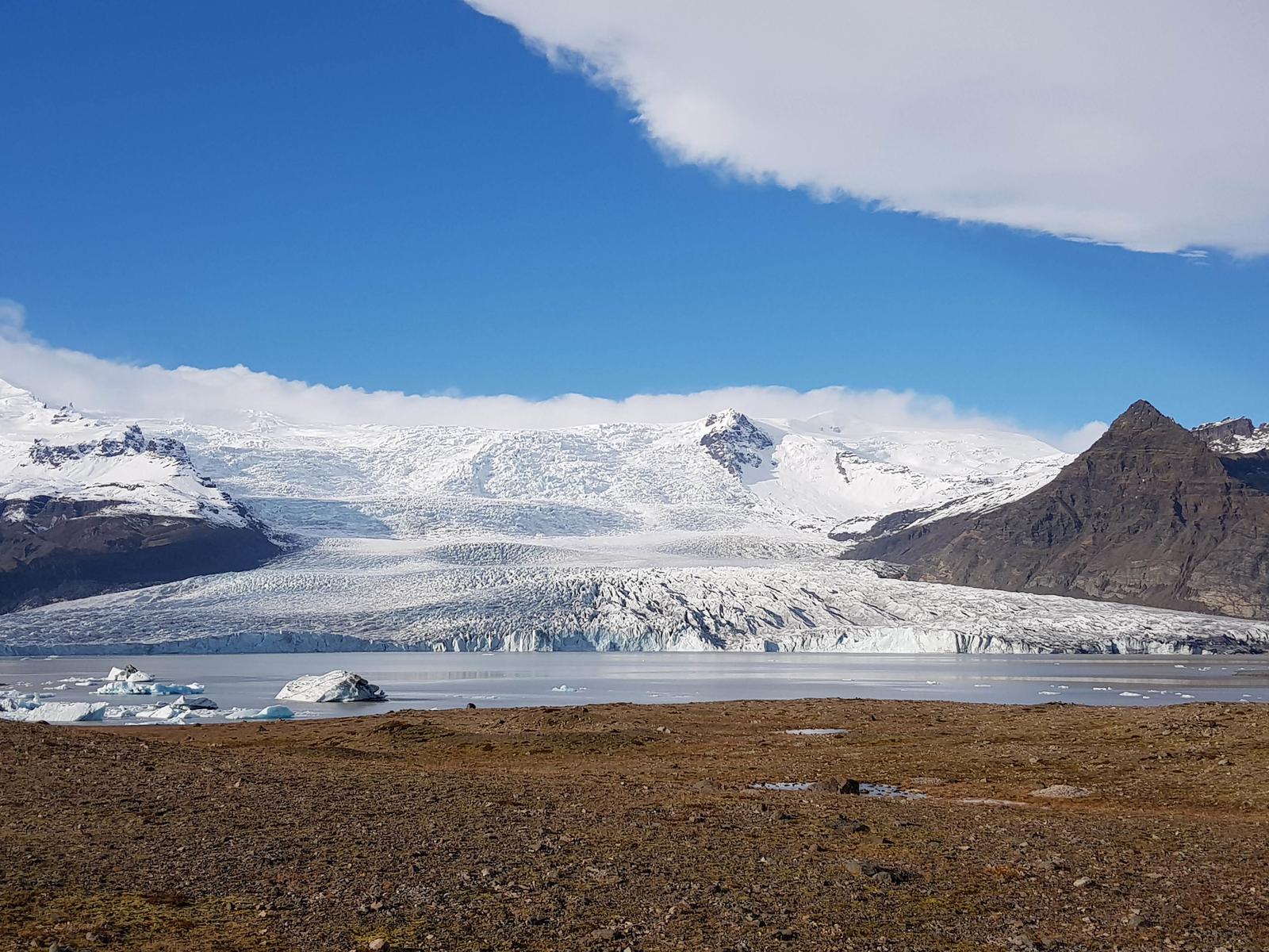
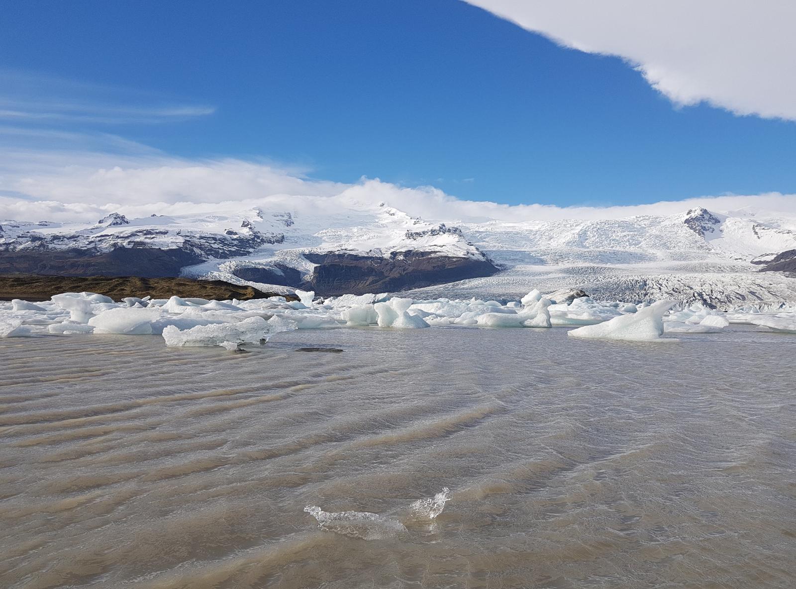
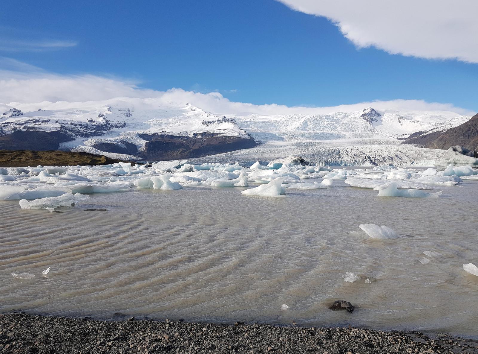
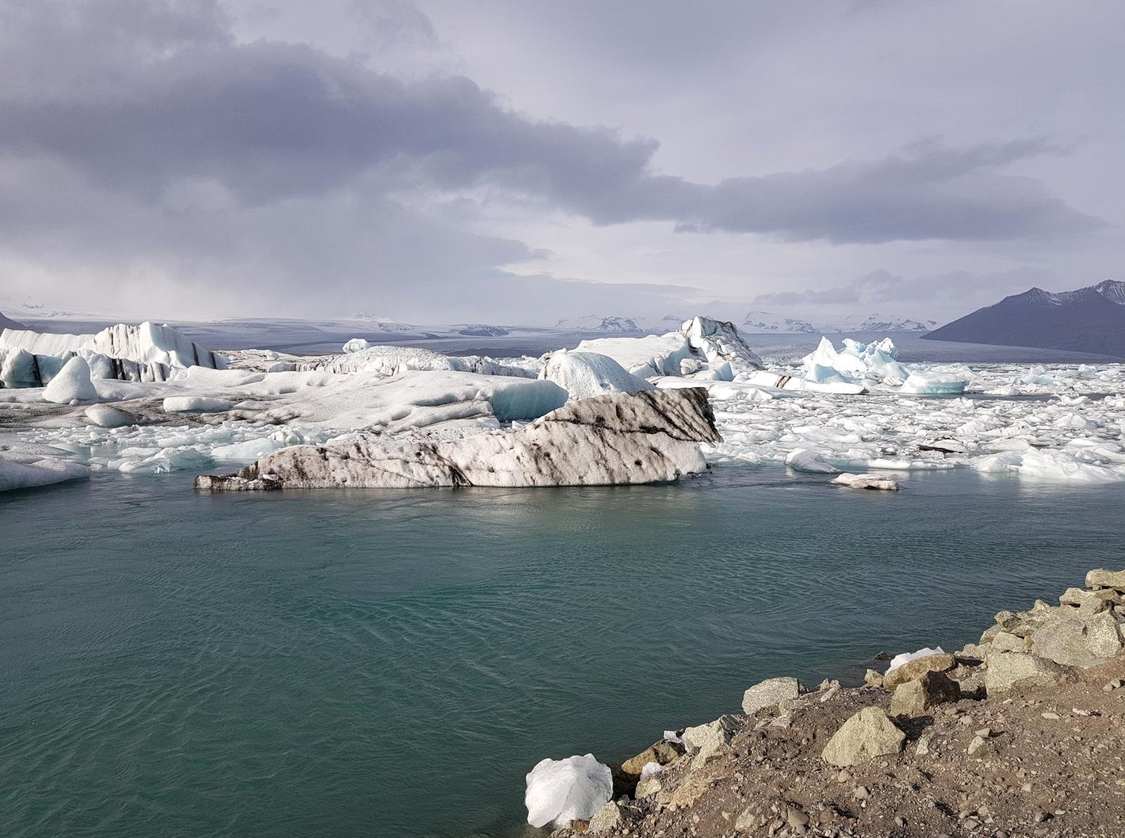
6. Fjallsárlón Iceberg.
Our next stop was the Fjallsárlón Iceberg, which we didn’t have on our itinerary originally but as we drove by we decided to visit. We were really glad we did as it was so quiet there (not like the Jökulsárlón Glacier) and while not visible from the ring road, it is only a very short easy walk to the glacier from the ample parking lot. There is also a visitors centre, cafe, toilets and picnic tables. We advise you to add this stop to your Self-Guided Tour of Iceland and enjoy some near solitude on this busy island circuit.
According to guidetoiceland.is:
“Fjallsárlón is a glacial lagoon …. located on the southern end of Vatnajökull Glacier.”
And:
“Fjallsárlón is considered to be a strong second to the nearby, and more famous, Jökulsárlón Glacial Lagoon”
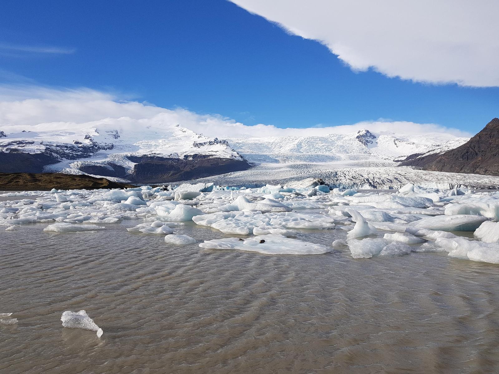
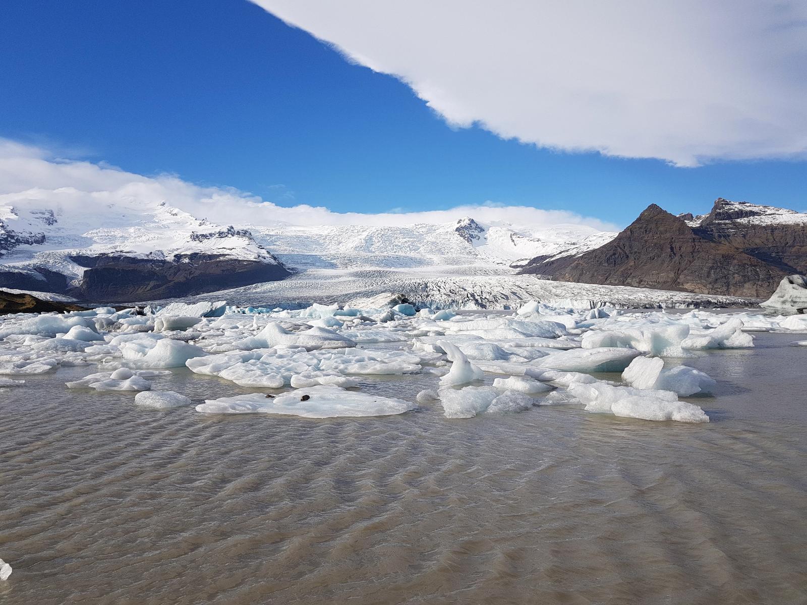
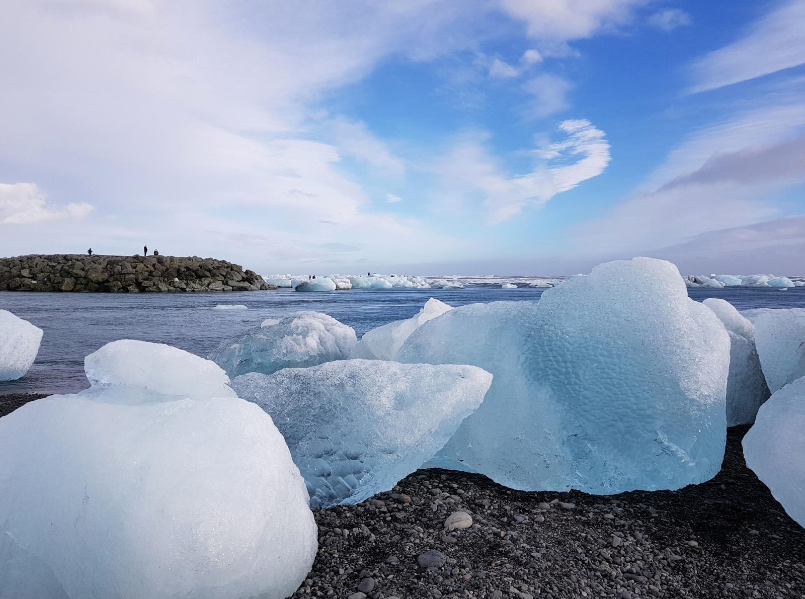
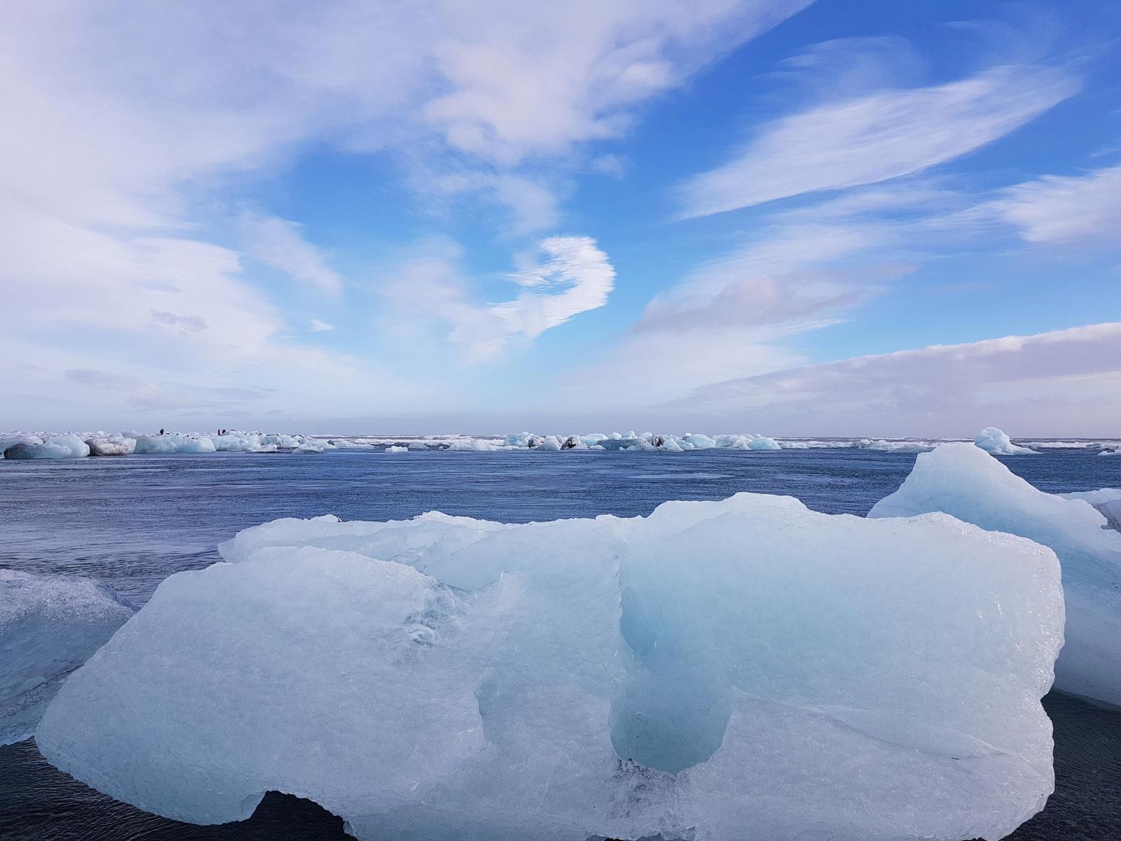
7. Diamond Beach.
A short drive later we parked up and walked to the Diamond Beach. This black sand beach is definitely a must see. It is covered with icebergs from the Jökulsárlón Glacier it is a photographers dream. I loved walking around the ice, a truly unique magical experience.
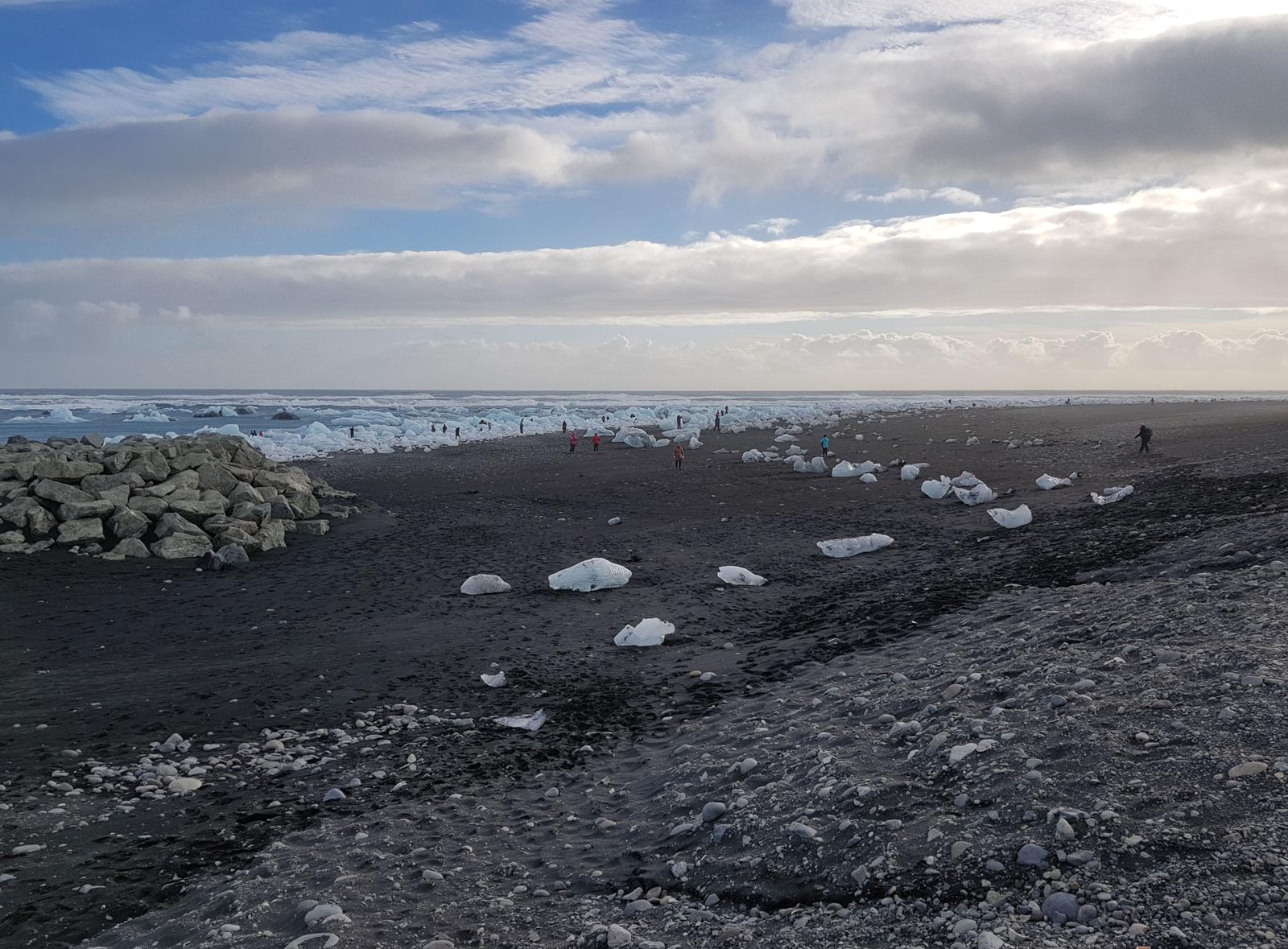
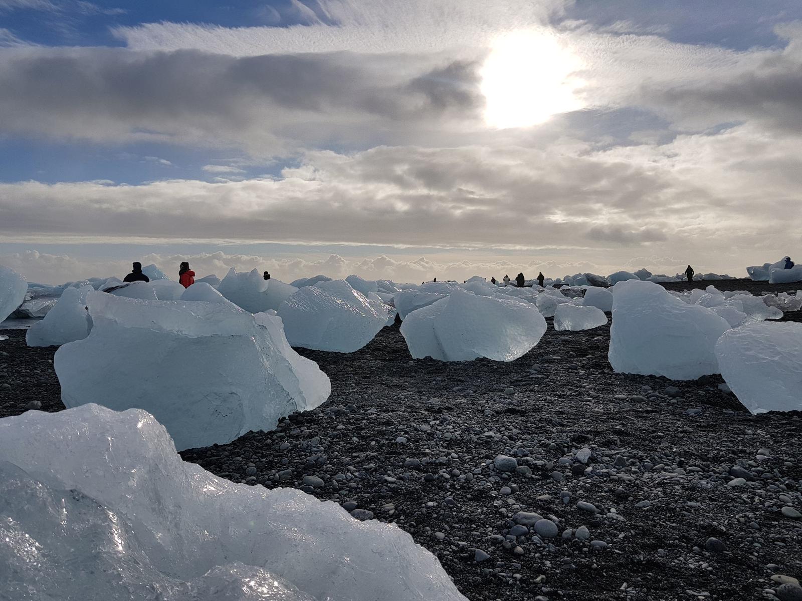
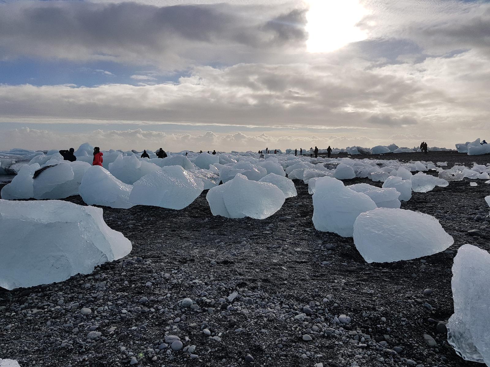
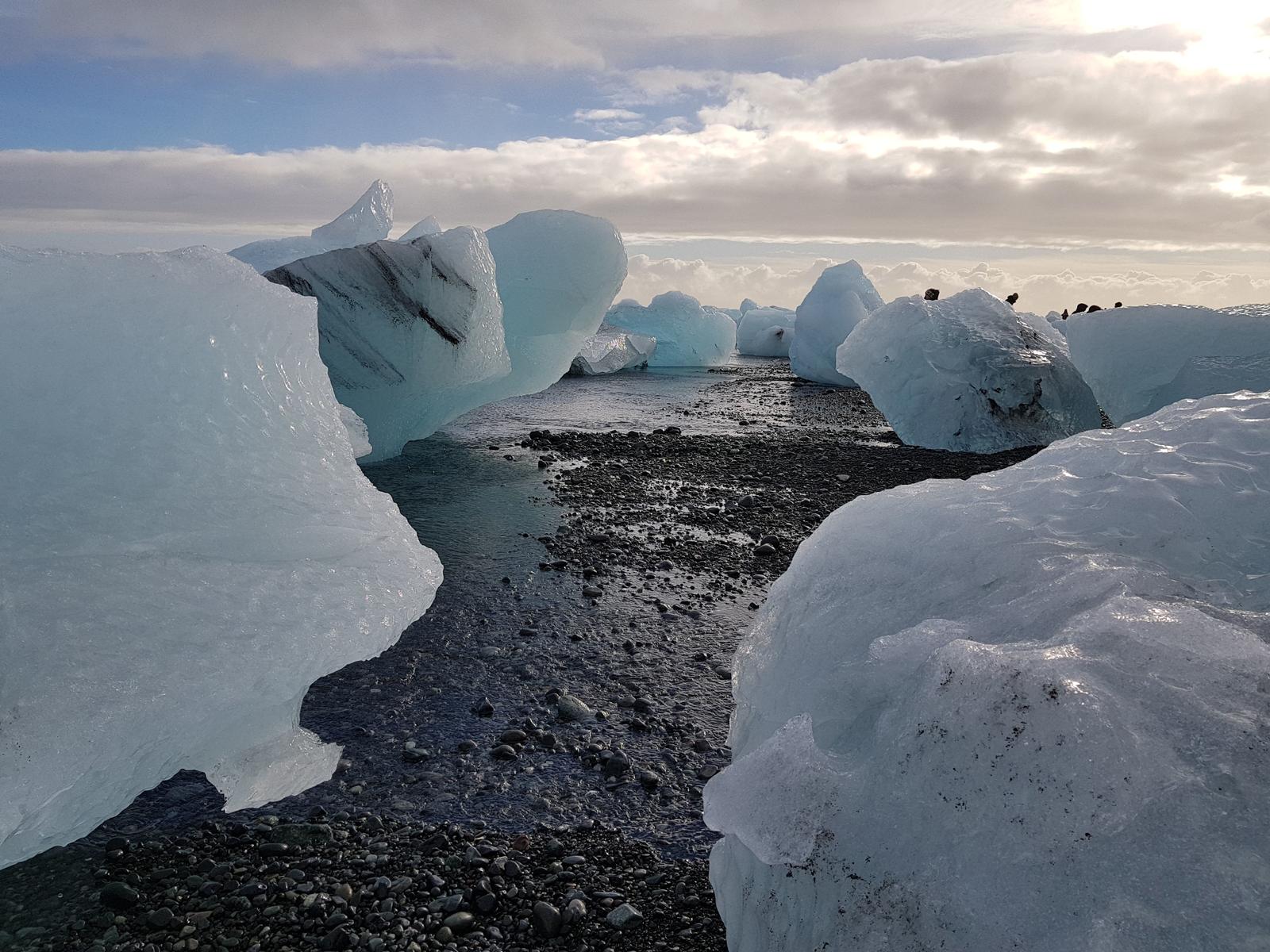
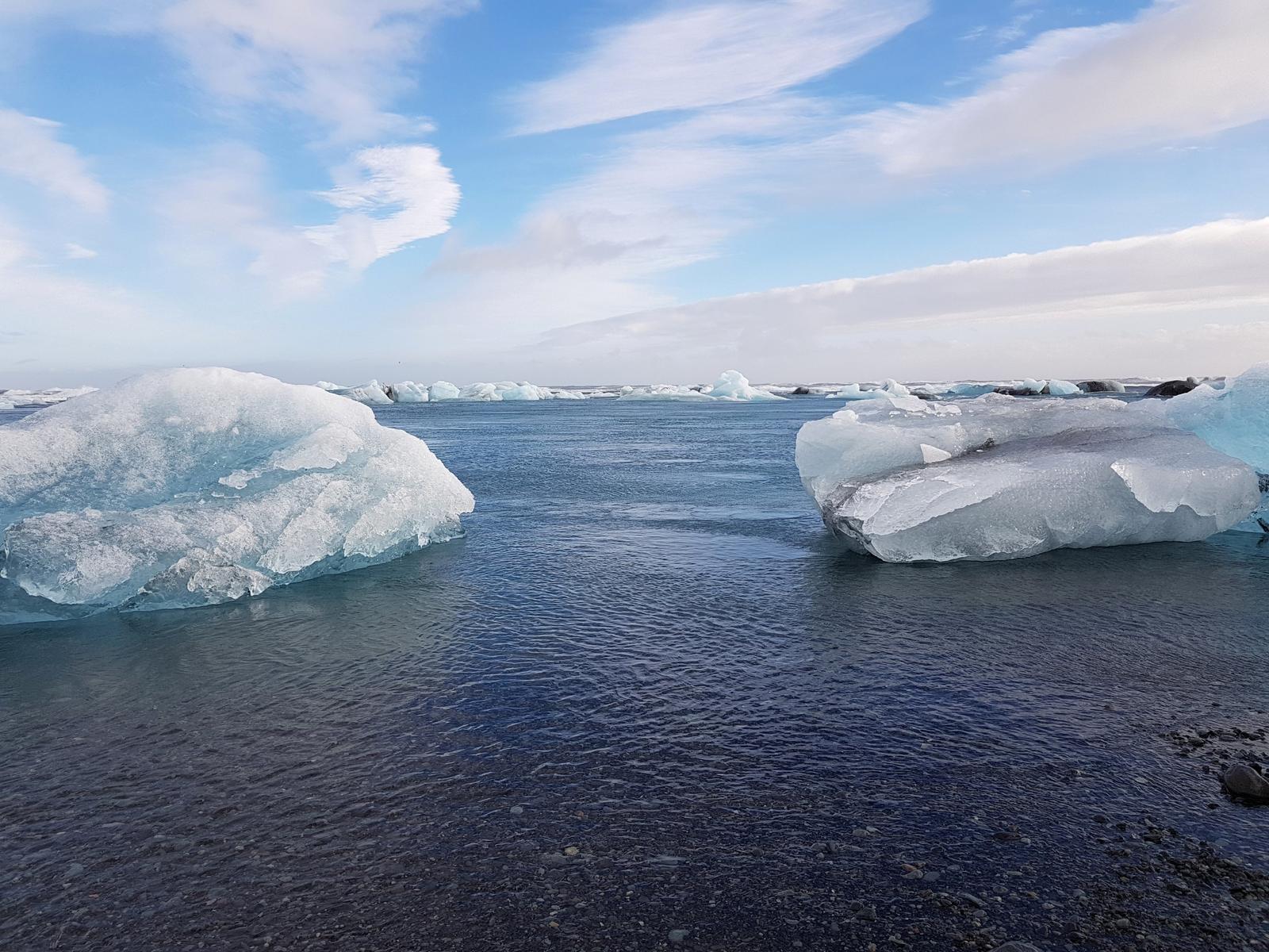
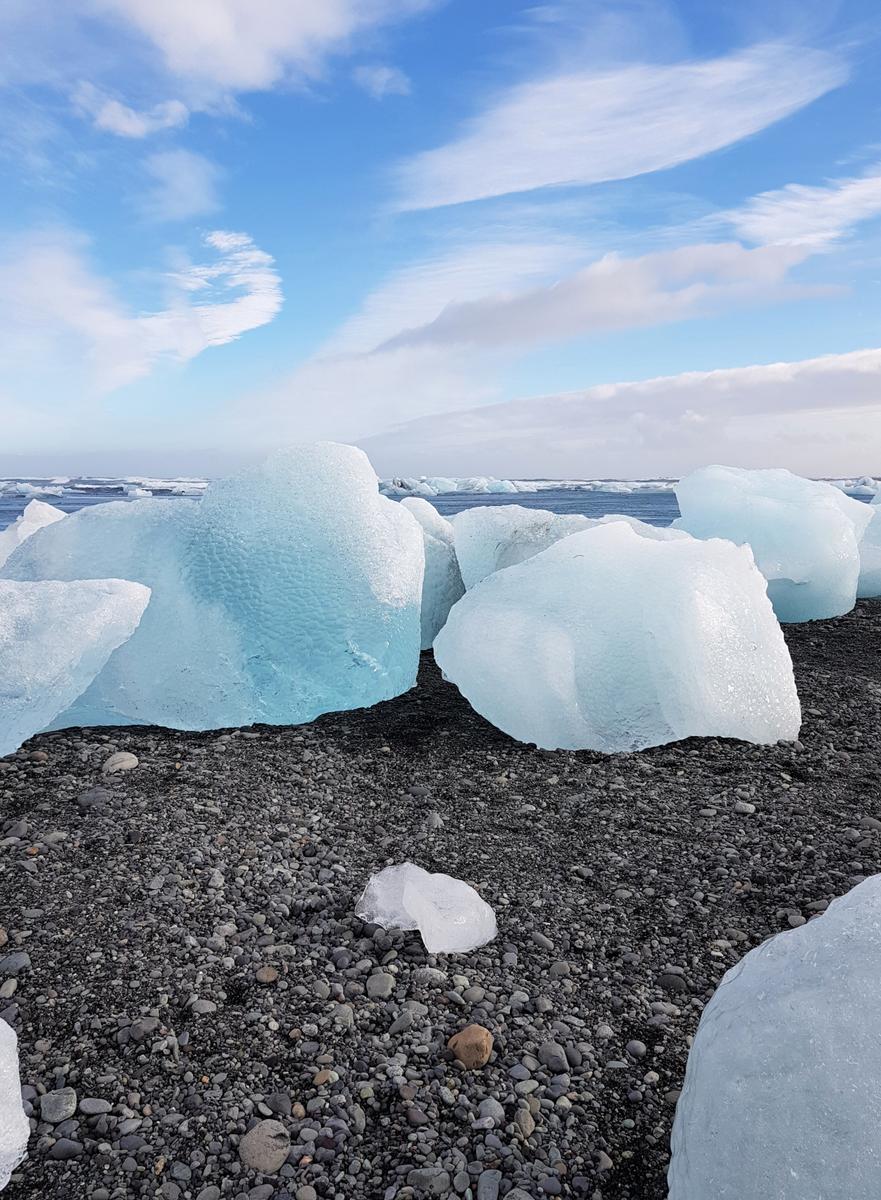
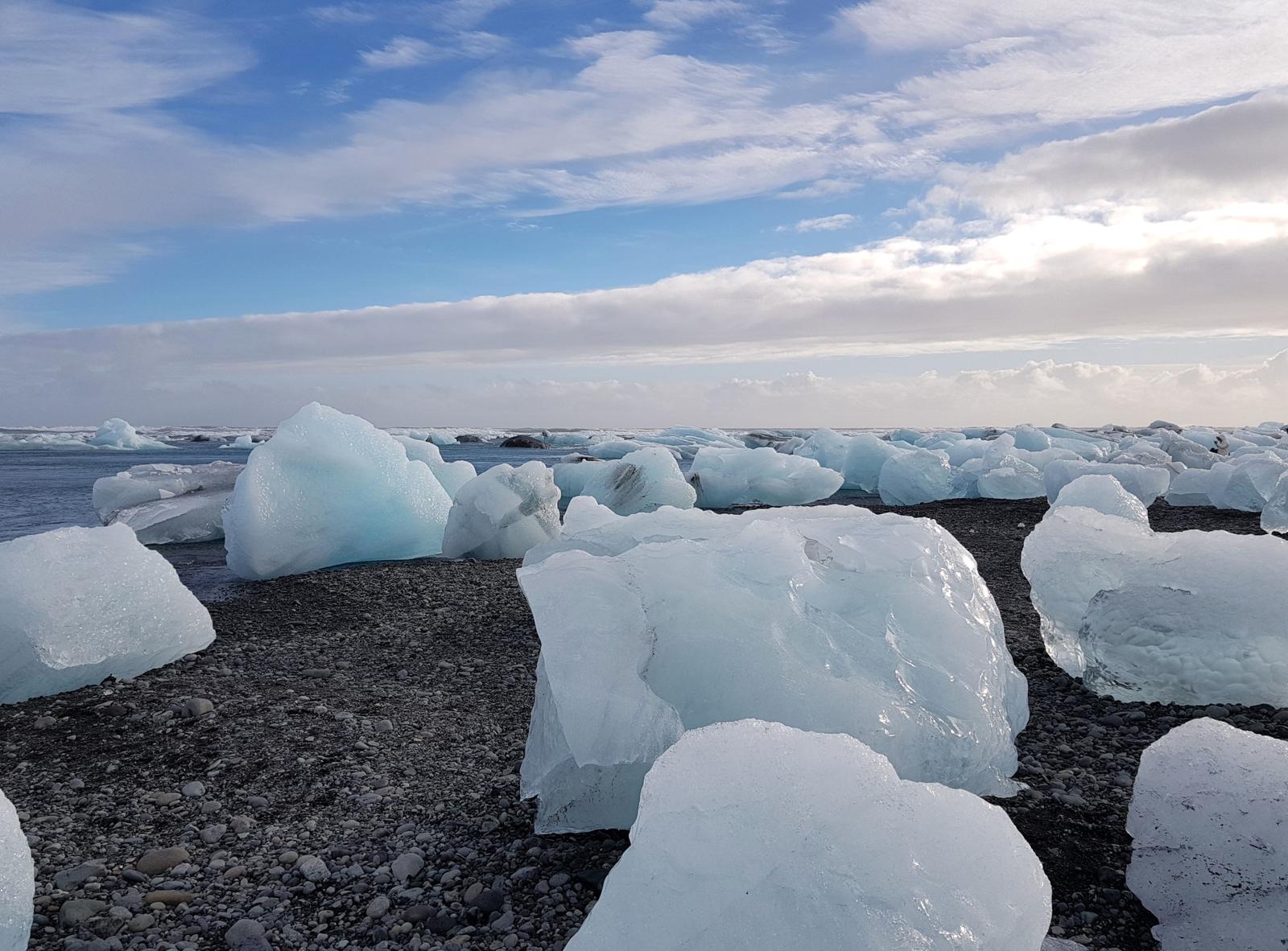
Icebergs on the move!
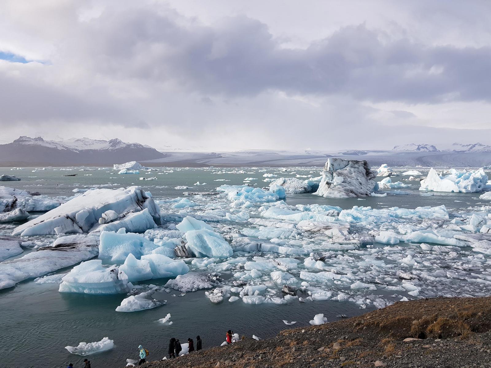
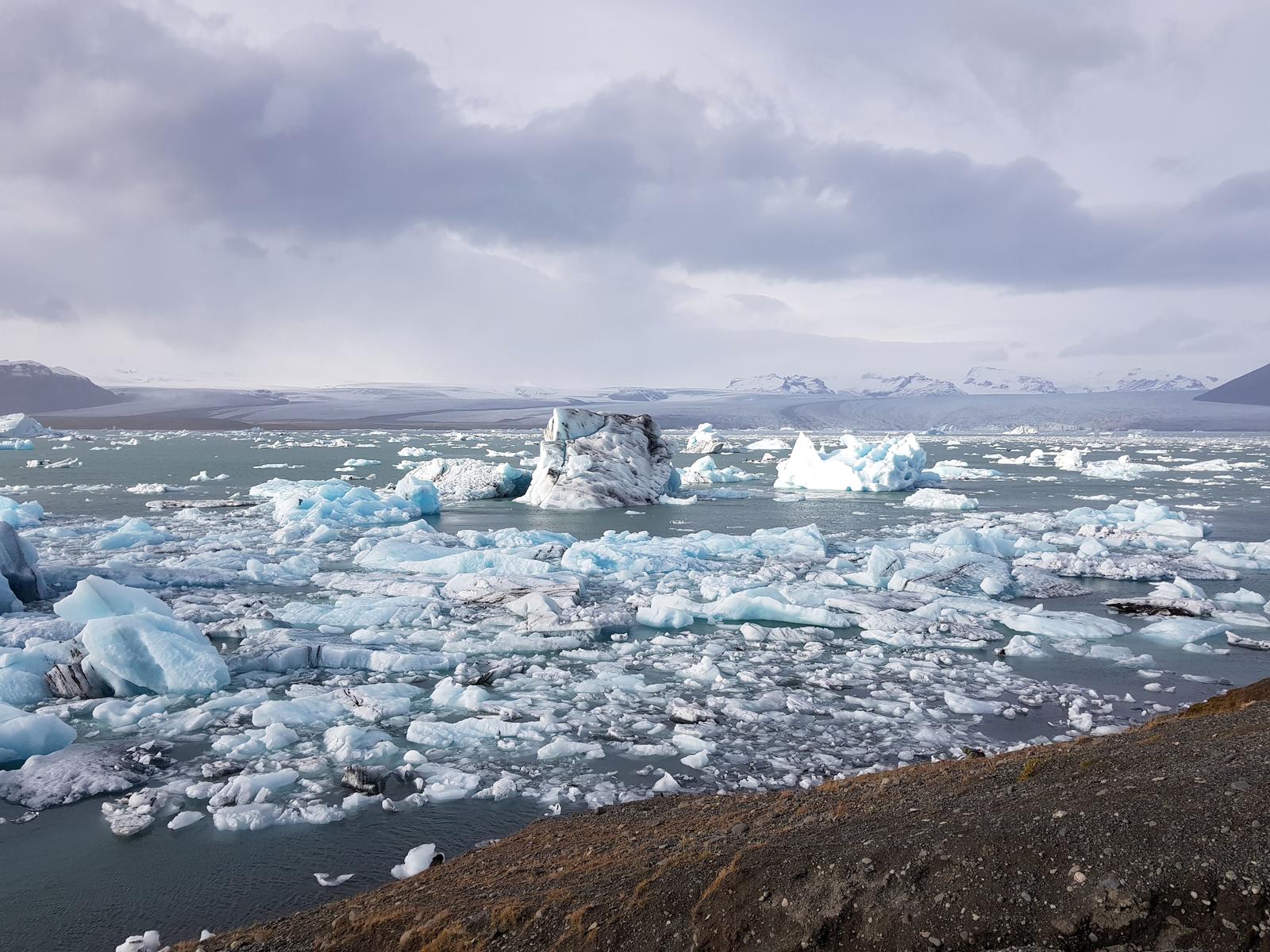
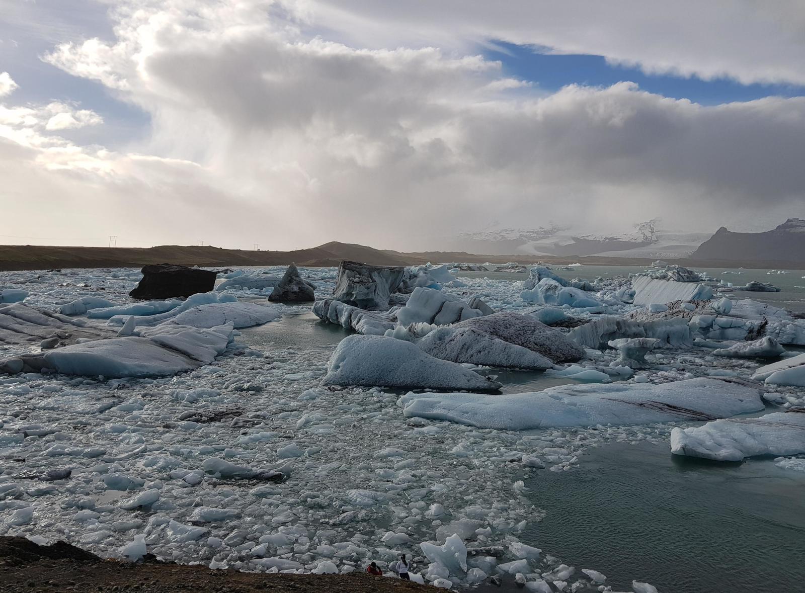
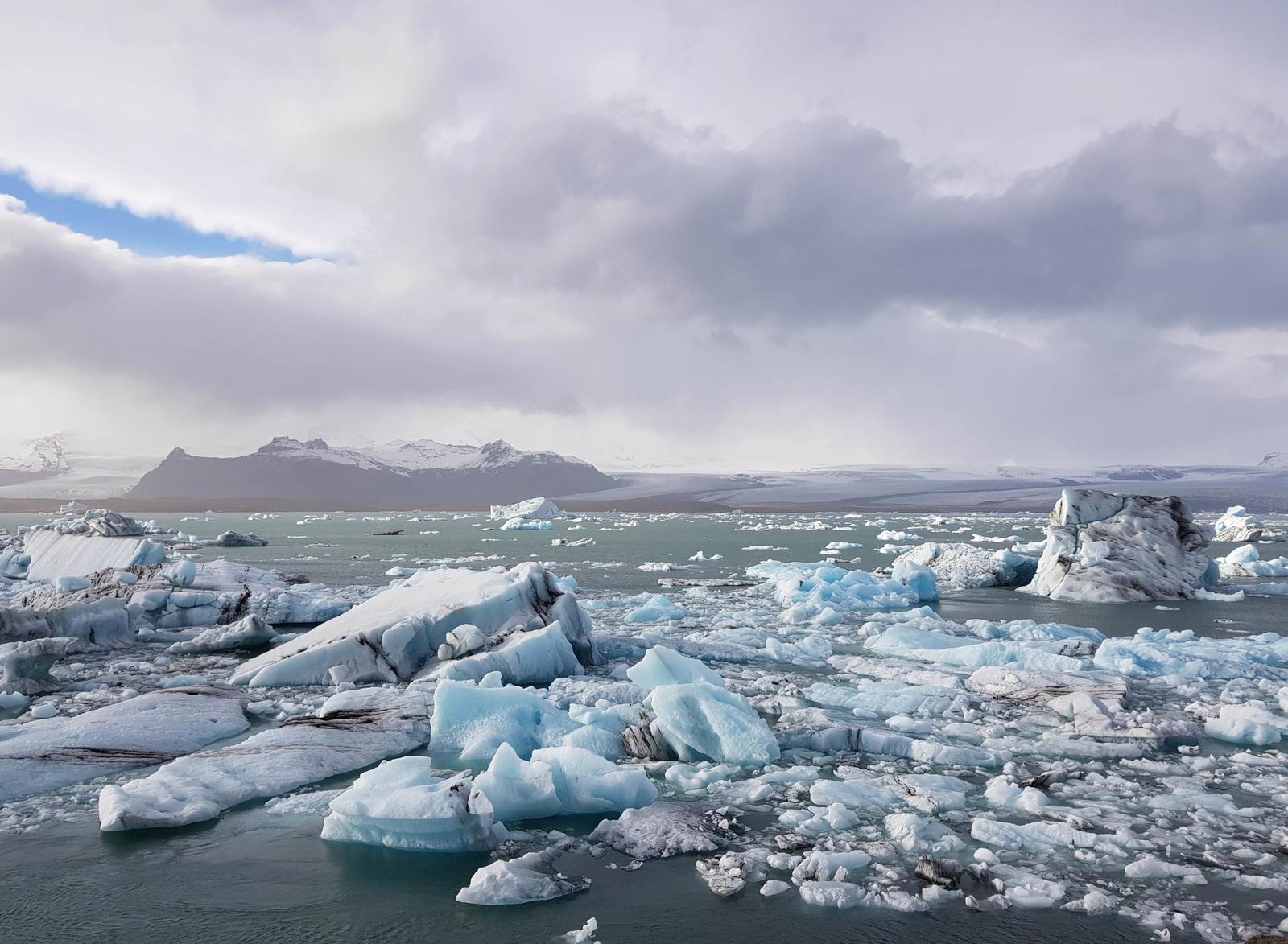
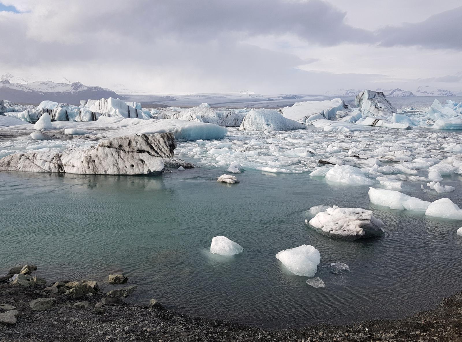
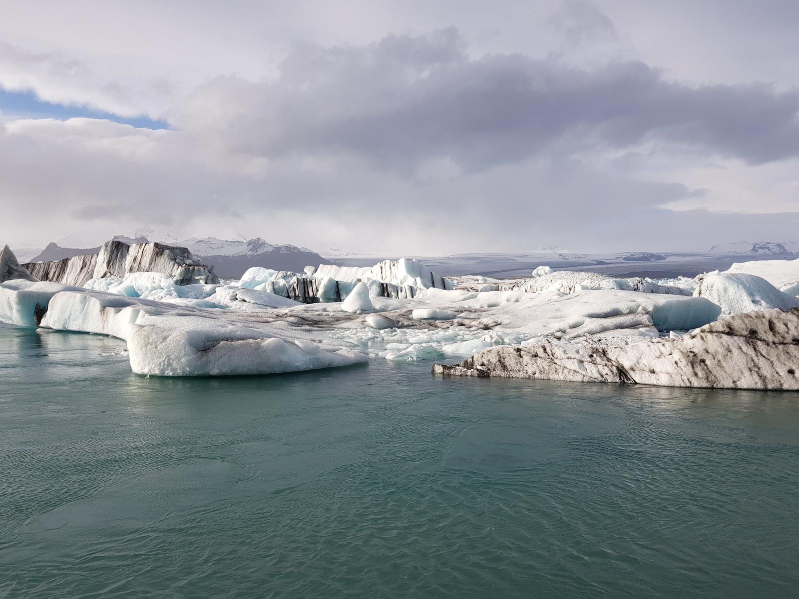
8. Jökulsárlón Glacier Lagoon.
A very short drive later we were at the crowded Jökulsárlón Glacier Lagoon. As stated on guidetoiceland.is:
“As a glacier lagoon, Jökulsárlón is a lake that is filled with the melt water from an outlet glacier. In this case, it is Breiðamerkurjökull, a tongue of Europe’s largest ice cap, Vatnajökull. It stands out, however, due to the fact that it also fills with icebergs breaking from the glacier, some of which tower several stories high.”
The Jökulsárlón Glacier Lagoon is well worth a visit and the view of the surrounding Icelandic landscape is wonderful from there.
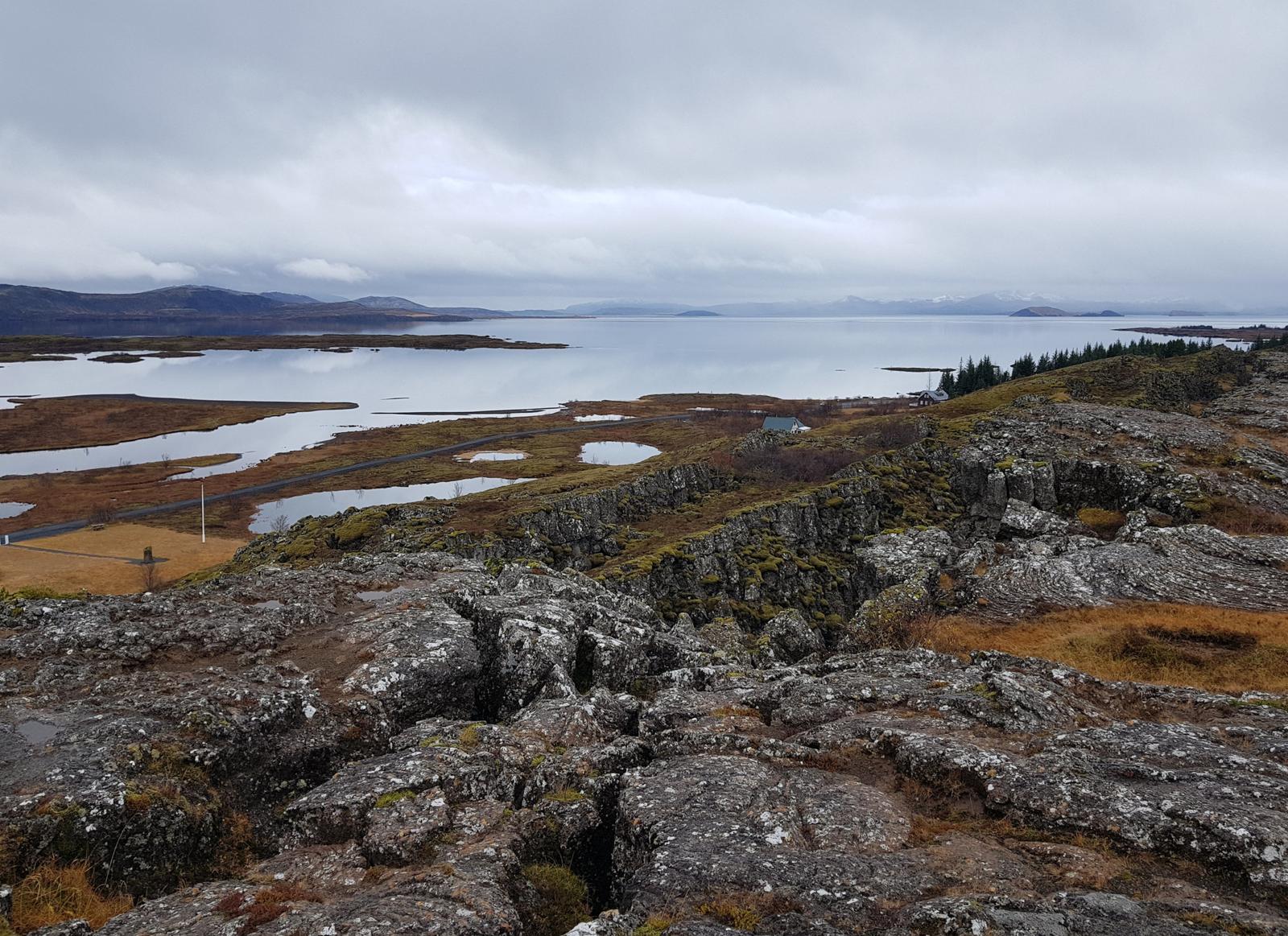
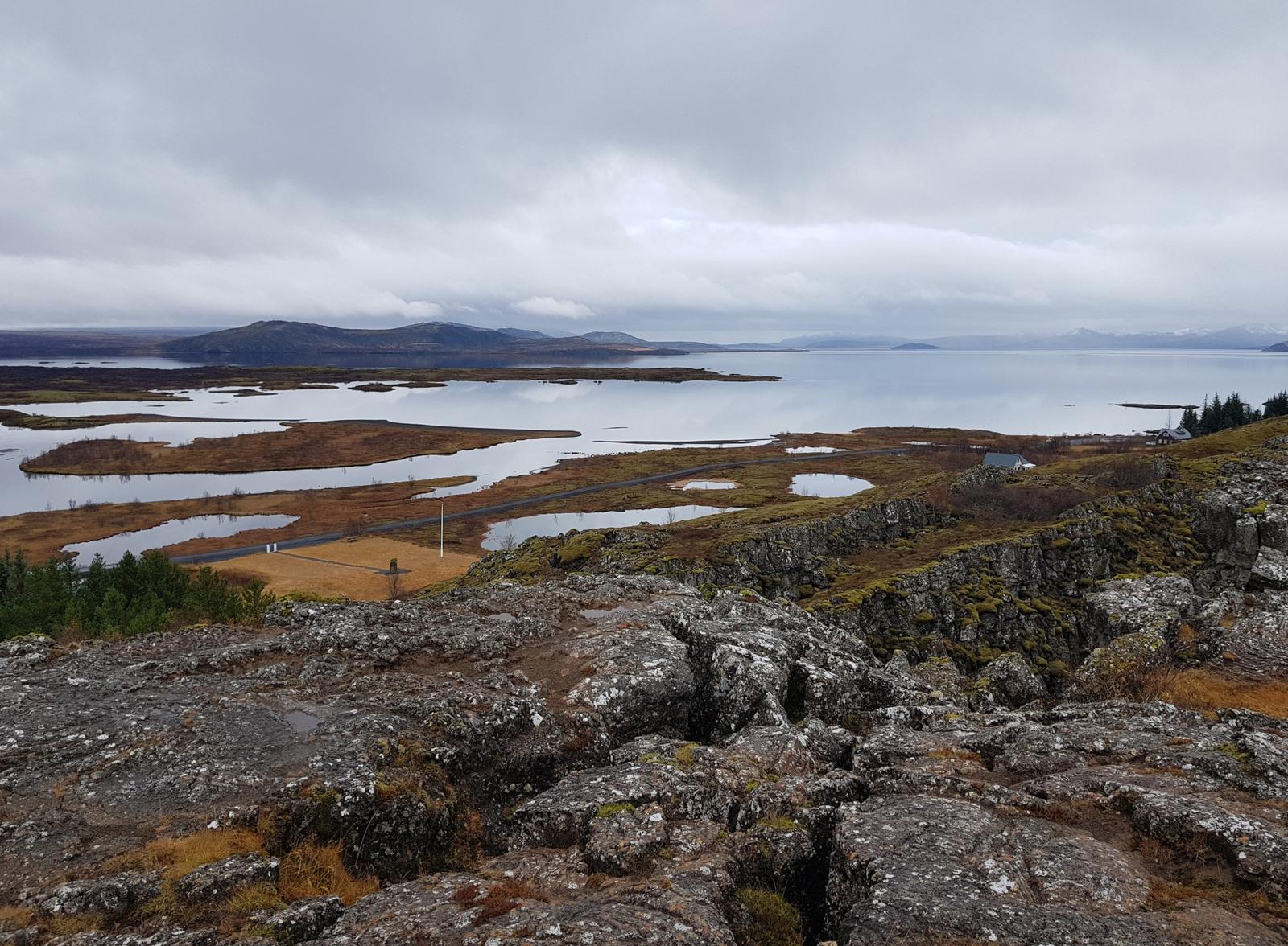
9. Þingvellir/Thingvellir National Park.
It was an overcast cold day when we drove from our Airbnb in Reykjavík to the UNESCO World Heritage Site Thingvellir National Park. As we drove we could see that the rain we’d had in Reykjavík had fallen as snow elsewhere, including in the park itself!
According to the official Þingvellir National Park website:
“At Þingvellir - literally “Assembly Plains” - the Alþing general assembly was established around 930 and continued to convene there until 1798. Major events in the history of Iceland have taken place at Þingvellir and therefore the place is held in high esteem by all Icelanders. Today Þingvellir is a protected national shrine. According to the law, passed in 1928, the protected area shall always be the property of the Icelandic nation, under the preservation of the Alþing.”
There are a number of car parks around the park so best to choose one depending on the direction you come from. We parked in P3 as we entered via Route 36.
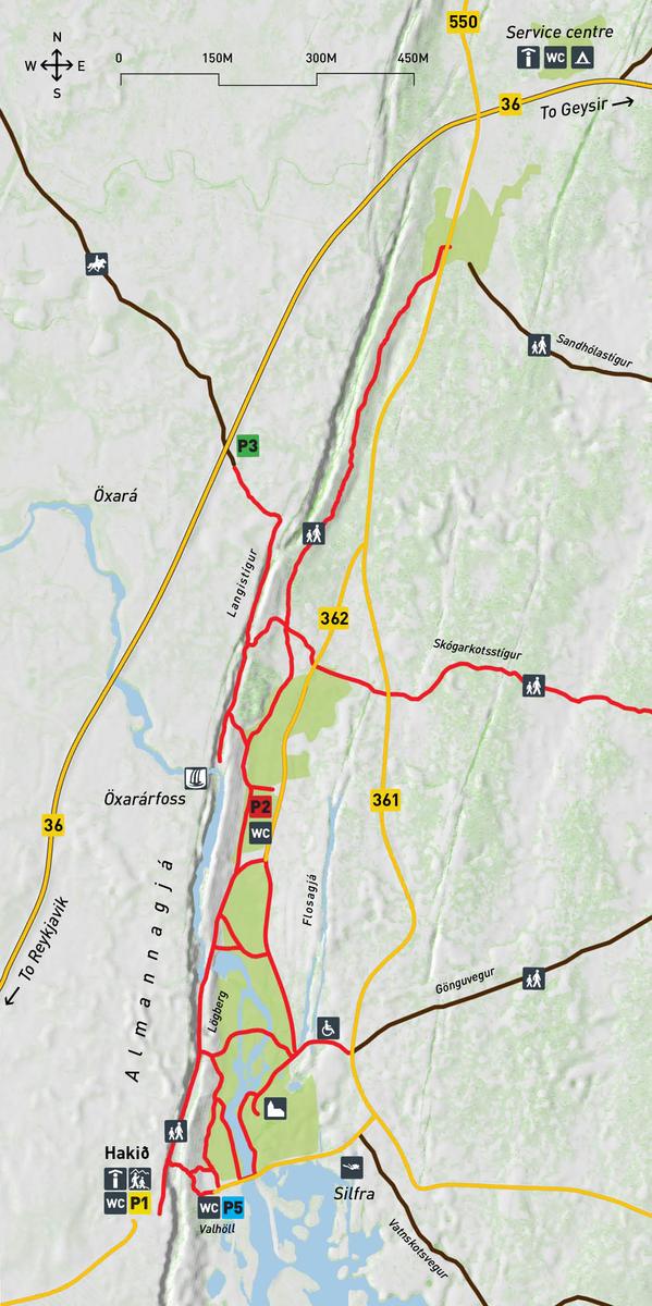
As you can see in the map above, the visitors centre is located at P1 so if you want information or a map before you start exploring the park then that would be the best place for you to park. For online Park Maps and Brochures click here.
Overall we found that the park and it’s many trails were well signposted and easy to navigate. Following the signs made for a very enjoyable couple of hours of exploring.
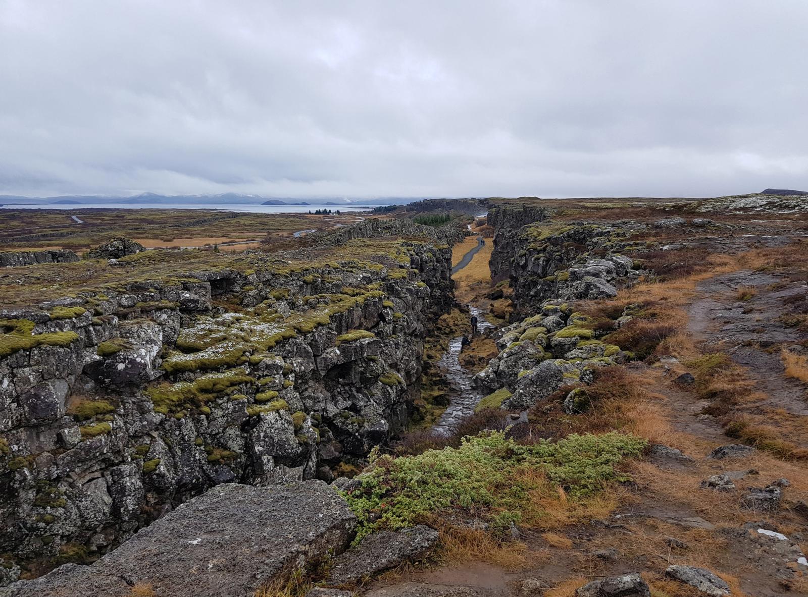
Thingvellir National Park occupies an noteworthy position in that it is located on a tectonic plate boundary. As a result, the landscape is dramatic, a mix of ponds, rivers, waterfalls and fissures. The plates are moving away from each other at a rate of 1mm to 18mm per year. It is also unique as it is the only place in the world where the rift occurs and is visible above sea level:
“Iceland is divided by the Mid-Atlantic Rift; some parts of it, such as the Westfjords and Reyjavík, are on the North American tectonic plate, while others, such as Vatnajökull glacier and the East Fjords, are on the Eurasian plate. Iceland is the only place in the world where this rift is above sea-level, and nowhere can you see the edges of both plates as clearly as in Þingvellir.”
You can read more about this here and here. We will return to this topic again below, as we make our way through the park.
As we were parked in P3, we began by walking through Langistígur, a valley/canyon of sorts that was made famous when it was used in scenes filmed for the cult TV show Game of Thrones. Here is a view of it from higher up and you can see the path snaking through:
Langistígur has a few nicknames, The Walk of Death or Execution Trail as according to here, it is where:
“… men were beheaded and hanged; while women either drowned or were burned to death nearby as a result of the harsh justice system of Iceland called Jónsbók, which was introduced from Norway back in the year 1281.”
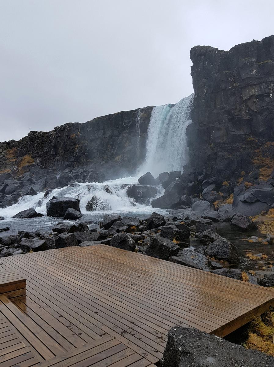
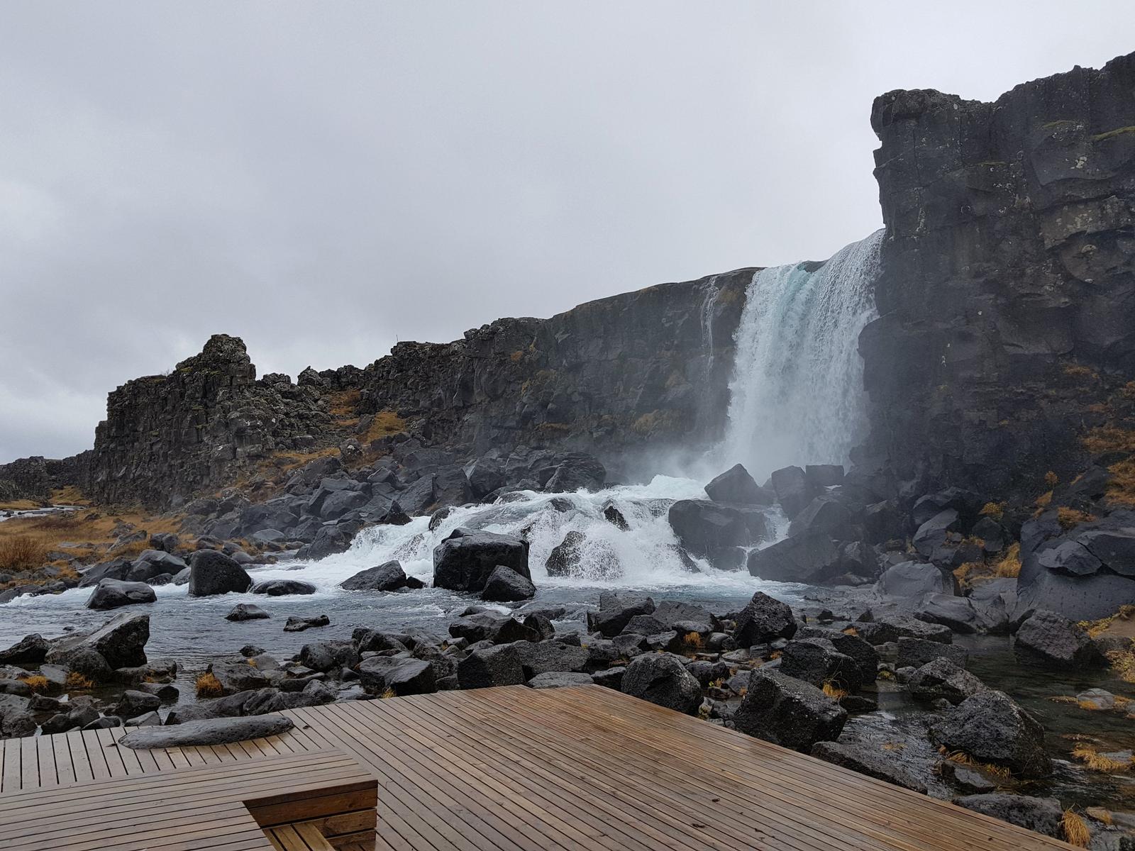
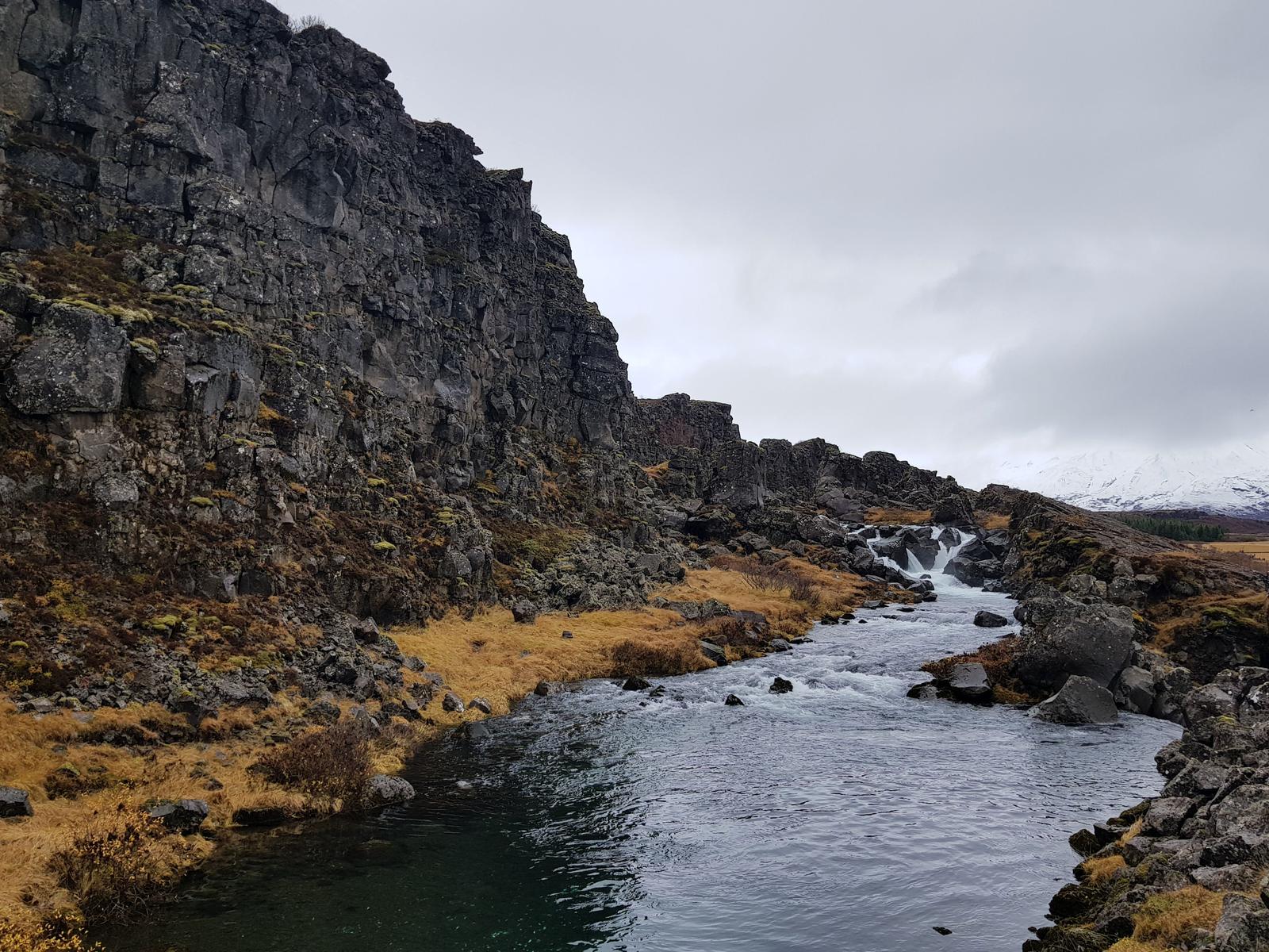
The trail through there brought us to the waterfall Öxarárfoss.
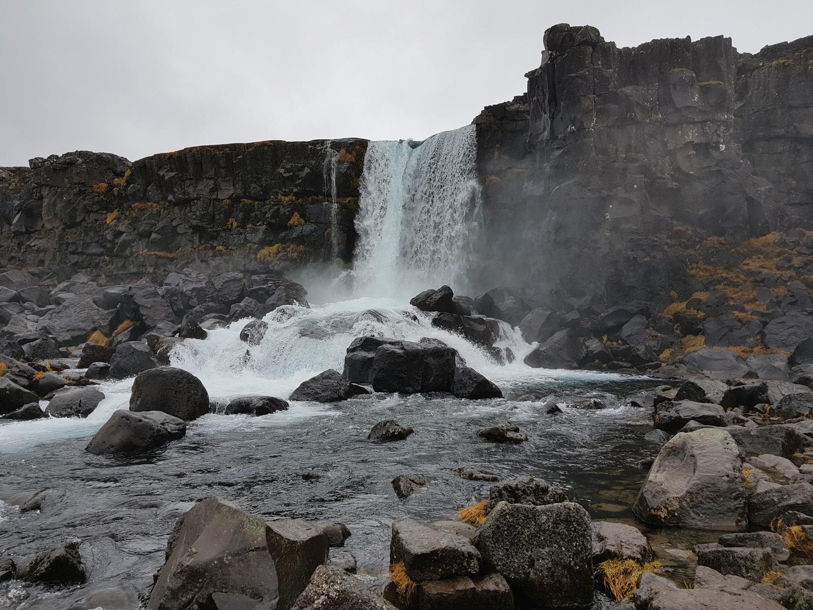
Further along, the Þingvellir Church was visible below us:
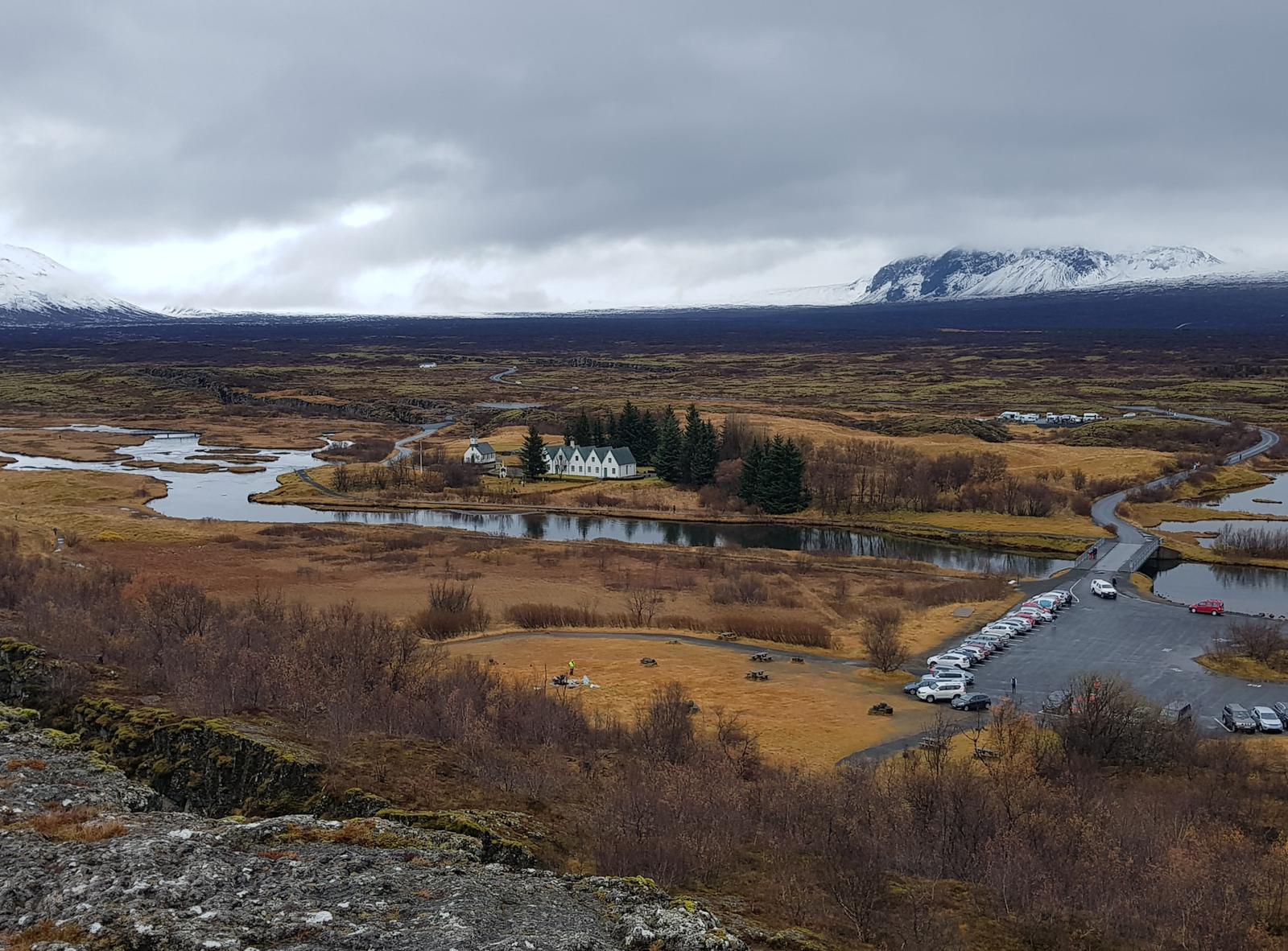
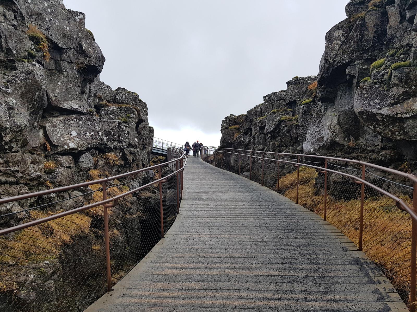
Next we entered the Almannagjá gorge/rift where there is a lovely path through the tectonic plates mentioned earlier. If you climb the trails to the side of the path, up to higher ground, there is a lovely view of the surrounding area:
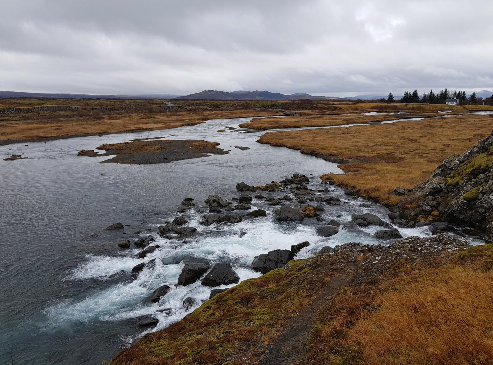
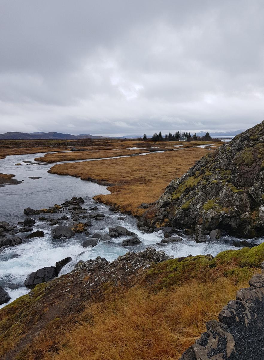
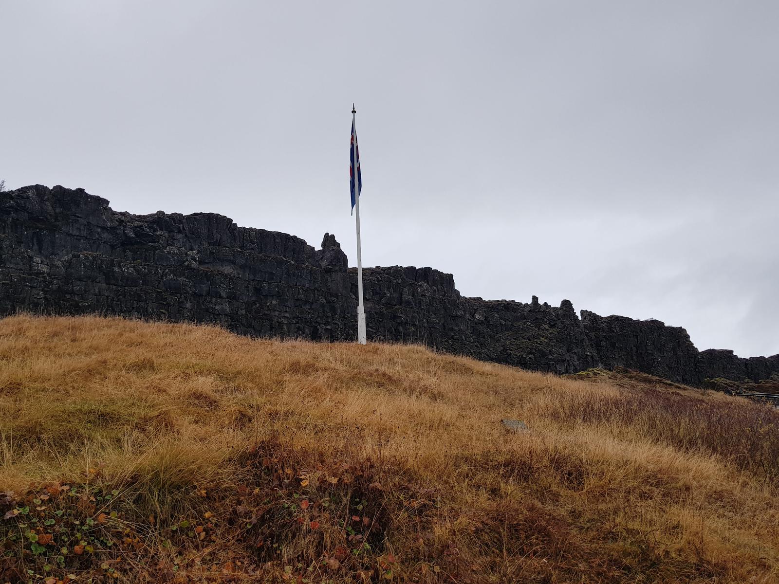
In the next two photos you can see Iceland’s largest lake, Lake Þingvallavatn.
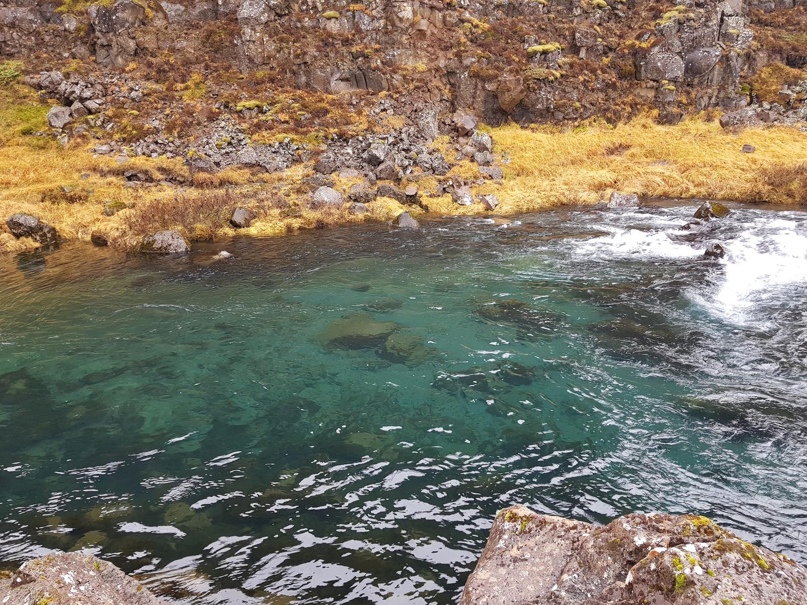
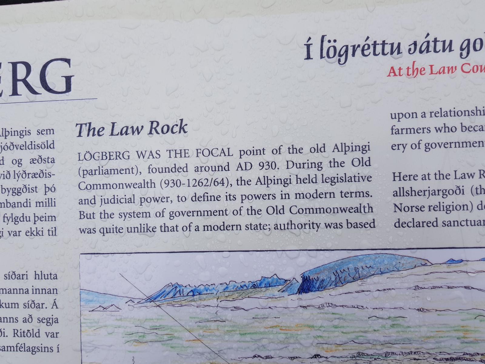
Walking towards the Law Rock, amazed by how clear the water was!
You can read all about the importance of the Law Rock here.
Continuing on the Almannagjá rift, this is the path up to the visitors centre, also through the plates:
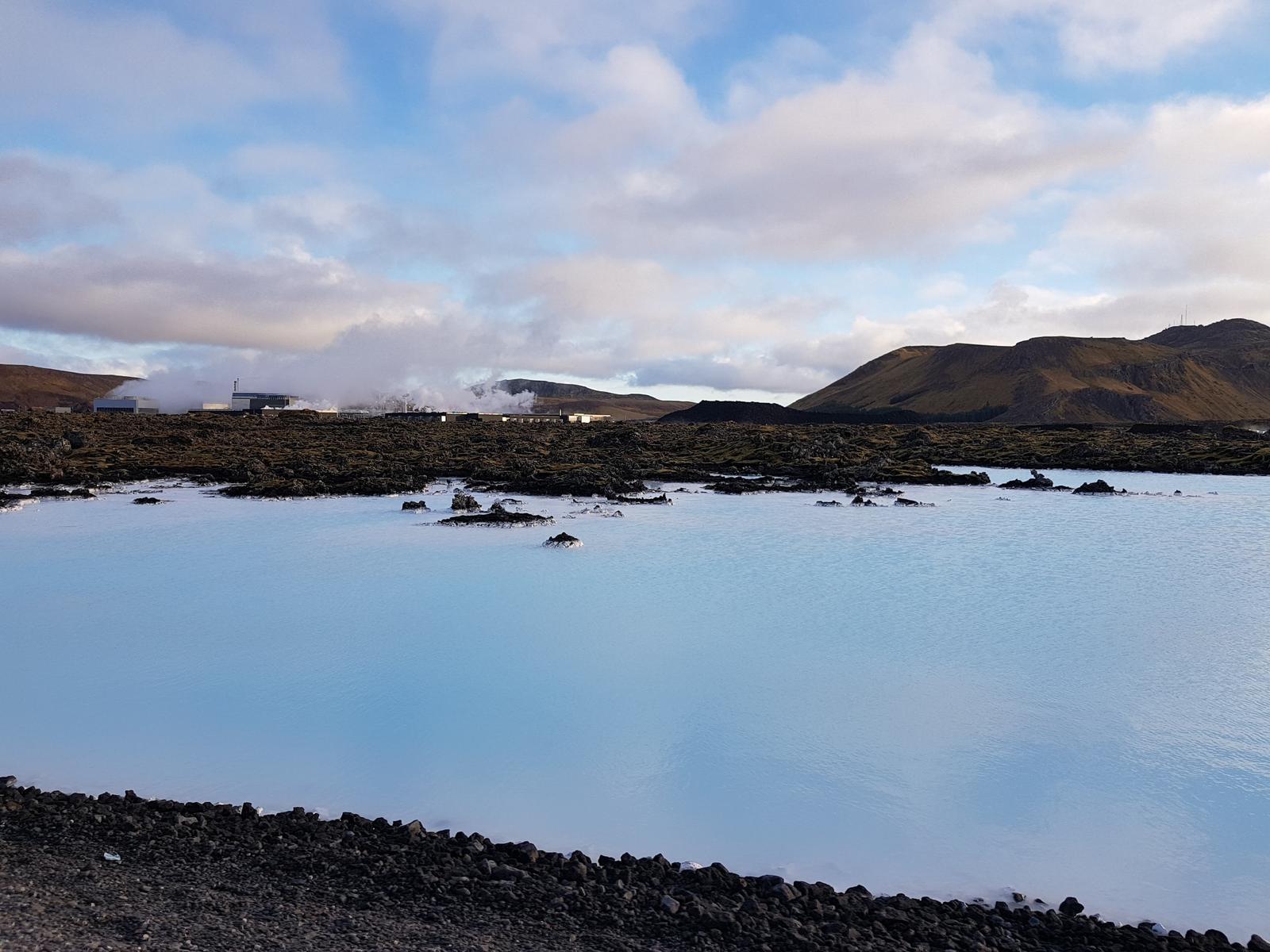
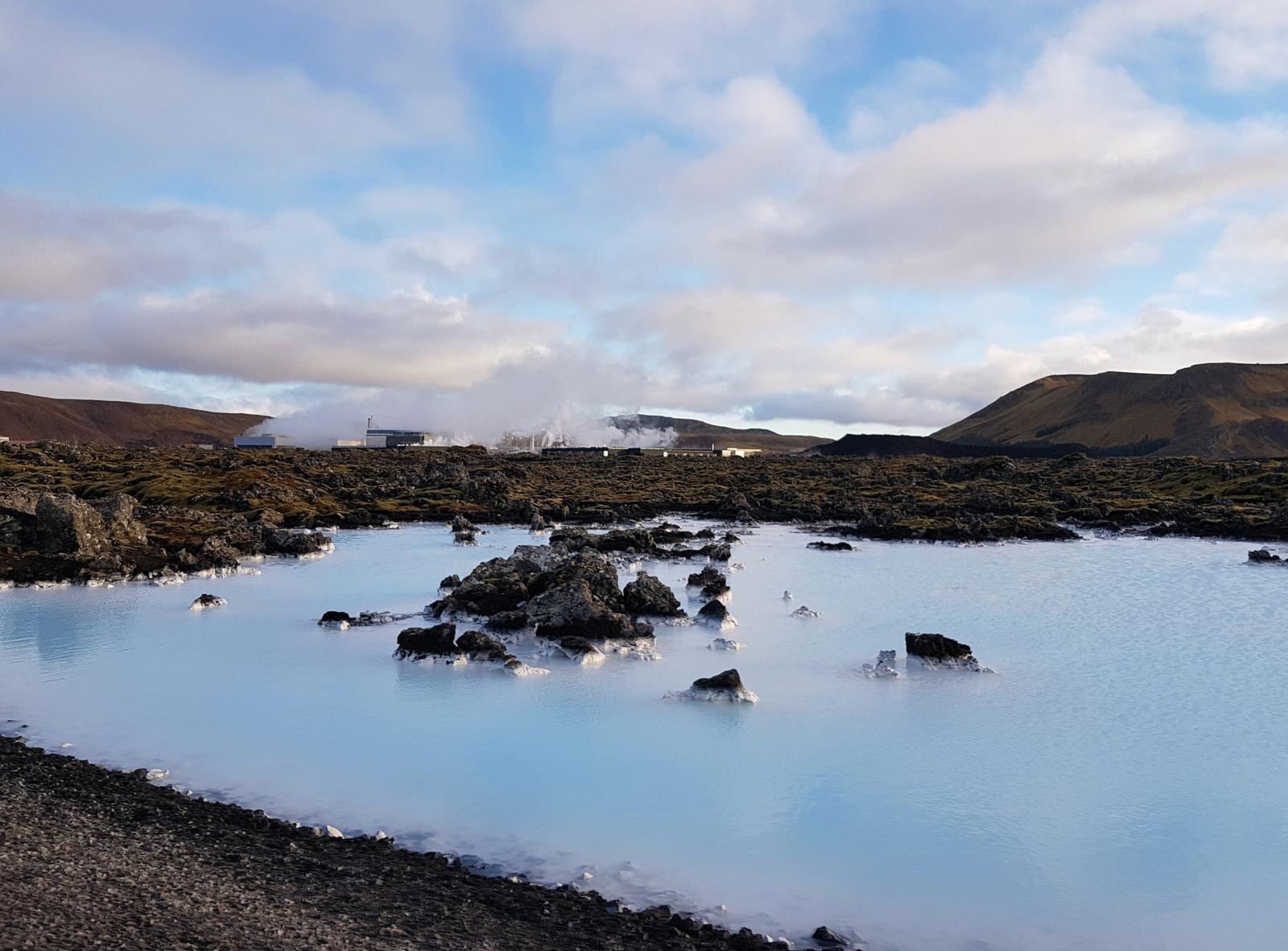
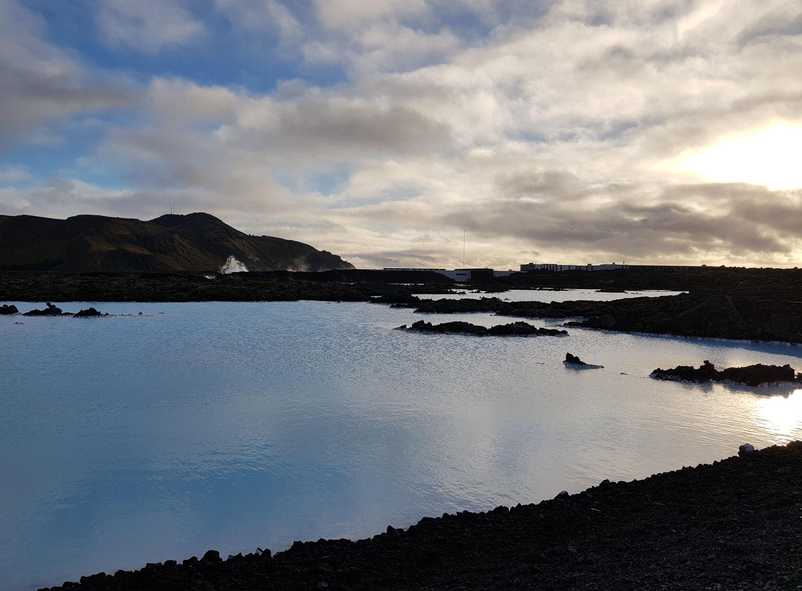
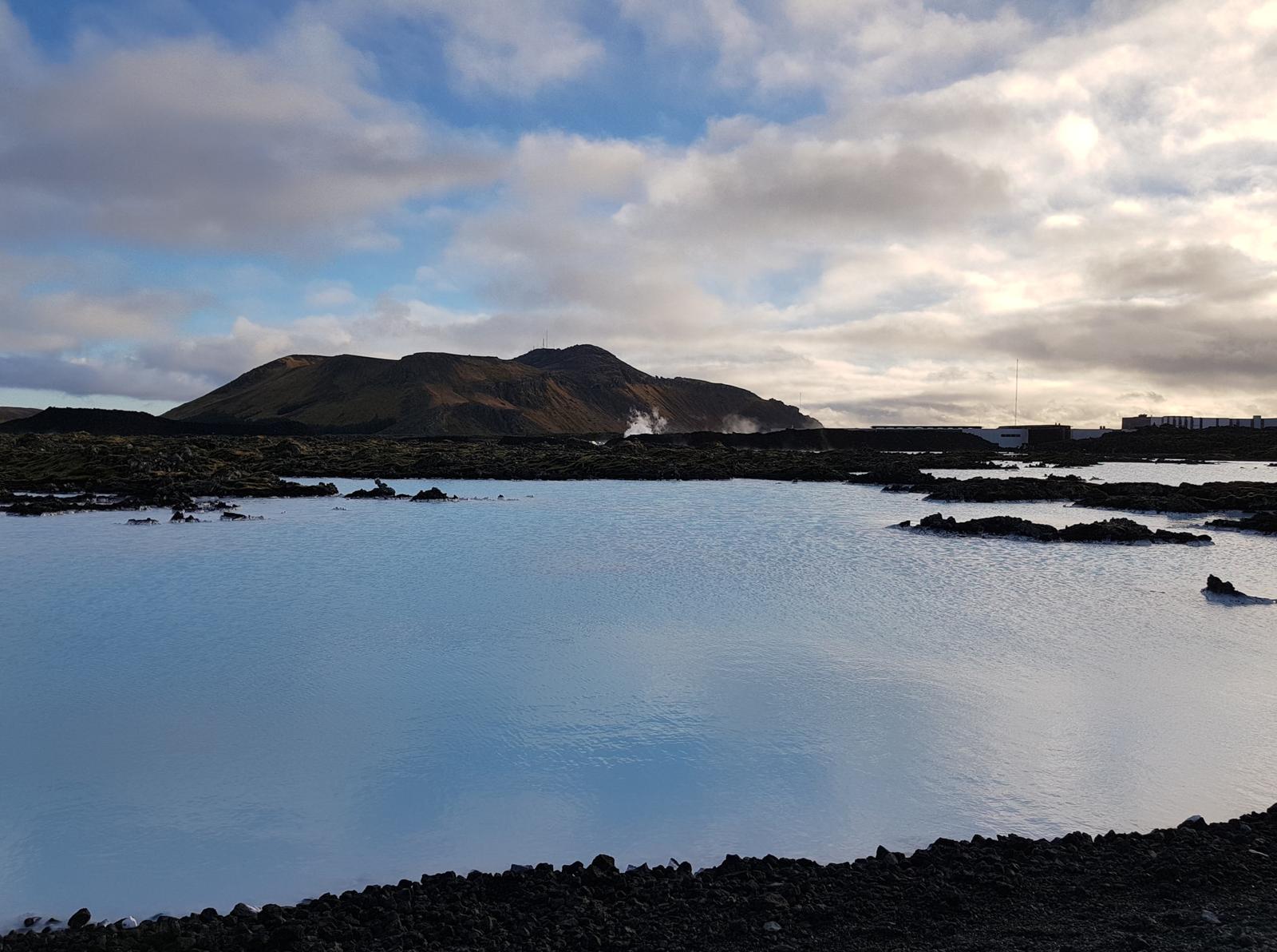
10. Blue Lagoon.
Did we save the best to last? Well, we thoroughly enjoyed our trip to the Blue Lagoon. We booked our tickets online about three weeks in advance (during peak season you need to book months in advance). Our tickets included a towel, one drink and a face mask for 70 Euro per person so it is not cheap.
I had always wanted to go to the Blue Lagoon and I am so glad we did. Even though it was busy we were able to find some space for ourselves and relax.
On the day we visited it was definitely too cold to be outside the lagoon itself. We literally went outside, dropped our towels and ran into the hot water. On a warm day you could definitely spend longer at the lagoon as you would be able to relax on the decking in the sun in between bathing. We stayed in the lagoon until we resembled prunes.
We didn’t take any photos inside as we didn’t want the hassle of minding our phones/cameras.
Here are a few photos from outside:
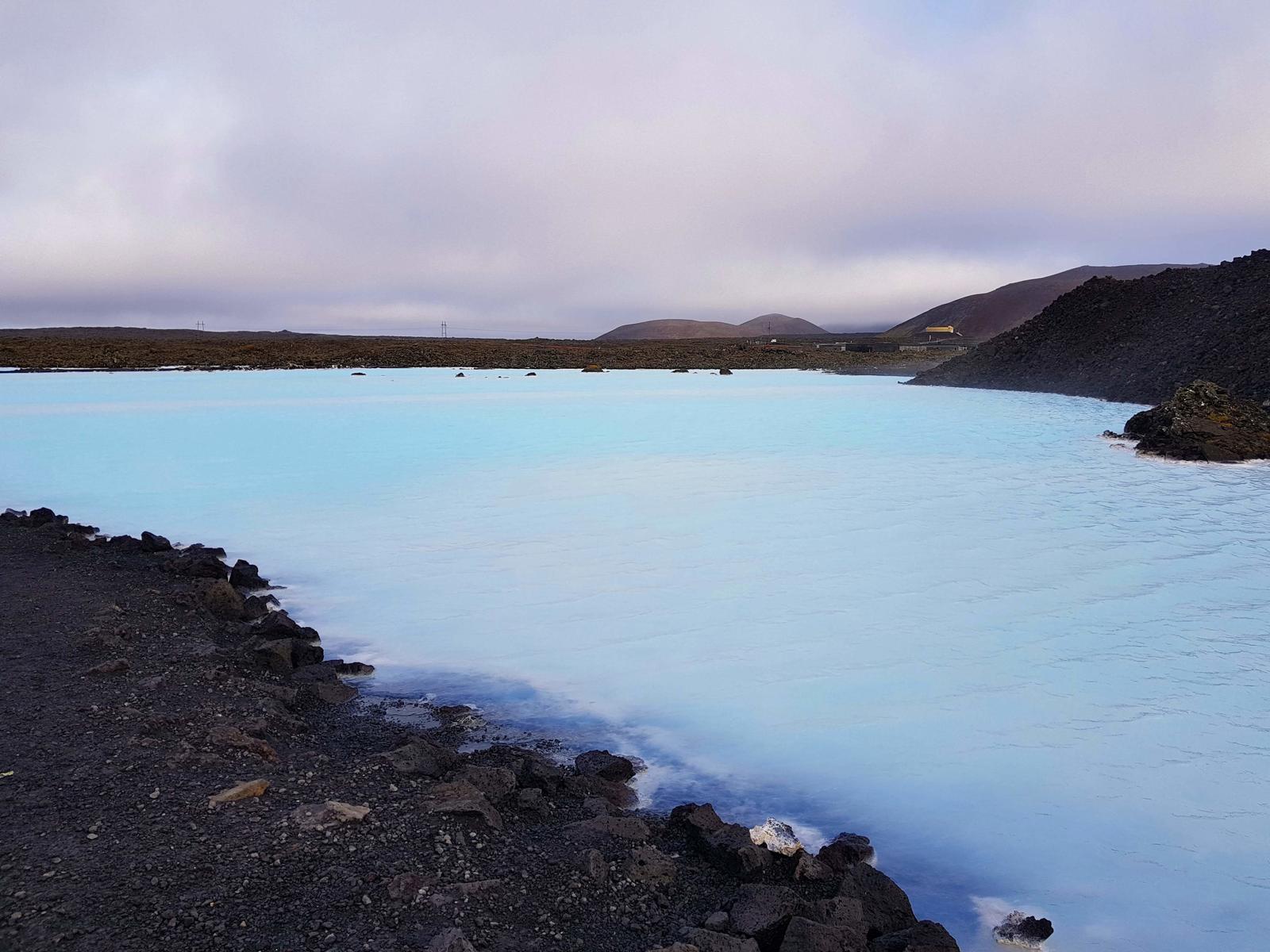
A little darker when we were leaving:
So that’s it! Iceland’s Golden Circle did not disappoint, there is so much to see and do in this part of Iceland alone but if you have time, I highly recommend exploring further! I would love to revisit some of the attractions again, perhaps do some of the longer hikes available and experience Thingvellir National Park and the Blue Lagoon in warmer weather.
If you've any questions, suggestions or just want to say hello, contact me via the Contact Form, Instagram (@noroadlongenough) or By Email noroadlongenough1@gmail.com